| Route 66 | Cities | Beaches |
|
|
Getting There |
Camping |
Restaurants |
Hiking |
HeHHensley Settlementley |
Cudjo's Cave |
History |
||
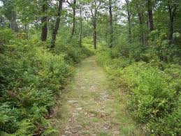
| Ridge Trail is the greatest backpacking trail in Kentucky. It is the closest you can come to true high mountain backpacking without leaving the state. It takes you to higher elevations with greater scenic vistas over a longer mileage than any other trail we have. Yet the trail is easy walking. Its 21 miles, stretching from Pinnacle Overlook (upper right) on the West to White Rocks (upper left) on the East, climb very gradually. Over 21 miles you climb a thousand feet but you never notice it. Compared to most backpacking trails, especially in mountain country, Ridge is a joy to hike. It's in deep shade most of the way, and high on the mountain gentle breezes blow almost constantly, so in Summer it offers escape from the heat and humidity. It's long enough that it's not heavily used, so after the first several miles you can escape the crowd. Its four campsites are very nice and there are historic and geologic features to add interest. The only caution is that you must allow at least a three day weekend and you really need five days to do it justice. | 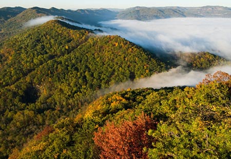 |
 |
You have some choices to make. We've done this trip every year for 20 years and we've tried it from every angle. We think we've worked out an ideal itinerary. We like to drive in the first afternoon and camp at the Wilderness Road Campground. This is a beautiful campground with very nice hot showers and good tent sites (unlike many campgrounds which are designed mostly for RVs). The next morning we either take the trail directly from Wilderness Road, or drive the van up to The Pinnacle and start from there. Either way, it will be a five mile hike to Gibson Gap Campground. The big difference is the hike up from Wilderness Road is a steady climb, whereas the hike from The Pinnacle is level all the way. But you can't leave your vehicle parked up at The Pinnacle. So if you want to start from there, you have to have a driver who will drop you off and then pick you up at Ewing several days later. If you don't have that luxury, and you need to leave your vehicle parked at the trailhead, you may have no choice but to hike up from Wilderness Road. Another consideration is whether you have one or two vehicles. If you only have one, so someone has to drive it to the other end and then meet you up on top, you may have to skip Gibson Gap and hike all the way through to Martins Fork, where the driver can hike up Chadwell Gap Trail and meet you at Martins Fork. |
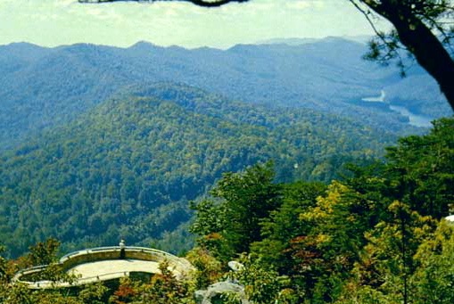
| If you start from The Pinnacle, you'll learn a little Civil War history. The North and South fought over Cumberland Gap for four years, with each side holding it several times. Shown here is a Parrott Cannon, which the Union installed. During one 12 month stretch, the South held the Pinnacle. They lugged a huge, accurate, powerful cannon, a strong telescope, and a year's supply of food and ammunition up with them. The South used their vantage point to pick off every Union train bringing food, supplies and ammunition through the Gap to General Sherman down in Tennessee and Georgia. Novels and movies have been made of this episode, including the romance between the Rebel commander and the daughter of the Union General down in Cumberland Gap, Tennessee. One of the Union strategies was to lure the Rebel forces into using up their cannon balls. The North kept sending through trains either empty or loaded with rocks or bales of hay. The South was never fooled. But when the North tried to send through food, supplies or ammunition, the South would blow up the train. The North could never figure out how the soldiers up on the mountain always knew. After the war they discovered that the daughter down in town would angle a mirror in her bedroom to catch the sun and send a signal up to the mountain. On cloudy days, she lit a lantern. On the mountain, a sentry used the telescope to read her signal. | 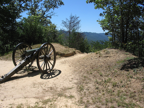 |
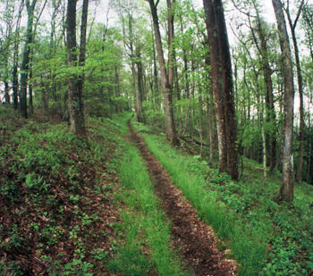 |
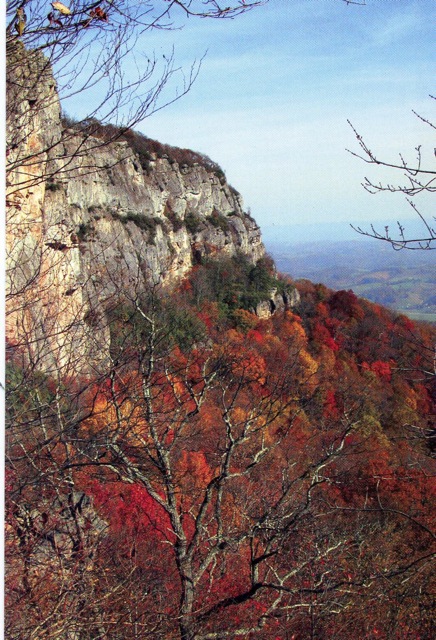
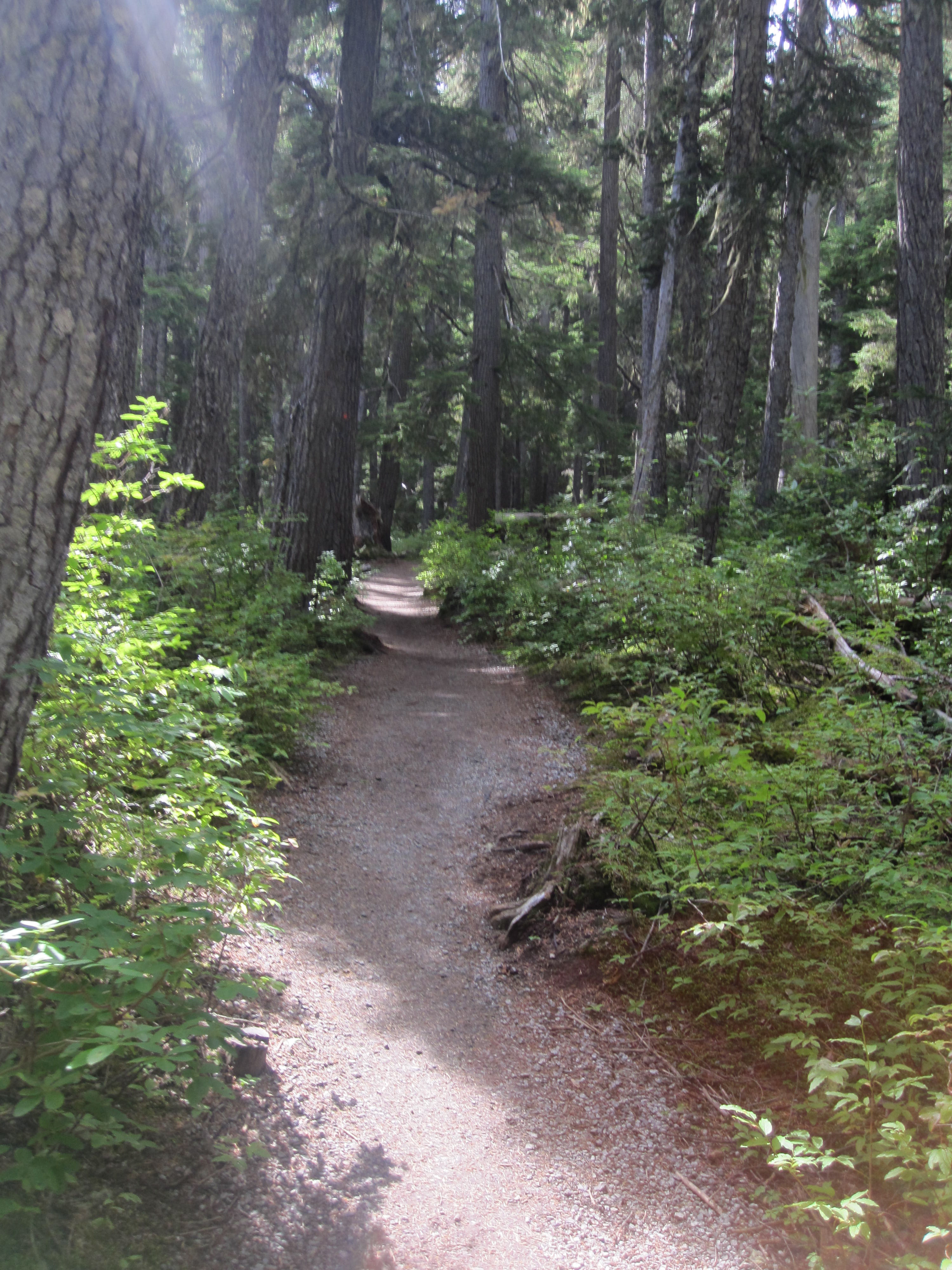
Ridge Trail is beautiful year round. In early Spring and late Fall, with the leaves off the trees, you'll be treated to spectacular views of valleys and mountains off in the distance, as far away as the Smoky Mountains in North Carolina on clear days. As Spring comes on, the mountain is a riot of color as blooms and flowers of every kind burst forth. In Fall the leaves are in color. And, if you can tolerate the deep cold and icy winds, Winter presents its own spectacle, with ice and snow. One problem you won't have here is route finding. As you can see, the trail is well maintained and easily visible. The high number of hikers and the hard work of the park service have kept it in great shape. Since you're high on the mountain, you don't have stream crossings to worry about, even after several days of rain. There are very few places where you even have mud to contend with. |
| Gibson Gap is a great campgroumd. You're in deep forest but right on the edge of a steep drop down to the valley, so there's almost always a breeze blowing. You do need to make reservations with the ranger back at the visitor center, but Gibson Gap is rarely crowded except for Memorial Day, July 4th and Labor Day weekends. There's enough deadwood laying around for a campfire. There are plenty of level spaces for backpacking tents and numerous young trees to stretch ropes from. The only problems Gibson Gap presents are those any experienced backpacker should easily deal with. Bears frequent the area so food must be hung. Wind can pick up and storms are frequent so tents should be firmly braced. And there's no water. You'll have to pack in enough to last you until you reach the faucet at Hensley's Settlement. If you do need water, the only stream is half a mile away in The Boulder Patch, also known as The Devil's Garden. | 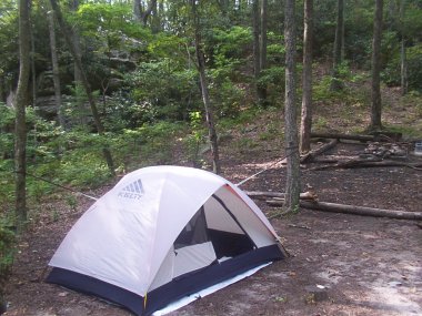 |
 |
The Devil's Garden is a spectacularly scenic jumble of house sized rocks and boulders covered with moss and ferns and interspersed with beech and birch trees. This square mile of land extends from the North side of Ridge Trail down to the park service boundary along the North flank of the mountain. In Spring and early Summer Devil's Garden Branch flows freely, splashing and gurgling its way down the mountain. From its various pools you can obtain plenty of water. It does need purification, but mostly for Giardia Lambdia spores. Frequent testing has found no other chemical or organic contaminants. But Devil's Garden does have its risks. No trails penetrate the maze of boulders, and it is extremely easy to get turned around, confused and lost. Second, the rocks and boulders, especially with their moss carpeting, are slippery. Many visitors have fallen here and injured themselves. Five miles from a trailhead, this becomes a serious problem. Finally, this is prime habitat for Copperheads and Rattlesnakes. They are frequently found sunning on the rocks, and they tend to live under them. If you venture into the Devil's Garden after water or photographs, wear heavy long pants and a long sleeved jacket, so that if you did surprise a snake and it struck, it would not penetrate to your skin. |
| Next morning, heading Eastward from Gibson Gap, the trail continues mostly level, climbing gradually to Butchers Gap. If you're going to see a bear anywhere on your trip, it will most likely be along here, because Butchers Gap is the most remote point on the mountain. It is the furthest from any roads, any access trails climbing up to meet Ridge Trail, from any overnight campsites, and from any attractions like Hensley Settlement or Sand Cave. In the Summer you won't be able to appreciate it for the leaf cover, but in early Spring, late Fall and Winter this is also the most spectacular part of the trail. For miles, both left and right, you have magnificent vistas looking up into Kentucky and down into Virginia and Tennessee. Layer after layer of high mountains roll off toward the horizon. |
 |
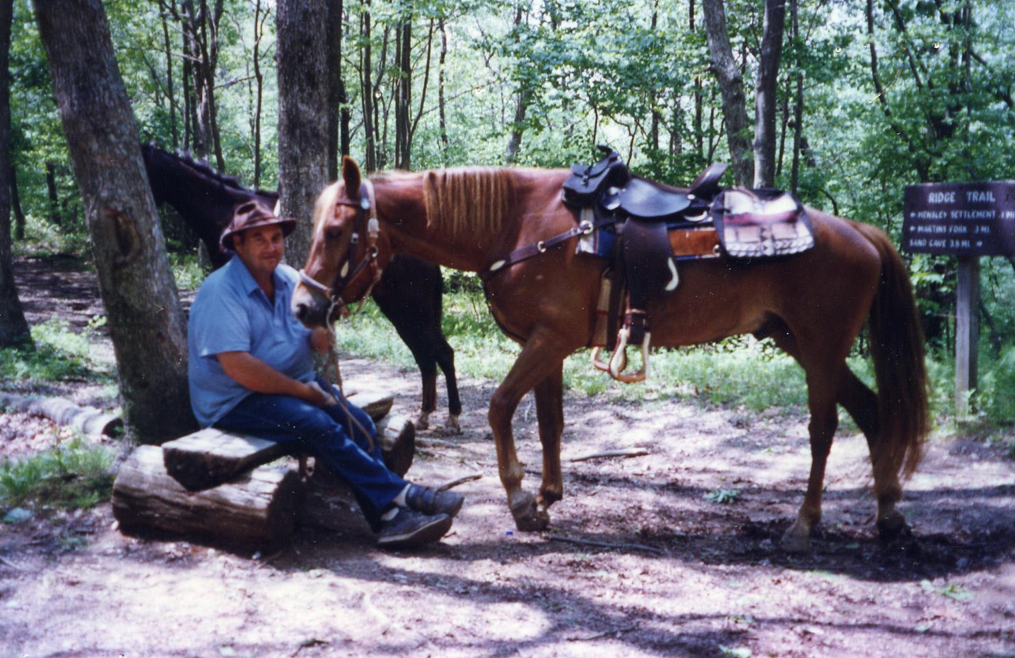 |
As you approach Hensley Settlement and Martins Fork, you are more and more likely to find yourself sharing the trail with horses and their riders. Theoretically, the whole trail is open to horses, but they tend to stick to the Eastern half of the mountain. One of the campgrounds over there, Hensley Horse Camp, was built and is maintained just for them, with watering troughs, hitching posts and other amenities. There are outfitters who will provide customers with horses and lead horse packing trips up to Hensley Settlement, White Rocks and Sand Cave, usually camping one night on the mountain. But most of the riders you'll see are people who own their own horses and trailer them around on weekends to various places with excellent riding trails. |
| This is Martins Fork Campground, with tents zipped up after a rainy night. It's close to Hensley Settlement and is the usual destination for backpackers hiking through, unless you're going to rent a cabin over in the Settlement. Martins Fork has an outhouse but no water. There is water in Martins Fork stream, downhill a short distance North of the campground, but it's a shallow stream with few pools. Most backpackers stop by the Settlement on their way in and fill up jugs or other containers from the well there. It's to your left just as the trail enters the settlement. Martins Fork Campground is a gently sloped clearing surrounded by trees. The clearing usually fills up at about 4:00 so any later arrivals are relegated to the trees. You need to reserve camp space with the ranger and we recommend at least a few weeks ahead in Summer, late Spring and early Fall. They do fill up. If Martins Fork is full, Chadwell Gap Campground is a quarter mile away. | 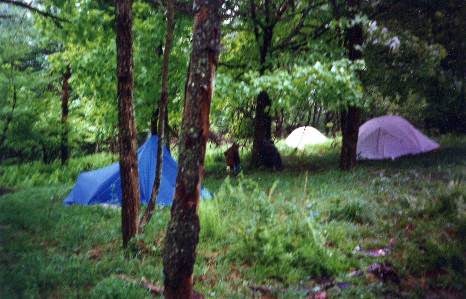 |
 |
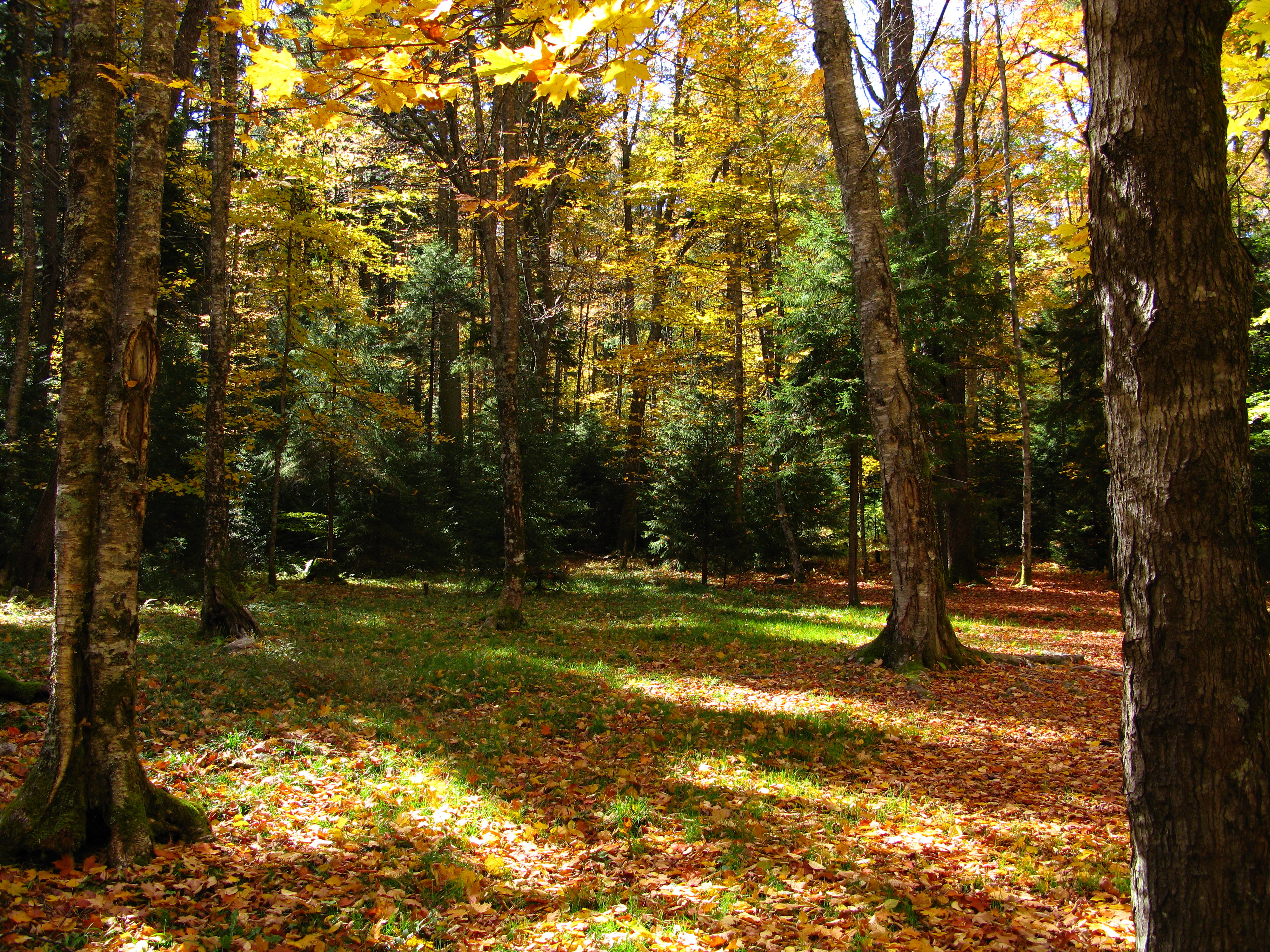
The trail continues on toward Bailes Meadows. The trees tend to be larger as you head further East on the mountain, and the undergrowth is denser. Even though the trail still seems pretty level, you're a full thousand feet higher here than you were back at The Pinnacle. |
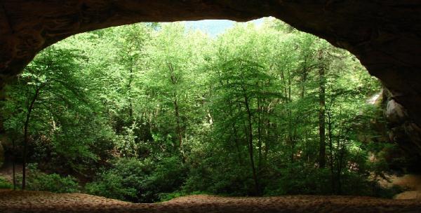
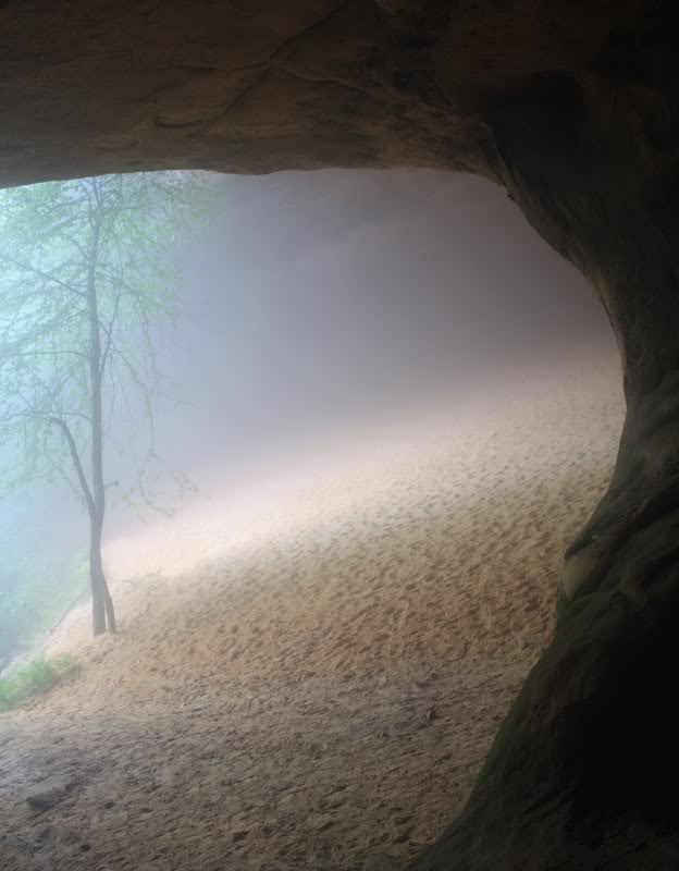
| After you hike through Bailes Meadows, a spur turns off to the left (North) to Sand Cave. You MUST take this spur. Sand Cave is one of the most spectacular sights in Kentucky. It is a Wind Cave, formed not by water but by wind erosion. An acre and a half of multicolored sand covers the ground. There is usually a beautiful waterfall here, and the area is a photographer's fantasy, especially on a sunny day, when the light reflects off the coloring in the rocks and the sand. Many people day hike up Chadwell Gap Trail several times a year just to spend all afternoon here. Artists come to paint scenes. Area churches have held Easter services here. | 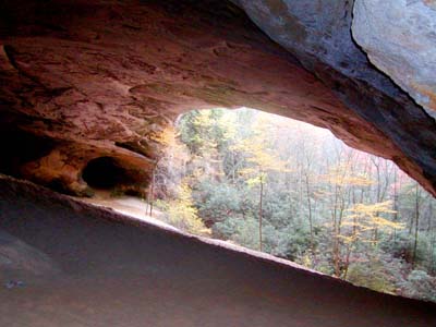 |
 |
 |
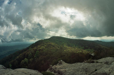 |
White Rocks is a series of limestone cliffs visible from 100 miles out on the Virginia valley below. Native Americans, Thomas Walker and Daniel Boone, and pioneers heading for Cumberland Gap used them as a landmark. The views from atop White Rocks are spectacular to the East, West and South, although you have to be careful because the drop is sudden, straight down and almost a thousand feet. One of the more interesting sights is watching weather developing across the landscape from here to Smoky Mountains National Park, which is visible on the far horizon. Even on a clear day, around 3 pm there's usually some sort of cloud action visible. |
| Ironically, White Rocks campsite is nowhere near White Rocks. The limestone cliffs face South. To get to the campground, you have to hike up to Ridge Trail and take the spur trail down the North flank of the mountain. They probably should rename it Rock Garden, because it's in one of the more scenic rock gardens in the park. A stream running through and below the campsite supplies water, although you need to purify it for Giardia Lambdia. There's not enough sun down here for snakes to be an issue, but there are plenty of salamanders and crayfish in and around the stream. | 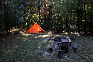 |
|
|||
|