| Route 66 | Cities | Beaches |
|
|
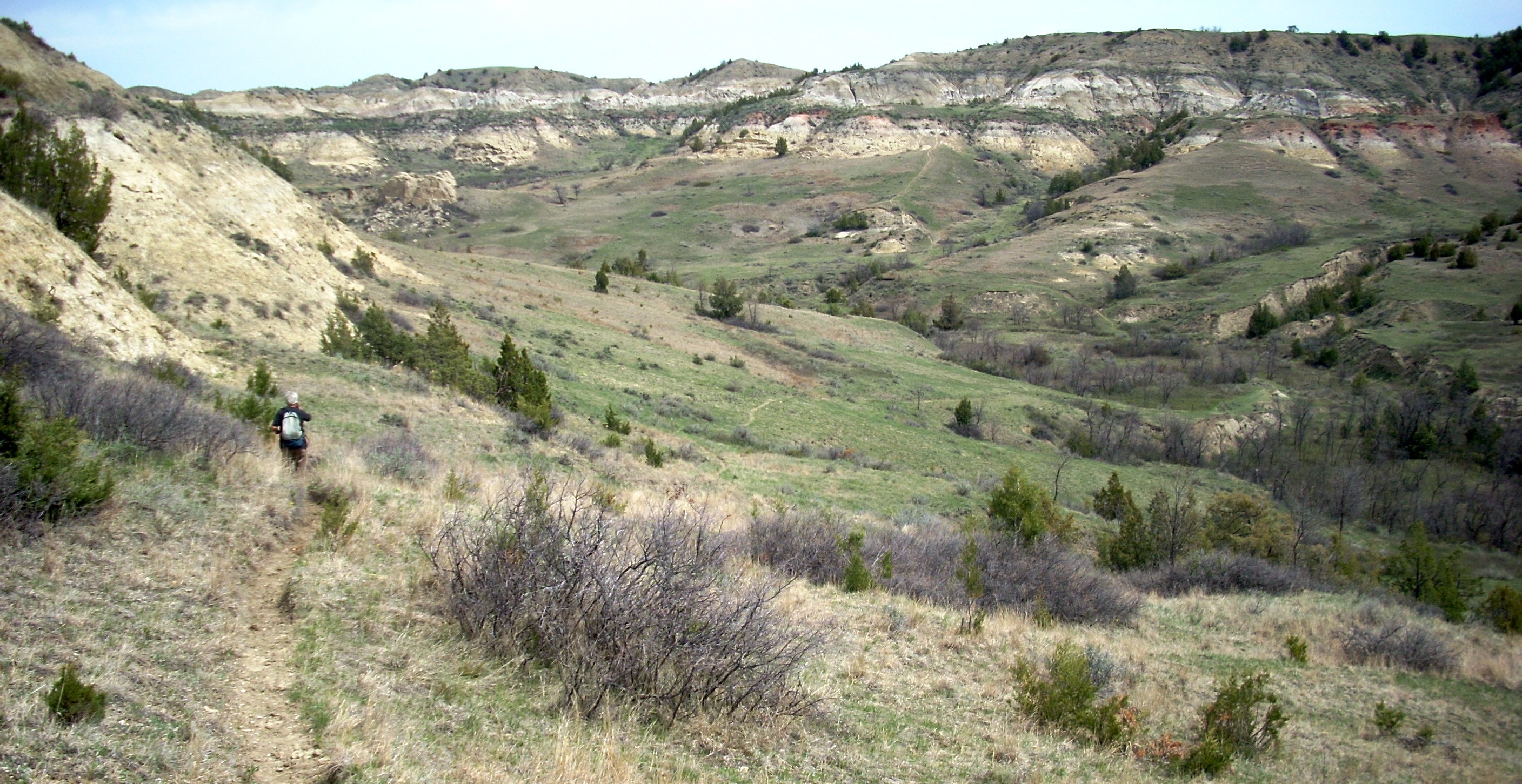
Your third hike should definitely be the Petrified Forest Triangle. This is a three sided hike of 10 miles which includes a few rigorous ups and downs and some of the most unreal, lunarlike, terrain you've ever seen. The eastern leg of this triangle also includes some of the most awesome vistas in the park, looking down on the Little Missouri River bluffs and 50 miles in every direction. You will also cross five miles of prime buffalo grazing land up on the plateau,, where we were chased by two belligerent bulls about two miles and an hour apart. It was inspiring to find out how fast we could run with backpacks on. This is a unique hike in that the search for the trailhead is as much of an adventure as the hike itself. It is such an adventure that we have featured it as a separate trip, with its own page and photos. See the "By Car" section. |
 |
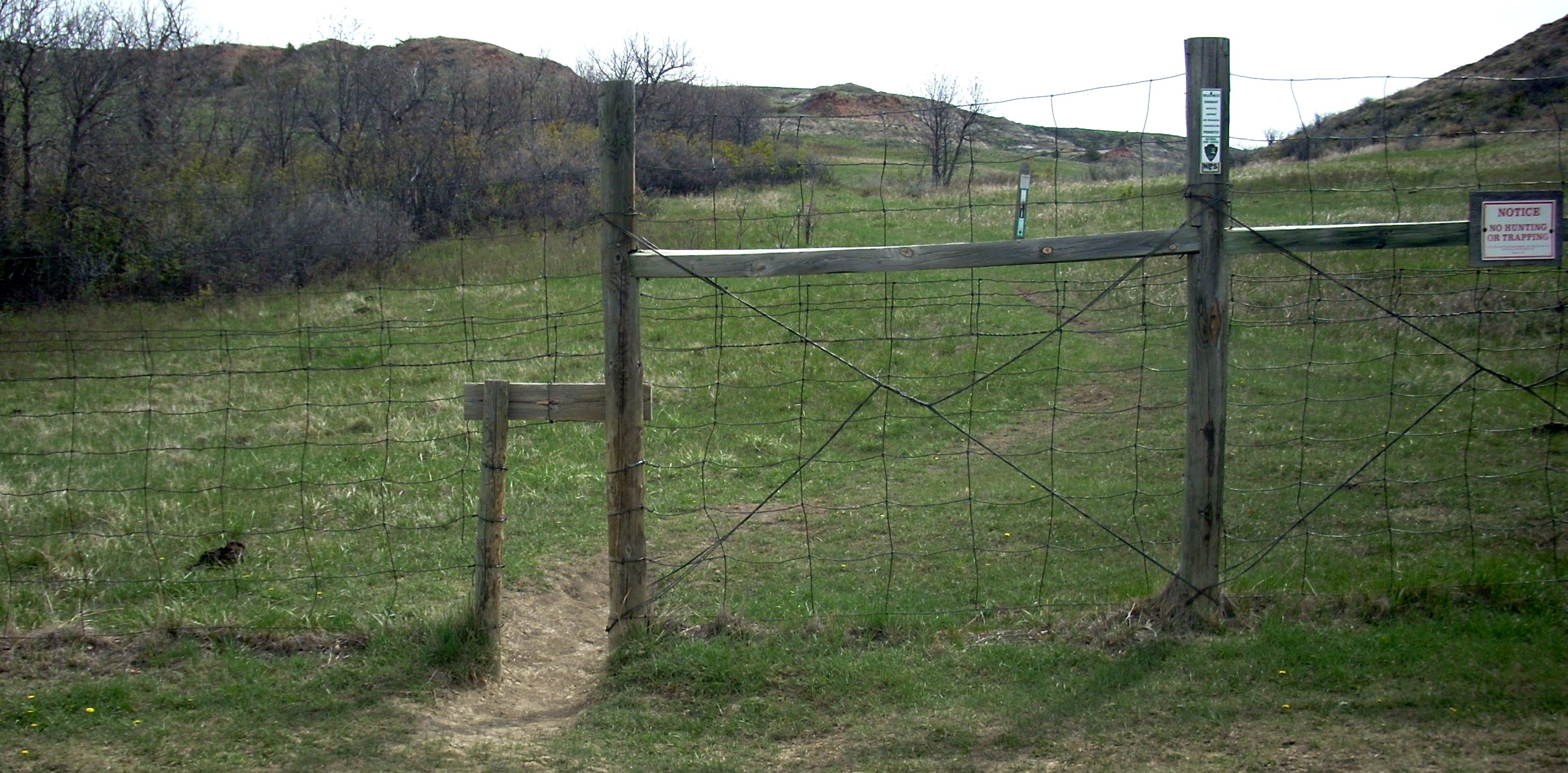 |
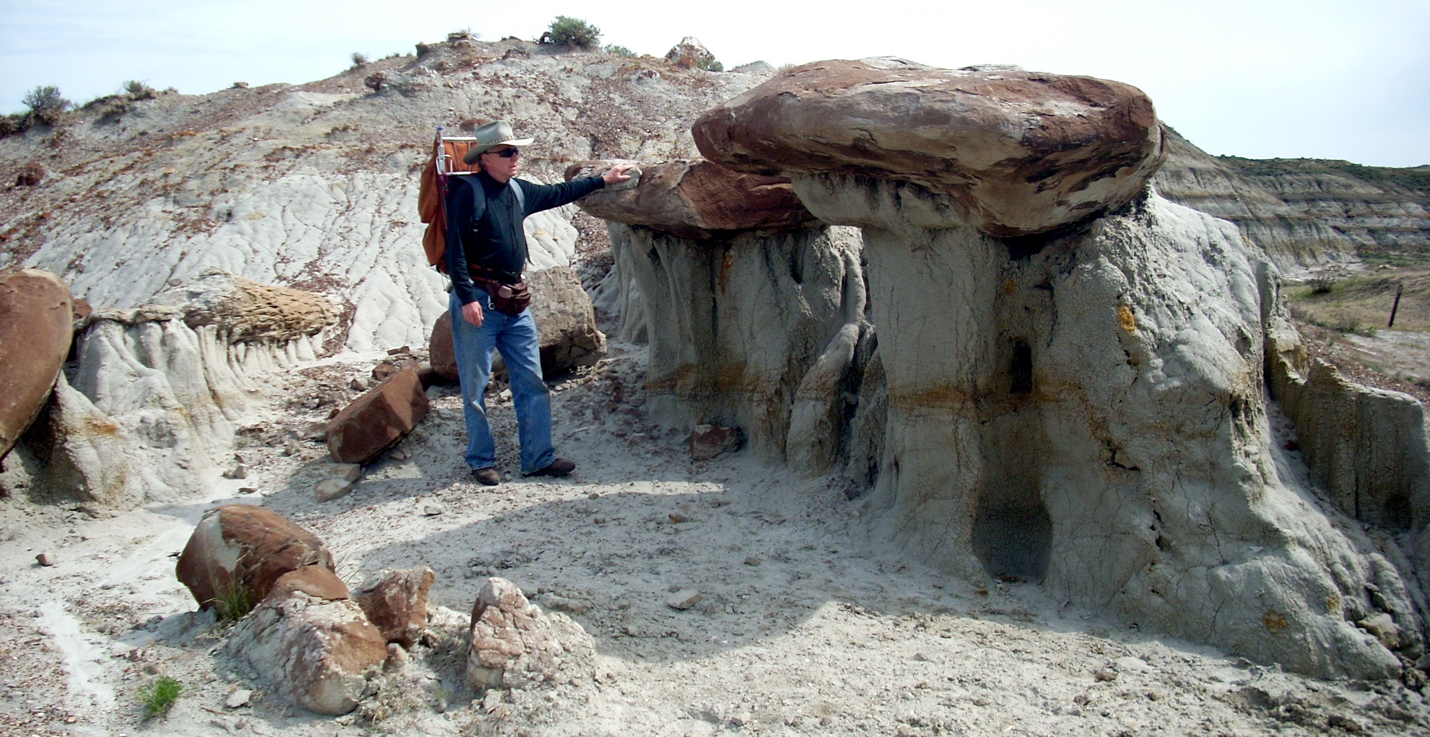
This is also the most unique entrance we've ever seen. As a hiker or backpacker, you kneel, take off your hat and pack, pass them through the hole, then crawl through after them. You put your pack and hat back on and head up the trail. Ranchers with contracts to take horseback trips into the park have keys to the gate. The reason for this gimmicky entrance is to keep out bikes and ATVs. After entering this gate, you climb a fairly steep half mile hill, where the trail splits (below left). That sends you around the triangle. Which direction you go is up to you. We like the left turn because then the most rugged part of the hike comes before lunch. You could also hike this triangle by taking the spur route up from Peaceful Valley Ranch, but there's a river wading which usually cannot be made until the river drops in late June. |
 |
 |
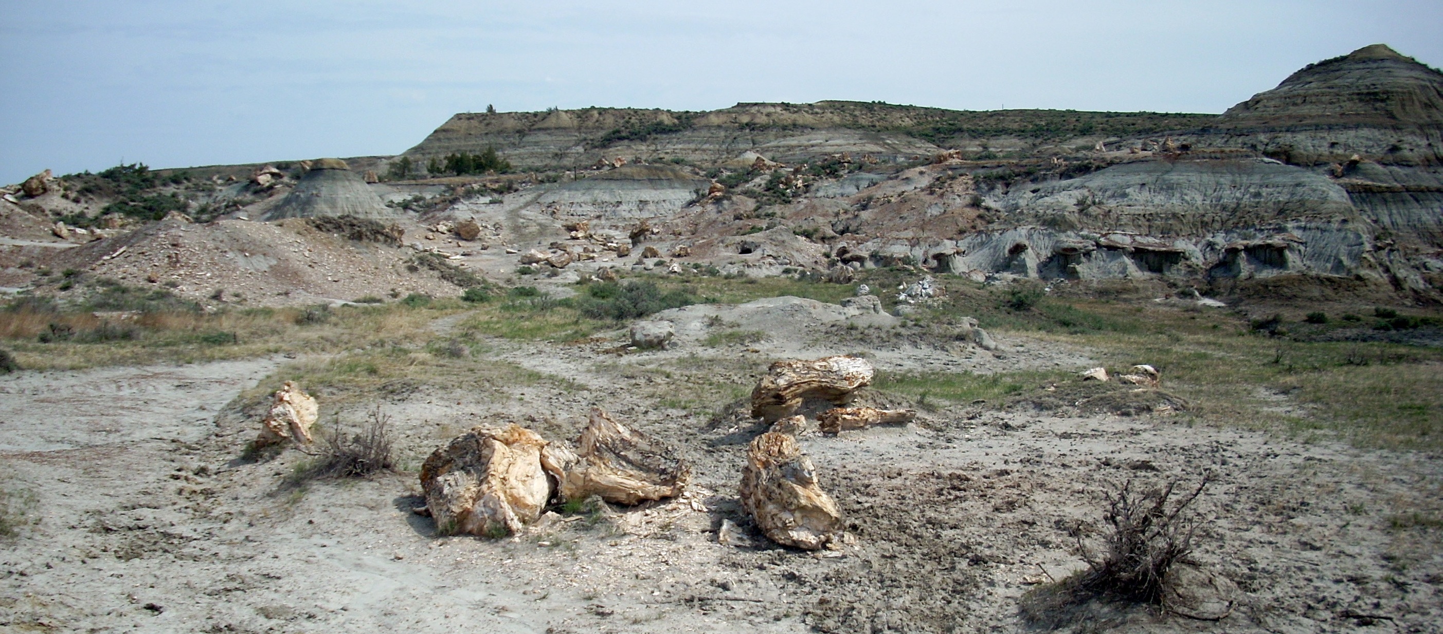 |
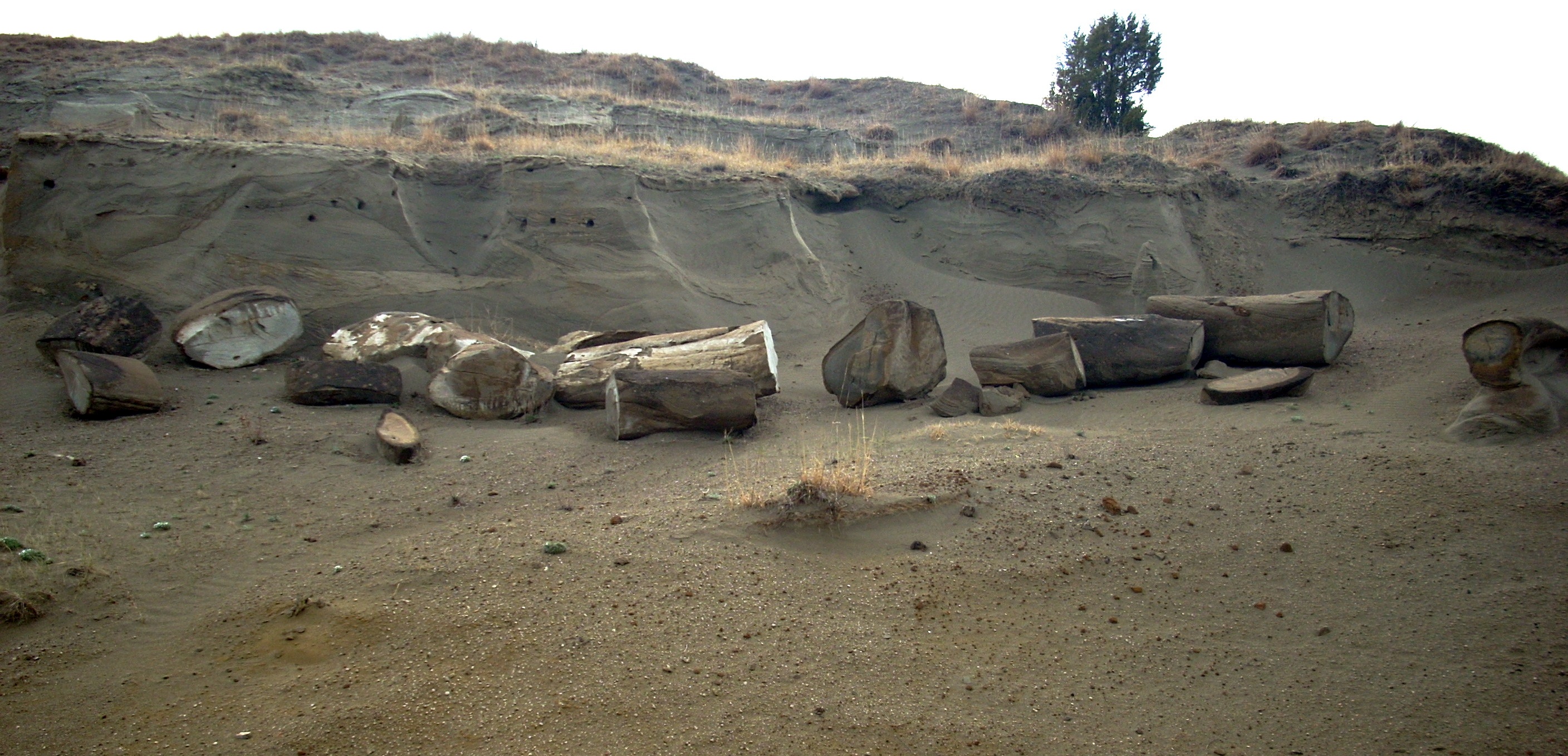
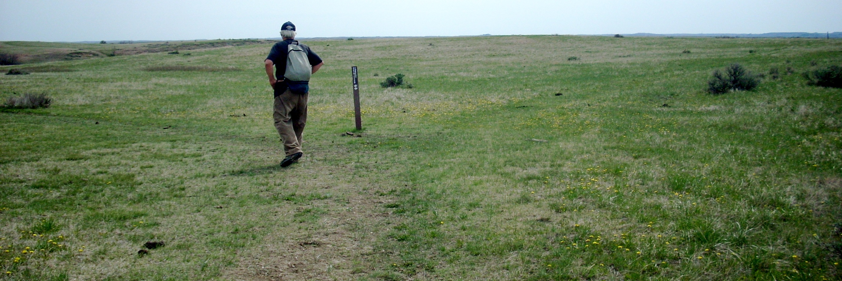
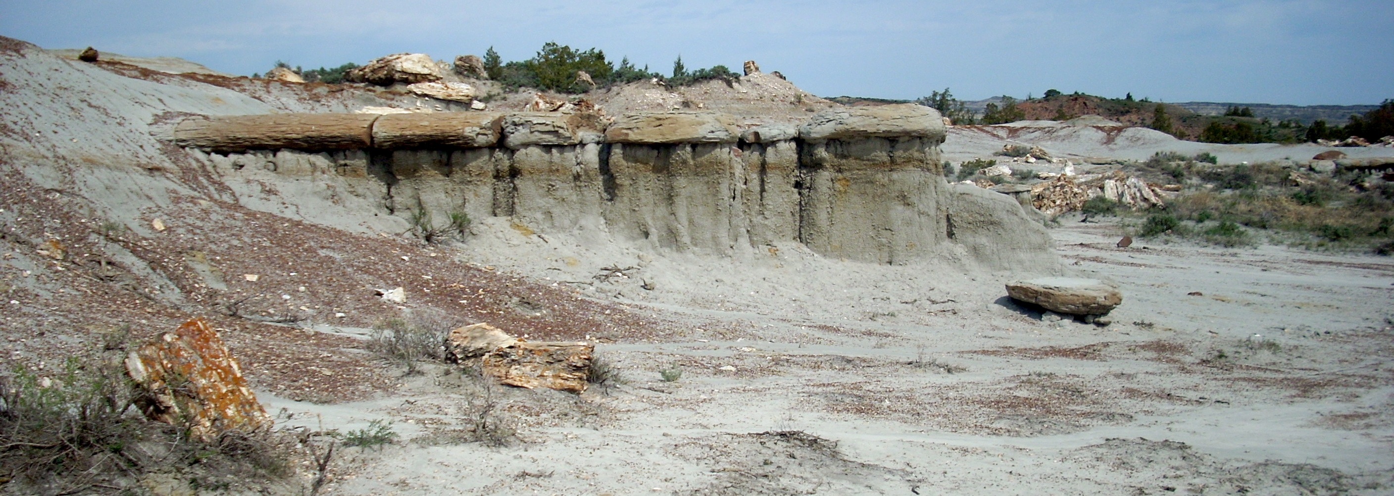
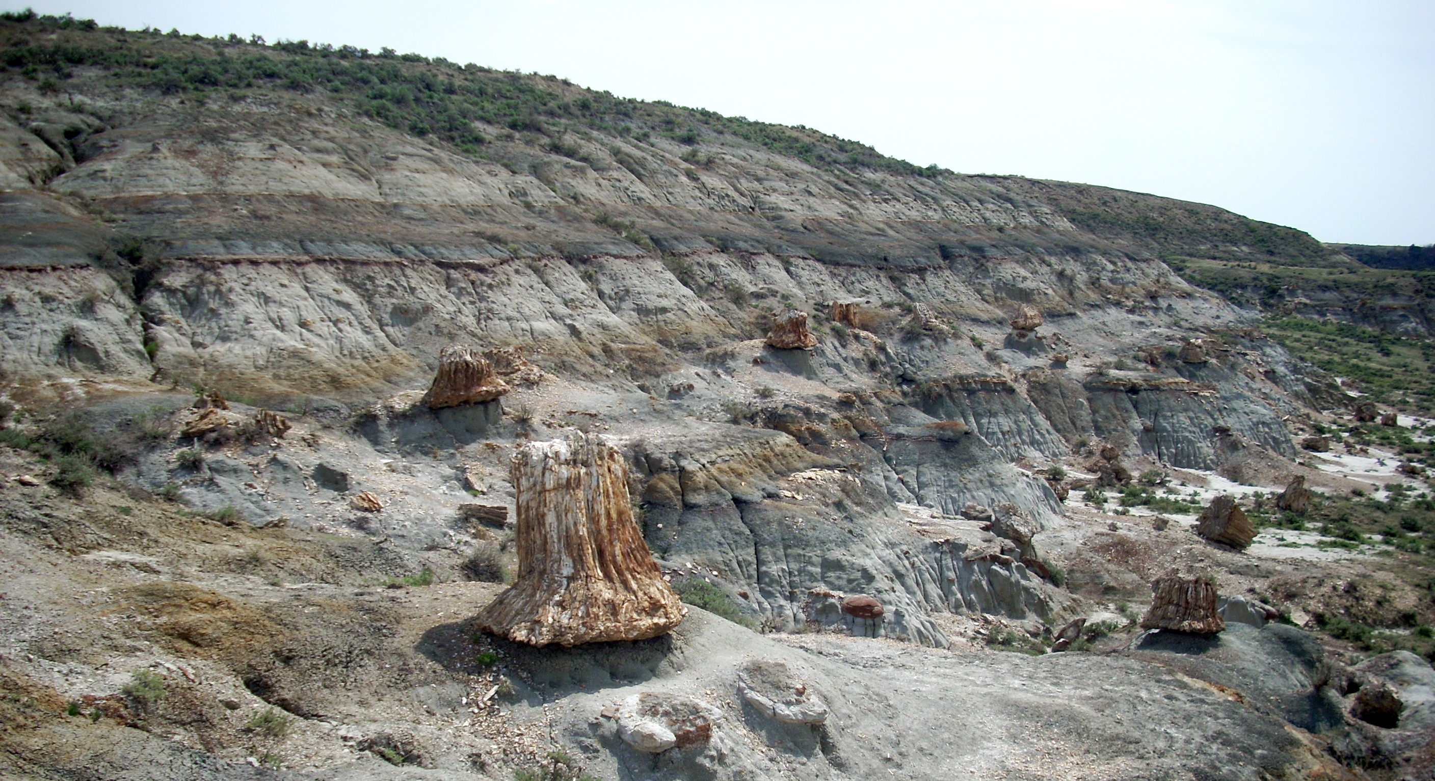
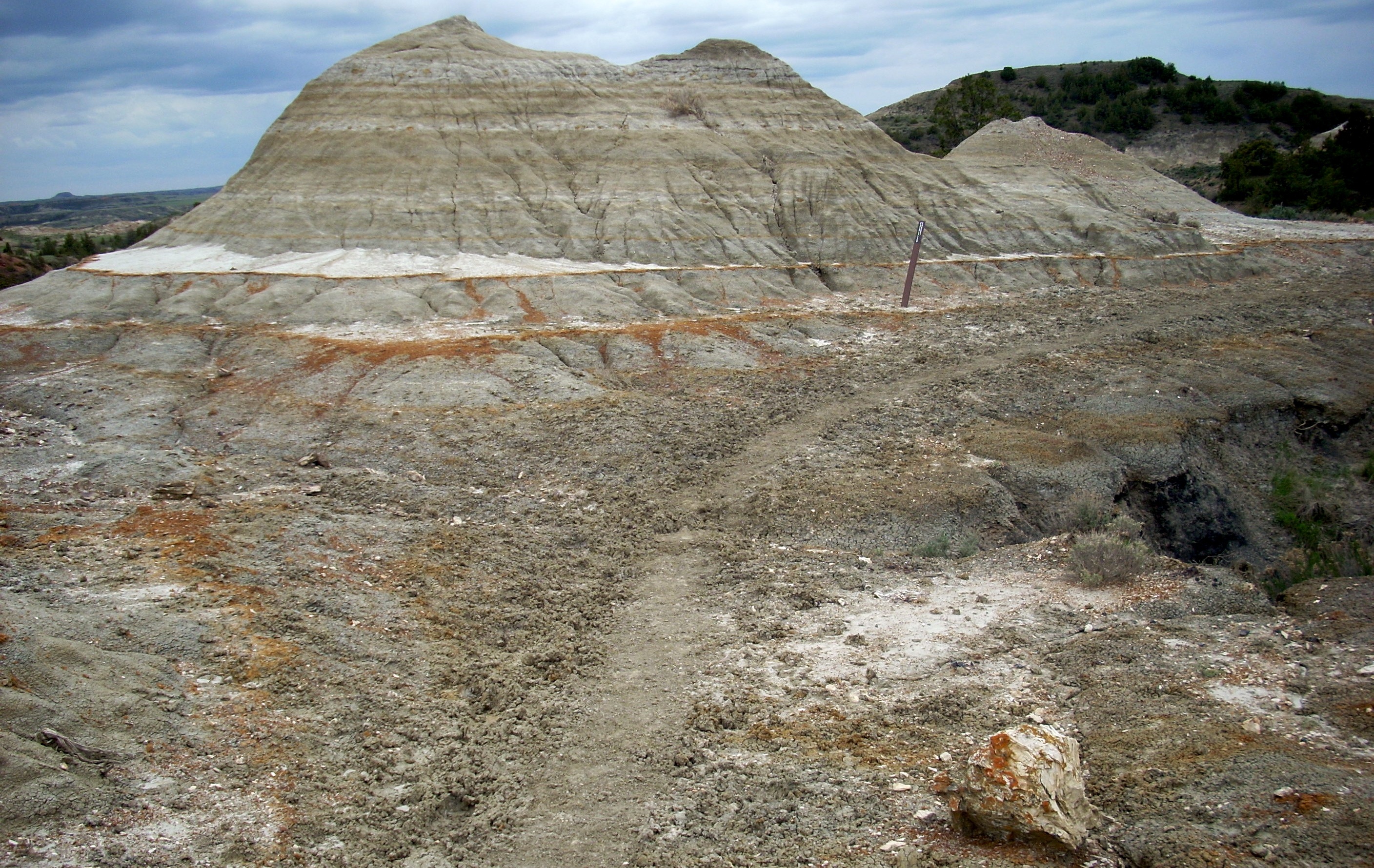
Having turned left, you hike across that wide plateau you see. Eventually you come to the vista above center, looking down into the lunarscape, which is the first petrified forest sector. There's nothing living in this area so you don't have to worry about grazing animals, but they continually pass back and forth en route to the grassy plateaus on both sides. You can get burned pretty bad here because of the sun reflecting back up off all these white or crystal surfaces, so be sure to use lots of sunblock. It will take you about an hour to cross this first lunarscape. Then you'll descend into the Wannagan Creek drainage (below left), cross the South Fork and climb up to the plateau on the other side, which in the photo is at the upper right. The climb out will test your legs, but there's a great rest stop halfway up. We saw more horned toads in the Wannagan sector than we have seen in any one place we've ever been. |
 |
 |
 |
 |
 |
At the top, you meet the Ma Da Hey Trail, a long distance horse route. You will follow it for four miles (right). It looks like a two track road, but actually there are more than two and they are caused by animals, not vehicles. Buffalo and horses often walk side by side. | 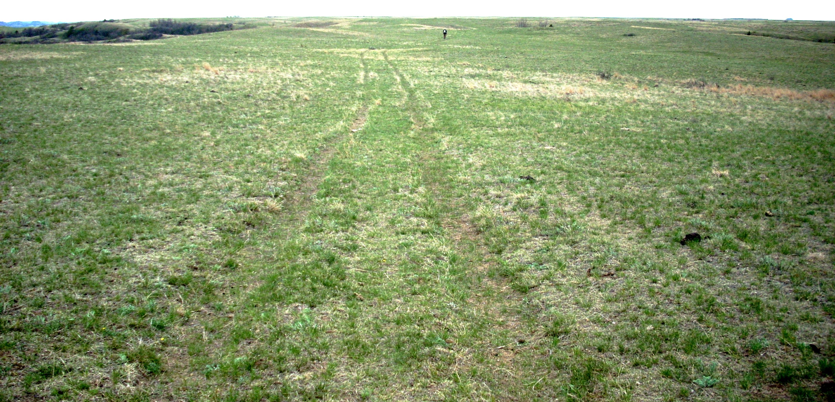 |
 |
At the southern tip of the triangle, the spur route goes off to your left. Far below, it winds down to the river and the Peaceful Valley Ranch. But you turn right and head west on the final leg of the triangle. You have three miles to go from this point. One of those miles will be across the plateau. This is where you are most likely to see buffalo grazing and where we had our confrontations. Later we talked to rangers. They said when in the vacinity of buffalo, to walk slowly, keep quiet, and give them a very wide berth, leaving the trail if they are grazing close to it. On this huge plateau, "wide berth" means perhaps a quarter of a mile, preferably toward one edge of the plateau or the other, since toward the edges the land begins to slope, and buffalo don't like to run down hill. So we did several things wrong. But we were astonished by how quick and fast these huge 3000 pound animals were. The rangers said average speed for a bull buffalo is 35 mph, and they are catquick, able to change direction like a rabbit. |
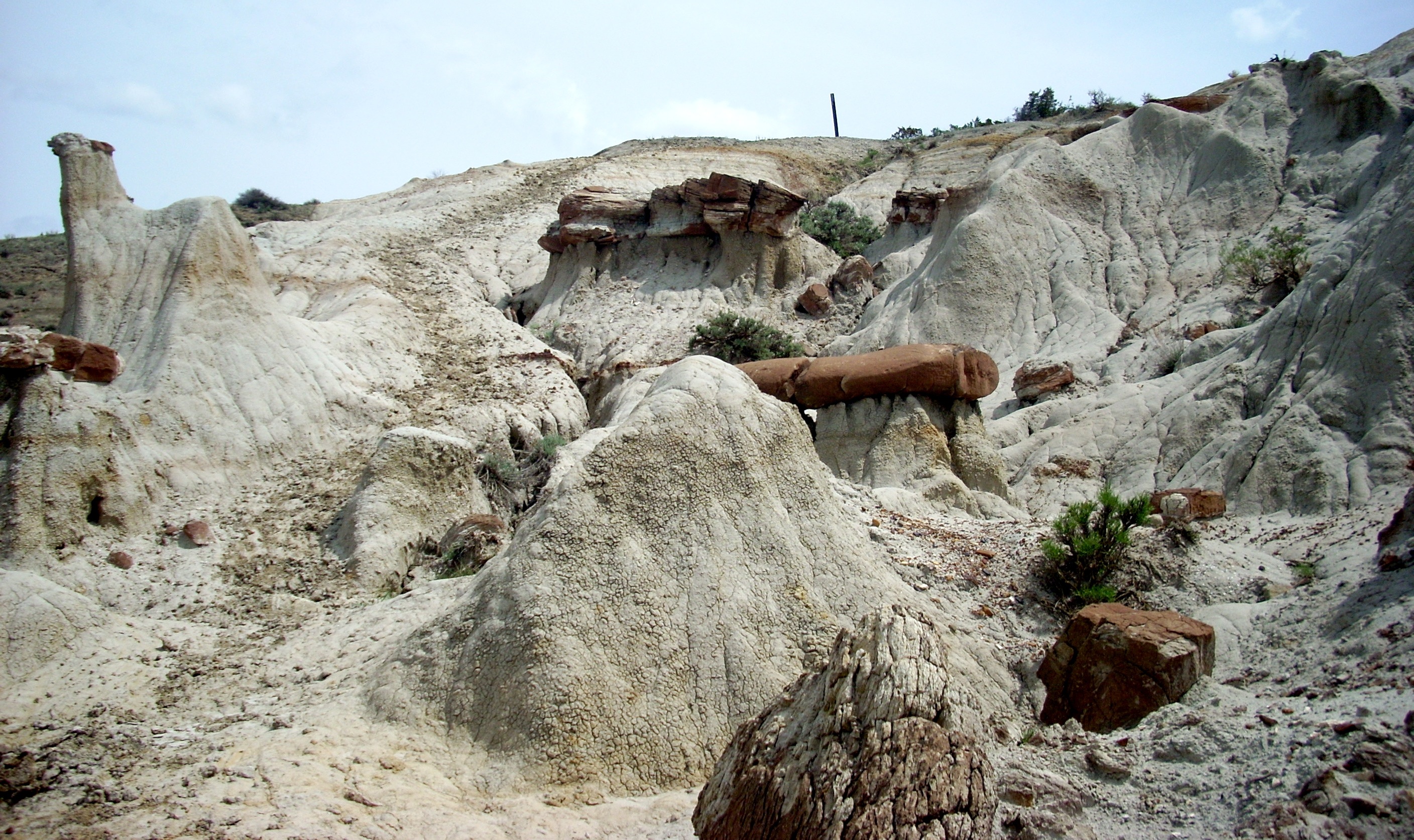
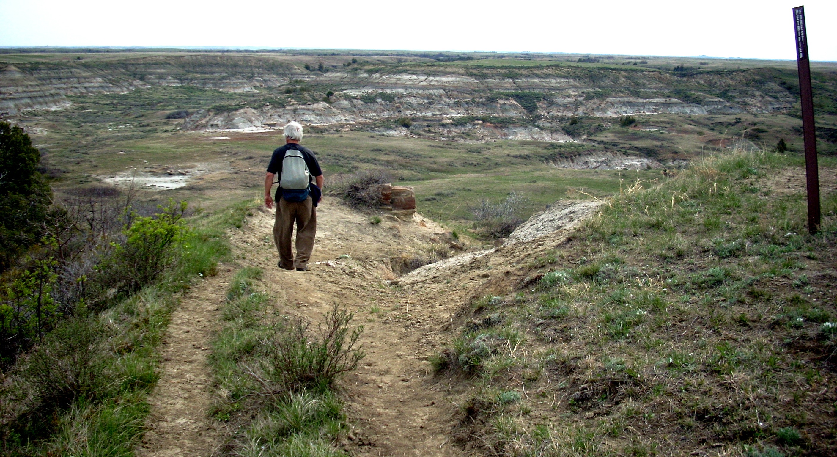
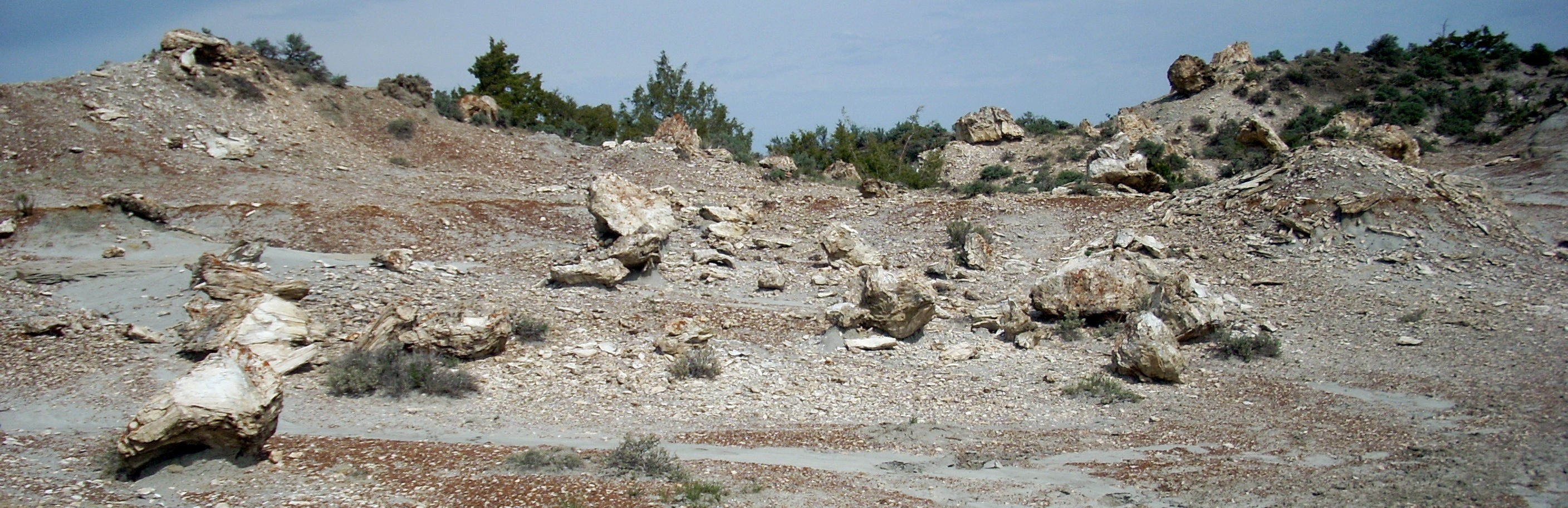
| But a mile from the turn you'll descend once again into the lunar landscape, seen above and right. There will be more stumps and trees of stone, wierd rock formations, and a barren and fractured vista. You'll be crossing this for about a mile. Because of all the rocks, there are several good places to stop for a final break, take a long drink, finish off your trail snacks, and take a few last photos. Then you climb back to the original plateau. It will be half a mile back to the intersection, from where you can see half a mile down hill to your vehicle. If you brought binoculars, you can look further West and a bit South and see the Buffalo Gap Ranch buildings. They're only two and a half miles from here, but without a four wheel drive vehicle you have to drive further around. | 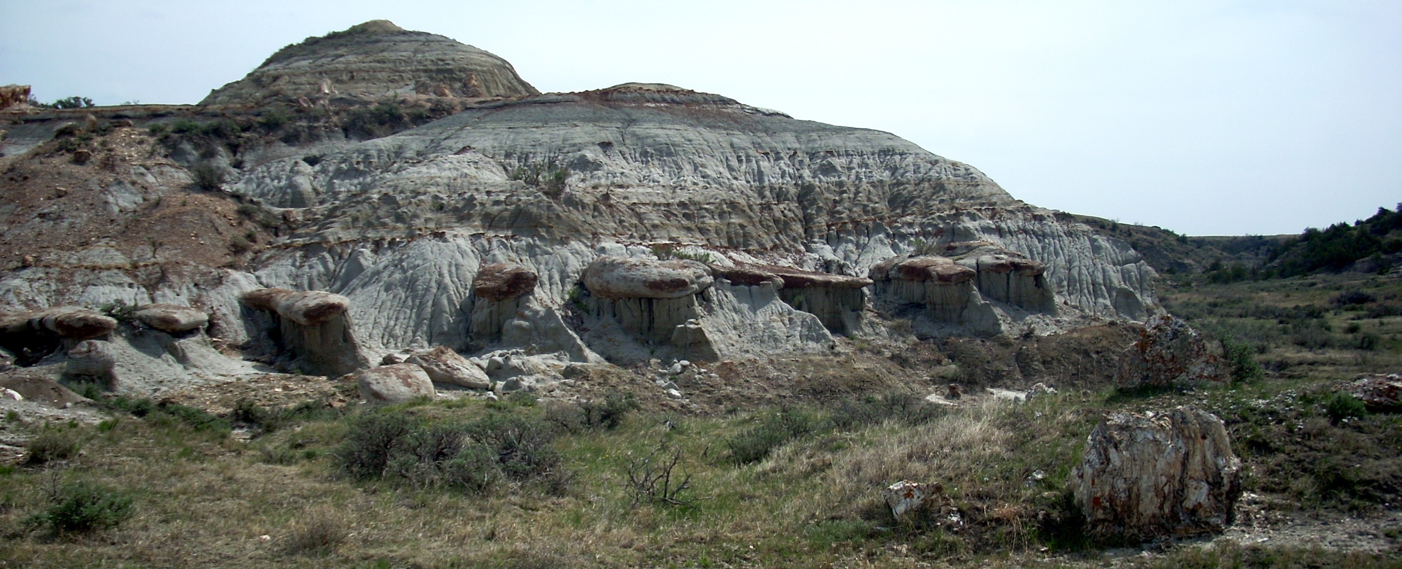 |
|
|||
|