Chimney Top Creek
| Route 66 | Cities | Beaches |
|
Chimney Top Creek |
|
| Auxier Ridge | Martins Fork | Grays Arch | Rush Creek | Pinchemtight | KoomerRidge | ChimneyTopCreek | ParchedCornCreek | SwiftCampCreek |
| IndianStaircase | Castle Arch | Osborne Bend | Raven Rock | Red Byrd Arch | Indian Creek | Revenuers Ridge | Copperas Falls |
 |
 |
 |
|
The Chimney Top Creek hike is one of our favorites. It offers wonderful photo ops, vistas of towering cliffs and rock formations, a sense of Indian and pioneer history, several unique stops, and lessons in forest dynamics. It is a comfortable day hike which could be extended to a weekend, with three outstanding camping areas just off the trail and the NFS maintained Koomer Ridge Campground down a one mile spur. The most convenient access is via the Mountain Parkway to Slade, along State Route 717 to Nada, in through the tunnel, across the steel bridge, and East (upstream) along the river until you see the gravel drive turning steeply down hill to the right, marked by the "Trail 100" sign. . |
The parking lot is along the Red River, and the trail immediately heads up along the north shore. It's a scenic stroll, with the water rippling a short distance below. Exactly how far below depends on the season. In the dry months of August through October, the Red can often drop to very shallow levels. But given a week of rain, it can rise over the trail. As a matter of fact, this hike should not be taken under wet conditions. In addition to the river section, the trail will become a quagmire along the Upper Adena Flat and the three creek crossings will become a knee high wade. We generally avoid this trail in Spring and after rains of several days. However, from June through September it is usually great. |
|
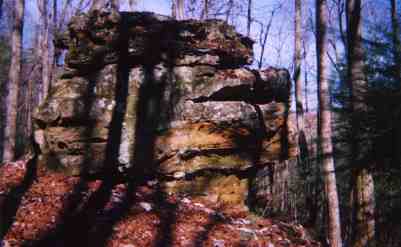
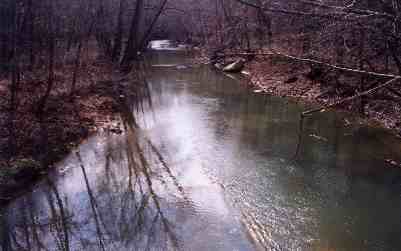
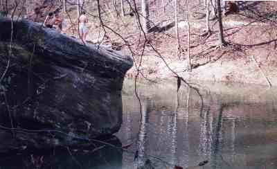
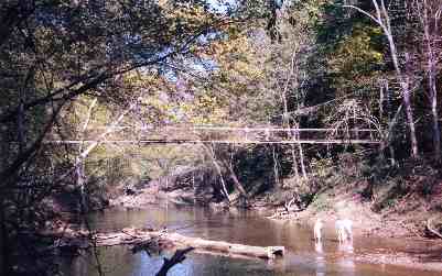
Do not let the flowing river distract you. High above and slightly behind you tower the cliffs of Pinch Em Tight. High to your right is Chimney Top. Just across the river is the upstream corner of Adena Flat. And straight upriver is Hog Snout Rock, pictured at right. You'll be looking at Hog Snout from several angles on both sides of the river. It is from straight ahead that the early settlers thought it bore a striking resemblance to the head of a male razorback hog. These wild boars were once plentiful in the Gorge, but hunting had already depleted their population, and the heavy timbering wiped out the habitat, thus eliminating what was left, so they've been gone for a century. Today, the only wild boar population in Kentucky is in the Big South Fork. However, Hog Snout Rock is popular for another reason. It juts out into one of the finest classic swimming holes left in Kentucky. |
 |
 |
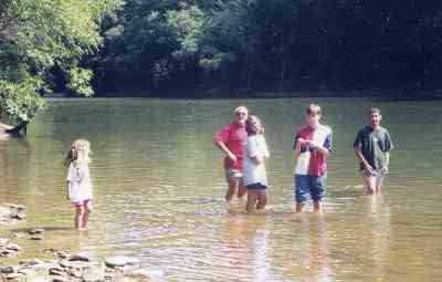
Tom Sawyer and Huckleberry Finn couldn't design one better.
The rock itself offers a wide, flat top ideal for soaking up the sun,
but sloping down toward the deepest water so the dive isn't too intimidating.
Three grapevines from the opposite bank allow swimmers to swing out and
drop into the pool. The river right below the rock is deep and wide enough
to allow legitimate swimming. Just downstream of the rock is a wide, gentle
sandbar so kids can step out of the water and climb back up to that flat
top. Just upstream of the rock is a steeper natural staircase winding
up the backside of Hog Snout. The Red current slows enough here to allow
inner tubers to bob in the bend with just occasional hand paddling to
keep them from drifting downstream. The shallows just upstream of the
bend allow the sun to warm the water enough to take the chill off, so
it's refreshing without being icy. And there are several grottos between
nearby boulders to allow privacy for changing clothes. Norman Rockwell
couldn't picture a better swimming hole. |
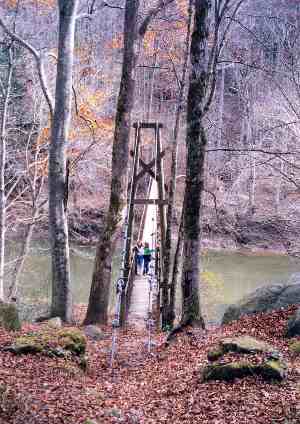
| Around the bend a short distance the trail intersects with the Sheltowee Trace, turns right, and crosses the Swinging Bridge. Hundreds of these once served East Kentucky, including a dozen in the Gorge. This is not one of the longest, but it's one of the best. Its "floating" design and screw trussed cables are sophisticated features. There remain fine swinging bridges at Torrent Falls, Charit Creek and all along the headwaters of the Kentucky River, but this is the closest one to Lexington that crosses flowing water. Of course, that has been a problem. Previous bridges here have been washed away by floods in 1942, 1964 and 1983, so if the pattern continues, this one, built in 1984, is living on borrowed time. As the various farms in the Gorge were bought out by the federal government, once a flood took a bridge, it was not replaced. The only reason this one is replaced is that the Sheltowee Trace comes across it and heads on up the hill. Most of the time this is a rather idyllic scene, but in flood the waters of the Red often lap at the bridge's planking. |
 |
 |
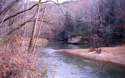
Across the bridge, the trail turns sharply right and drops down to the river. And here is perhaps one of the most unique sights in the whole Gorge, or even the state : The Red River Dunes. As in sand dunes. These may not compare to the windblown dunes hundreds of feet high in North Carolina and Colorado. These are waterborn and only several feet high. Nevertheless, seeing shifting sand in the middle of the forest, covered in October by falling leaves and surrounded in May by wildflowers, is bizarre. On the other side of the trail is another rarity, this one botanical. Here is a surprisingly plentiful colony of Maidenhair Fern. The only Kentucky fern with a circular leaf pattern instead of the usual vertical stalk, Maidenhair is extremely delicate and is not usually found in such abundance along a heavily travelled path. |
You hike through a boulder
garden and pass within a few feet of Hog Snout Rock. Then the trail curves
to the left and begins climbing the shoulder of Chimney Top Ridge. The
famous rock formation looms directly above you, usually obscured by leaf
cover. Chimney Top Creek appears below you, and what used to be Adena
Meadows spreads out across the valley toward Pinch Em Tight Ridge. This
100 acre bottomland was farmed for two thousand years by the Adena Tribe,
which maintained homes in the pocked cliffs up the East Branch of Chimney
Top. Sentries were maintained atop the five rock formations surrounding
the valley, with fires built and ready to light. If anyone were seen approaching,
the sentry would start the fire. Lookouts down in the valley alerted the
women and children in the fields, who fled upcreek to their rocky shelters.
The maize, squash, pumpkins, beans, tomatoes and other crops provided
a valuable supplement to the usual Adena diet of game, berries and fruit.
|
 |
 |
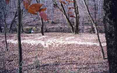
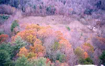
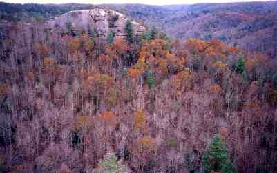
The Adena were gone before Daniel Boone discovered the Gorge, and Adena Meadow had reverted to forest. But early pioneers moved into the Gorge, and the Ledford family homesteaded this piece of land between Pinch Em Tight and Chimney Top. They recleared the land and cultivated it for another 200 years. There was plenty of water, and every Spring a flooding Red River deposited rich silt on the flat. The Ledford home, barn and various outbuildings stood in the upper right corner of the meadow in the photo above, just left of the bend where the river turns abruptly to the right. The photo was taken looking down from Chimney Top. The trail is under the trees in the fore ground. When the federal agents began buying up land in the Gorge, the farm had come down to Dottie Ledford and her husband Chester Morrison. They decided that fighting the right of Eminent Domain in the courts was futile, so they offered the government a deal : Rather than sell, they would give the land to the park, in exchange for the right to live on it and farm it until one of them died. Dottie died in 1971, and in 1972 Chester moved to Winchester to live with his son. The family now lives in Nicholasville, and Morrison comes back to visit the Gorge several times a year. The buildings were removed in 1978. The meadow has now grown up in tightly packed, slender 30 year old beech, birch, sycamore, elm and sassafras trees, shown in the photo at left. This is a classic example of succession unfolding. Over the coming decades it will be fascinating to see the trees thin out and the oaks move in. And once the mature forest evolves, it will be the largest level valley floor of any wooded part of the Gorge. |
|
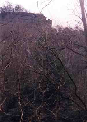
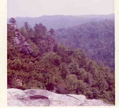
The trail drops down the south flank of Chimney Top Ridge, all the way to the valley floor, then climbs midway up Half Moon Ridge. Half Moon Rock is the formation shown in the photo at right, as seen from Chimney Top. If you look carefully, you can see the trail angling up from lower right toward the center of the picture, then switchbacking back toward the upper right and disappearing over the ridge. If you're into bushwacking, you can leave the trail where it reverses direction, and navigate your way up to the bottom of the rock formation, where several well used routes allow access to the top and a trail leading out to the road. But the main trail continues over the ridge and drops back down to the top of the old meadow. It will bottom out and follow the creek for half a mile. This is the section that becomes swampy in high water. |
 |
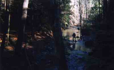 |
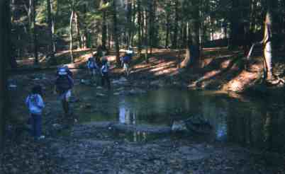
Assuming you have dry footing, the trail will wind along through undergrowth, and eventually swing in to the left of Chimney Top Creek. Watch carefully, and you'll see the creek split. Immediately after a trail sign will indicate that Rough Trail (#220) turns to the right and crosses East Chimney Top Creek just above the split. If a day or so of rain has fallen in the past week, this can be a very tricky crossing. There are logs and rocks, but when the water is running calf deep you need a good pair of trekking poles. If you didn't bring any, look around for a good branch you can trim down to a hiking stick. You'll need it to keep your balance. Changing into river shoes is a good idea here, since you have some demanding miles ahead and cannot afford wet boots or socks. A trick we use is two large plastic garbage bags. We stick each foot, boot and all, into one, use a large rubber band to hold it tight at the knee, walk across, then take them off and hang them outside our pack. We can use one pair about four times before the bottoms give out. |
The white diamonds on the trees lead you up the valley. You are now walking along West Chimney Top Creek, and you soon come to another crossing. The creek is squeezed here, so it's not as wide but deeper. In high water it can be knee high. The best crossing is just upstream of the trail where several logs provide a dry if somewhat precarious bridge. There are half a dozen of these logs, and they are rearranged by each new high water surge, so you never know what you may find. It may help to rearrange a few, recreating a bridge. You will then leave the creek behind for an hour or so and head up the hill. This is ironic, because an old Adena trail led directly up the creek valley and if you're in a mood to bushwack, you can easily follow the stream through a very scenic winding route, eventually meeting the maintained trail coming back down off the ridge. |
 |
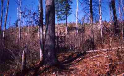 |
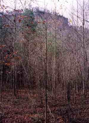
Assuming you follow the official route, you'll be climbing steadily for a while. The top half of the climb passes through The Burn, a section hit hard by forest fire a decade ago. For a few years the blackened trees, both standing and downed, created a grim mood. But the forest has begun to come back. Hundreds of slender 10 year old saplings stretch upward. The cliff on the outer edge of the ridge is clearly visible right now, but in 10 years it will again be obscured. | 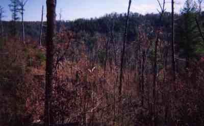 |
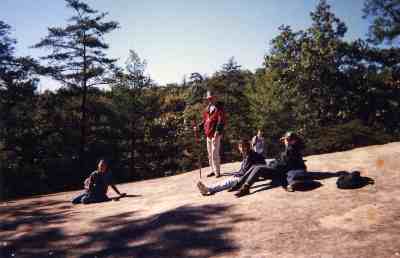 |
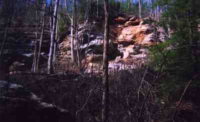
Once you reach the ridgetop, you'll have easy walking for a while, with occasional views of the deep ravines on both sides. But then, to your right, you'll see a huge boulder emerging from the ridge itself, and the trail will suddenly turn and bring you out on its surface. This is the largest rock outcropping in the entire Gorge, and what you see today is only part of what used to be visible. The forest has been busy for decades encroaching on this boulder face, and walking around the edge you can see the process at work. First the lichen colonizes the rock. Next it begins holding leaf litter, which allows small seedlings to take root. Pretty soon, plant life claims that section of the rock, and the lichen moves further out onto the bare surface. However, there's plenty left to enjoy. We always use this for our lunch stop. We can spread out, bask in the sun, take a nap, watch the birds circling in the thermal currents, and take a few photos. |
The trail continues along the ridgetop. Rough Trail cuts off to the right, heading toward Pinch Em Tight, while we continue straight, winding along the narrow ridge. We cross a few more rock outcroppings, but none nearly as big as our lunch stop. Then the trail starts back down, through a dense rhododendron thicket. This is a pretty rugged descent, with the route narrowing and switchbacking several times. But you finally come back down to West Chimney Top Creek and cross it. There are several scenic campsites down here, but they are small and tight, suitable for only one tent each. Be careful at the bottom : the trail crosses the creek and turns right. It appears to start downstream (left), and is not clearly marked. The climb back up out of the valley to Koomer Ridge is a killer, but it's the last ascent of the day. At the top, a one mile spur heads Souith (right) to Koomer Ridge Campground. But the main trail continues left on out the ridge, then turns and starts another descent, this one to East Chimney Top Creek. It may help to know that this is the last descent of the day. |
 |
|
|
It's a spectacular segment. The wind has not
inflicted the havoc here that other areas suffered, so you're hiking down
through huge trees, with a rhododendron understory and a fern cover, mostly
ebony spleenwort, New York fern and some bracken. You also find two massive
rocks, unusual in that they are completely isolated and far from any cliff.
The first is Bison Rock, named because the early settlers thought from directly
downhill it looked like a buffalo head. The side view from the trail, shown
to the right, does not give this impression, but it's still well sculpted
.
The second is Emerald Rock. Boone says the Shawnee called it "Much Grene Rock," but he never could spell. Emerald Rock is in year round deep shade and next to a side stream, so it is heavily covered in moss and algae. |
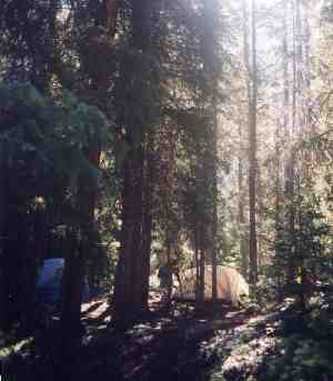 |
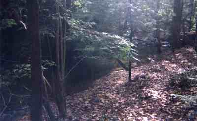
From there, the trail drops fairly quickly to East Chimney Top Creek. This is a very photogenic valley if your camera has a good lens and is big enough to bring in adequate light. But you're in deep shadow. The trail heads downstream along the scene at lower left. You'll pass several huge rocks and climb around several smaller outcroppings. Above you, a whole section of cliff has just broken away due to extensive rains, shown below center. The trail cuts across a wide flat, where grass is actually growing. And then you'll come to your final stream crossing, shown below right. Again, in a dry time, this will be an easy hopskotch over shallow water, but after heavy or prolonged rains it can be knee deep. As you climb the opposite bank, a popular campsite, pictured here and in the back- ground below right, appears on your left. It has the disadvantage of being adjacent to the trail, but there are rarely any hikers from mid evening until midmorning. It's large enough for a group. It's perfectly level with a dozen large trees. It sits in the bend of the stream, so you have plenty of fresh water and can drift off to sleep listening to melodic flowing sounds. There's firewood all along the creek, and a large fire ring is usually already in place. On a dayhike, this makes for a nice final rest stop. As you head north beyond the campsite, almost immediately you come to the trail intersection where we turned off on the way out. From the signs, it's an easy hike back to the swinging bridge. |
 |
 |
 |
|
|||
|