Swift Camp Creek
| Route 66 | Cities | Beaches |
|
Swift Camp Creek |
|
| Auxier Ridge | Martins Fork | Grays Arch | Rush Creek | Pinchemtight | KoomerRidge | ChimneyTopCreek | ParchedCornCreek | SwiftCampCreek |
| IndianStaircase | Castle Arch | Osborne Bend | Raven Rock | Red Byrd Arch | Indian Creek | Revenuers Ridge | Copperas Falls |
|
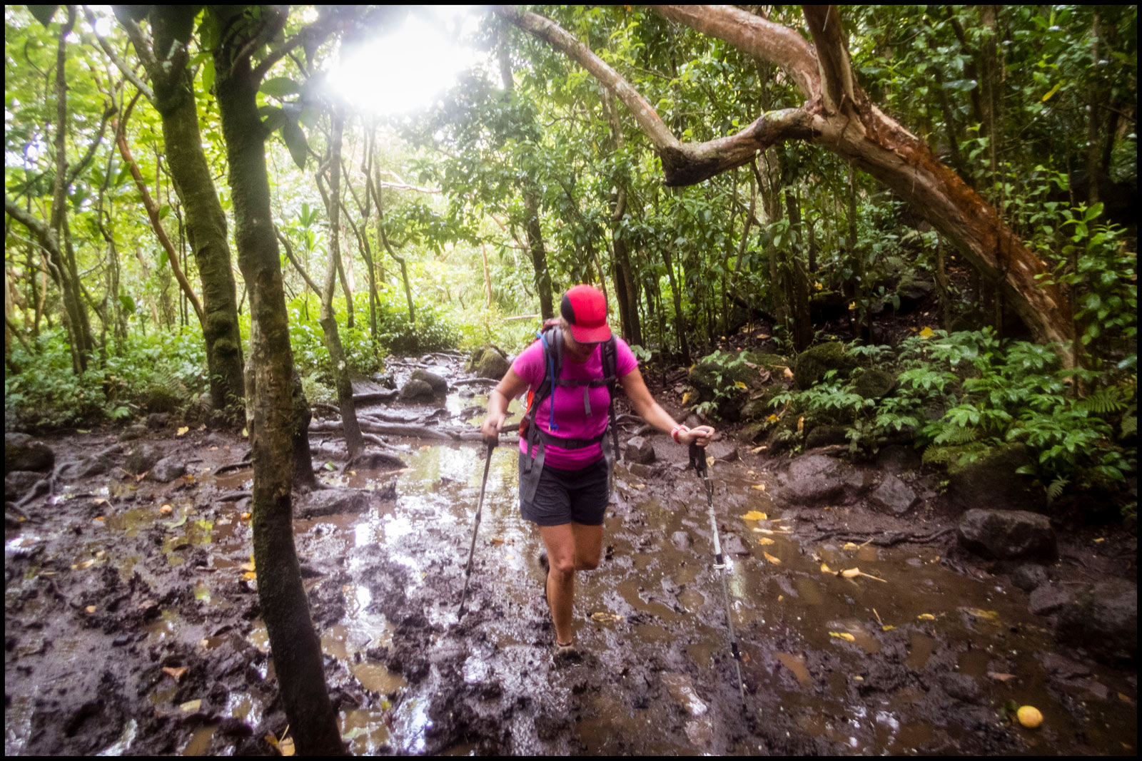
Swift Camp Creek is a very scenic hike, possibly the most beautiful in the Gorge, but it can also be exhausting, What makes it strenuous is not a single long hill. It is simply a continuous up and down, up and down, on a narrow, winding trail beset by stream crossings, gnarled roots, trees down across the trail, growth pressing in and boulders. In wet weather it has several mucky stream crossings. If it has rained several days previously, don't even try it. It's also awkward because it's a long point to point with the two trailheads quite a drive apart. We urge you to do it from north to south, meaning you should begin at the Parched Corn Creek Overlook, along state road 715, also called Sky Bridge Road. You take the Campton exit off the Mountain Parkway, turn right, come to the crossroads of Pine Ridge and the old Dessie Scott Children's Home, turn right onto 715, cross over the Parkway, and enter the Gorge. It will take 10-15 minutes on 715 to reach Parched Corn Creek Overlook (on your left, west) on the narrow, winding road. |
|
 |
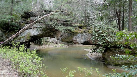
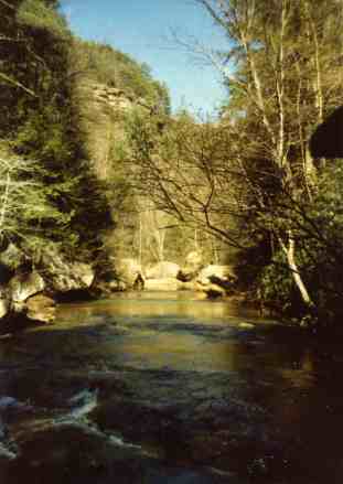
In addition to your usual hiking supplies, we suggest extra changes of socks, a fluffy towel, and a pair of river shoes, Wellingtons or waders. The mud can suck sandals or loose fitting boots off. When you come to one of the mucky sections, you're better off to stop and change, then stop and change back after the crossing, to protect your hiking boots. In any event, the trail begins across the road from the Parched Corn Creek Trailhead and parking lot and heads East. The first mile crosses a level plateau through beautiful open forest. Then it drops down off the plateau, a 300 foot descent in a third of a mile. As you enter the valley, you will notice a tremendous amount of blowdown off to your right, and you may find trees or branches blocking your own path. At the very bottom of your descent, the trail comes through a very steep 40 foot chute, then levels out on the flood plain of Swift Camp Creek. Watch carefully. The route appears straight ahead, but that is a spur people use to fish or picnic along the creek. The through trail cuts sharply right and drops to a grotto and a side stream. You climb around a large boulder and descend a series of steps carved into the stone. This brings you to the main creekside. The trail then sets off on its six mile southern journey along the stream. If you enjoy sitting with your feet in the water, wading, swimming, rinsing anything out, or refilling your canteen (after purifying), do it here where the trail is so close. From here on, the terrain will grow much rougher, and while the stream will be foaming and gurgling far below, cliffs, steep banks or scree slides will separate it from the trail. You'll cross several beautiful side streams, as shown by the one at left, but you never cross Swift Camp Creek and rarely even drop down to hike alongside it. |
You'll climb a shoulder and hike along it for a while, turn right and head up the Wildcat Creek drainage, dropping slowly down to the stream crossing. Then the trail angles steeply up the hill to the intersection with Wildcat Trail. This could be considered an escape route. You could switchback up to the plateau above, hike a mile out to the road, turn right, and follow it a mile to your vehicle. However, the main trail swings around a rocky outcrop and continues southward. At this point the scenery changes abruptly. The trail rises and falls, twists and turns, crossing streams, wet spots, and logs, all the while threading its way through rhododendron thickets, large rocks, and banks. Above you, high rocky crags jut skyward. Everywhere huge boulders peek out from dense foliage. If the producer had decided to film Lord of the Rings in America, this would have been the place to do it. |
 |
 |
About a mile of this brings you to Dog Fork. In dry weather, this is one of the most scenic spots in the entire Gorge, especially if you leave the main trail and wander upstream around a few bends. In wet weather, it is your worst nightmare, an unending bog of knee deep goo with so many crisscrossing trails it can be hard to find the true one. As you descend the steep trail with the boulder to your right and prepare to cross Dog Fork, take a minute to look across. The true trail goes straight ahead, then climbs the mucky slope until it comes out on a gray mud ledge under a sandstone cliff. It turns left and follows along under the cliff until it comes out on dry ground. The Forest Service and various volunteer groups keep building bridges, steps and railings to help hikers, but they keep vanishing into the quicksand like mud. Whether any of them are in place to help you is a matter of luck.
|
|
Once you navigate the muds of Dog Fork, however, the trail resumes its up and down profile, with several great views of the creek far below and the valley spreading out beyond. Over there, on the other side, is The Calaboose, the wild trailless eastern section of the Gorge. This is also the supposed site of Jonathan Swift's legendary silver mine. Like any good legend, various retellings slightly alter the details. But the main story tells of an early prospector who discovered a mother lode somewhere in the headwaters of this drainage during the 1760s. He took silver samples and a map to the assayer in Lexington, who verified that it really was silver. Swift then filed his claim at the land office. However, the outbreak of the American Revolution prevented his immediate return. During the Revolution, he was injured and died in a Baltimore hospital. His map was lost. But his journal remains, complete with drawings. They clearly show various landmarks along the approach : Haystack Rock, Chimney Top Rock, Sky Bridge, Castle Arch, and Turtle Arch. Most striking are his drawings of a base camp at Rock Bridge. It is an irregular formation, unlike anything else in Kentucky, and his art is unmistakeably of this particular site. |
 |
 |
Skeptics point out that nobody has found any other silver anywhere in Kentucky, that silver does not occur in sedimentary sandstone, and that 200 years of searching have found nothing. Believers have the journal, with its accurate art and descriptions of the valley; the silver samples, still on file; and the mining claim, still on file. Most curious is the discovery by archaeologists that the Shawnee were extracting silver from some source in Northeastern Kentucky and using it in jewelry. Therefore, do not be surprised if you see amateur silver sleuths along the trail, with their metal detectors, sifters, hammers, maps, GPS instruments and sometimes copies of Swift's journal. Whatever the truth of silver deposits, you are also entering another historical location, this one very well documented. The Upper Swift Camp Creek valley was the scene of extensive timbering, and the trail leads right through the heart of it. |
You'll notice a trail going off to your right up a small stream. If you're on schedule and can spare the time, you might hike up that trail to Turtle Back Arch, one of the Gorge's more interesting arches. It's only a few minutes stroll from the main trail. And the Arch isn't the only interesting aspect of this brief side trip. The terrain itself will pose challenges. The trail actually passes over the arch. Just before you get there, a side trail drops off to your left. It will pass under the arch, then loop around and climb back up to the main ttail. Turtle Back Arch is about five feet high and very deep, like a cave or tunnel. It's overlain by a wide concave cap, with the trail passing over it. When the Sun hits it from various angles, it's quite photogenic. The best photo opportunities are in the Fall, when the Sun filtering through the golden leaves gives the arch a glow, and in Winter, when you can often find it encased in ice with the sun glinting off it. The trail continues past the arch, but resist the temptation to take it. It eventually comes out up on the gravel road to Rock Bridge, but then you'd have to hike back to the parking lot to a vehicle if you left one there. You'[re better off to return to Swift Camp Creek Trail and hike up through Hell's Kitchen, past Rock Bridge and Creation Falls, and climb to the parking lot from there. |
 |
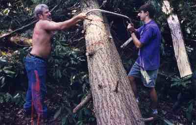 |
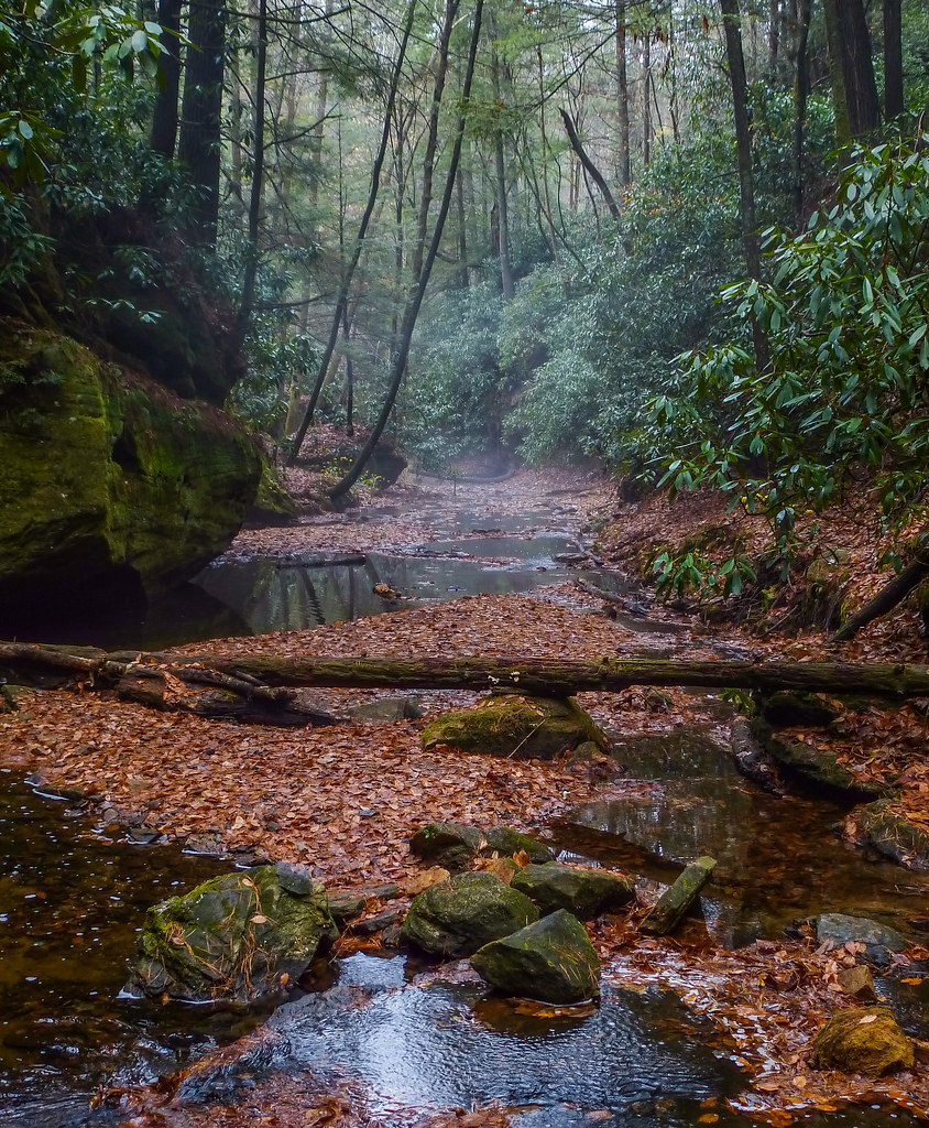
Anywhere along Swift Camp Creek Trail you may encounter downed trees. Strong winds and storms roll through this valley and the entire Gorge often, especially in the Winter and early Spring. However, you may also notice that there have been a lot more trees and branches down that have been cleared. Most of this work is done by local volunteers. One group assembles on weekends, camps out, and spends two days working on trails. Scout Troops, Venture Units, school groups and local businesses "adopt" a trail and devote one weekend a month to work on it. Like all national parks and national forests, the Gorge is seriously underfunded by Congress, so volunteer labor never catches up. But they help a lot. One problem is this is part of the Clifty Wilderness, so chain saws and other power equipment is forbidden. That means cross cut saws and other old classic tools must be used. With the large trees, this requires quite an effort. |
Notice the stream below. When it narrows and enters a tight canyon, if the weather has been dry and the stream shallow, you might consider donning river shoes and wading upcreek. It's worth it just for the scenery and after a long hike on a hot day it's kind of refreshing. But, more important, you're walking through Hell's Kitchen. This was where the loggers built splash dams, temporary waterbars to back up a sizeable pool on this small stream. They then cut the logs and floated them on the water. After each two day rain, they pulled the bar and the dam swung like a gate, releasing a tidal wave downstream, carrying the shipment of logs with it. A special crew wearing spiked boots rode the logs, using hooked poles to keep the mass more or less together. This dangerous ride continued on down the Red River to sawmills at Stanton. Injuries and deaths were common, but the pay was high, and the men got a weeklong break after each run. The last major bars and gates washed out in 1984, but if you study the streambed and sides carefully you can still find remnants. |
 |
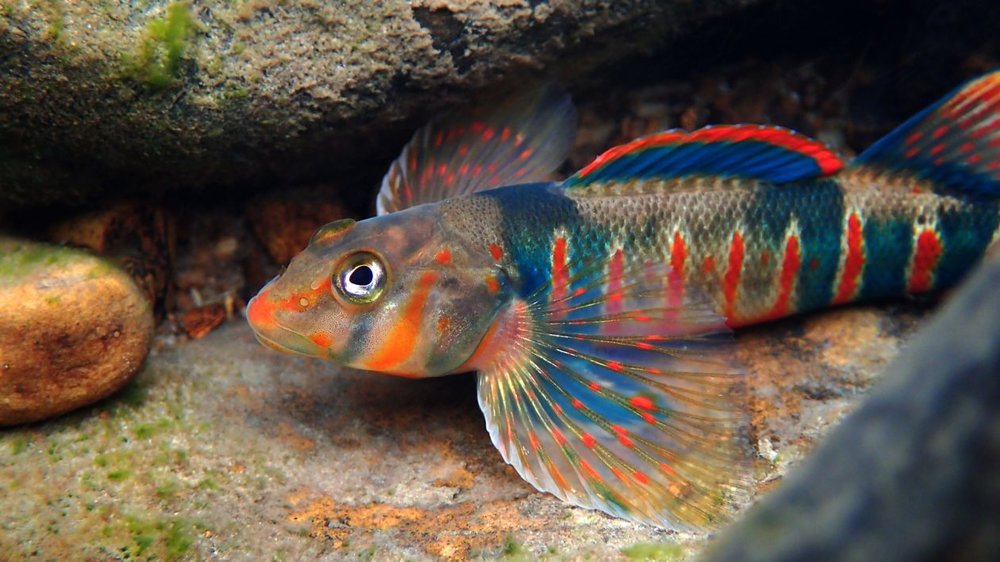 |
While you're wading along, notice the fish. There are brook trout in here. Those would be the bigger fish cruising around. But the dozens of much smaller fish are darters. They're a whole family of fish which have evolved down in size so they can specialize in these shallow tributaries where their larger predators cannot pursue them. If you can focus fast enough to see them clearly, they're beautiful fish. The short, stocky fish with little color are sculpin, fascinating creatures which use their fins to brace themselves in position facing upstream where they can catch tiny prey washing down with the current. |
| After the loggers cut the trees and left, the moonshiners moved in. Even before the big trees grew back, dense rhododendron thickets provided cover. The farmers could raise their corn up on the plateaus, then haul it down here and distill it into whiskey. Thus began half a century battle between the "whiskey runners" and the "revenooers," special agents representing the Bureau of Internal Revenue.It was not illegal to distill corn into whiskey, or to drink it or serve it to friends. But the farmers wanted to sell it, and refused to pay the taxes on it. The revenuers destroyed almost all the stills they discovered, but many were never found, and a few remain not far from this trail. A short trail to one leads uphill off Swift Camp Creek Trail just above Hells Kitchen. The one shown here is near Turtle Arch. | 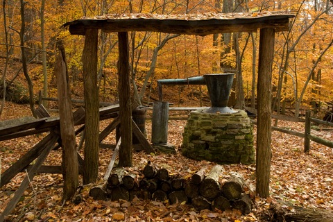 |
 |
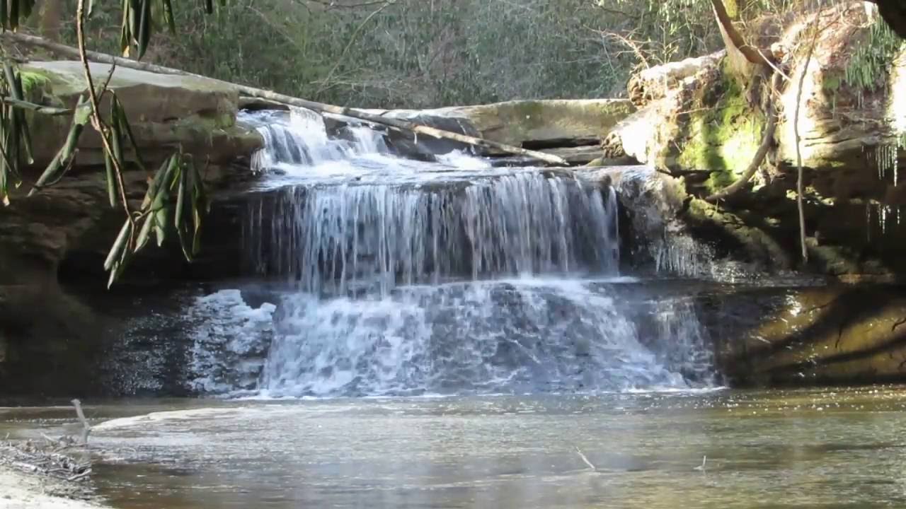
If you continue up the stream, as the canyon opens out again, you will wade directly underneath Rock Bridge (second photo from top and here at right), the only natural arch in Kentucky which spans a year round flowing stream. It is a jagged, unbalanced formation, but photogenic nonetheless. It would be a good place to climb out, dry your feet and put your socks and boots back on. The trail here is paved, as people often hike down from the parking lot just to picnic or photograph this arch. You could climb up, dry your feet, change back into your hiking boots, cross the bridge, and, to your left, enter the Calaboose. This is the wild, remote, trailless eastern expanse of the Gorge. In the Calaboose you could search for Castle Arch, Red Byrd Arch, and several spectacular waterfalls and white water sections of the Upper Red River, a famous canoeing and kayaking run. |
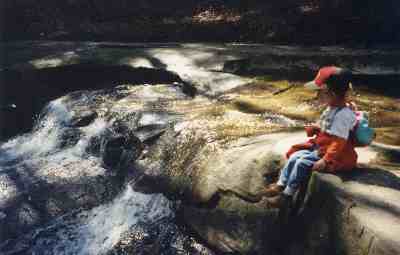 |
By following Swift Camp Creek around the bend, you'll come to Creation Falls, deserving a few photos. The trail in wet weather is difficult, but that's when the falls is most spectacular (see photo at top). A tremendous wall of water comes cascading down, and swimming is possible in the bank to bank pool below. In dry weather (shown here left and right) a mere trickle of water flows, and below it is just a wading pool. From there, you'll climb a quarter mile up the paved trail to the parking loop. | 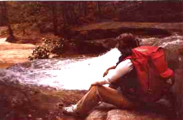 |
|
|||
|