| Route 66 | Cities | Beaches |
|
|
Barren |
Blue |
Miami |
Nolin |
Whitewater |
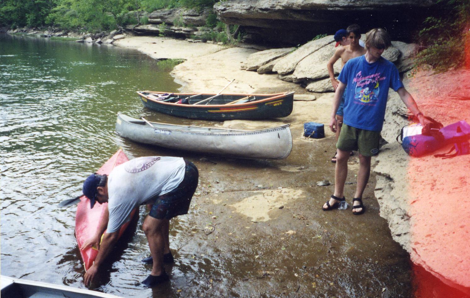
The Lower Rockcastle is the ultimate canoeing run in Kentucky. Understand, though, that it is not an adventure for beginners. As the river descends into the canyon, you are out of cell phone range, far from roads, and in some places hemmed in by cliffs so there is no choice but to continue down the river. People die in the canyon every year, mostly trying to run the Upper Narrows, and the landscape on both sides is littered with canoes wrapped around rocks and trees. The Lower Narrows is one of the most technical water routes in the nation, so long and meticulous that you need to camp overnight just above it to allow all day to work through its mile and a half. The scenery in this wilderness gorge is spectacular but you don't have much time to enjoy it until you stop and camp for the night. Not only is running the river demanding, but planning the trip is demanding. You have to set up the shuttle, and pack the canoes for multiple days but make sure everything is balanced and properly sealed against capsize because it's quite possible you may roll at least once. You also need to be in condition, since this will be an exhausting two days. However, despite all of these problems, you should try to make this trip. There are ways to bring it within reach for intermediate canoeists. You should find at least one experienced paddler who is also familiar with the river. You need to schedule so you have plenty of time; many of the accidents occur because people are trying to hurry through rather than stop and scout the next drop or around the next bend. And if you're an intermediate, you should just portage both Narrows. Carrying around the Upper Narrows is relatively easy. The trail is only a quarter of a mile. Carrying the Lower Portage is more challenging, with a mile and half of up and down rocky trail. But that's why you scheduled plenty of time. Just carry for a while, stop and rest, then carry some more. You can struggle through in an hour or so. The Lower Portage Trail ends at the lake, and from there it's an easy 45 minute paddle to the takeout. |
 |
 |
Shuttles and rentals are through Ruby & Doyle Huskey, Rockcastle Adventures Canoe Livery, 606-309-2976. To reach their outpost, follow I-80 west from London or East from Somerset to where it crosses the Rockcastle River on a high bridge. A mile west of the bridge, take Route 1956 (Old London Road) north. In about a mile it will cross the river. R.A. is in a low steel building slightly down hill from the road. A trail leads down to the water. They'll pick you up at Bee Rock. As long as you take the proper precautions and make sure everyone is paddling within their own limits, this can be an incredible trip. It is the most perfectly sequenced river in the nation. It starts out, under the Ky. Route 80 bridge, as Class I water, and stays that way for a full hour, a scenic, relaxing chance to review fundamentals and loosen muscles. Then, the second hour becomes lower Class II, very lively riffles with bends twisting into and out of them. The third hour advances to upper Class II. You start getting into rock ledges, tight squeezes, blind turns, eddies and diagonal waves. |
| There is an "escape route" here. Precisely 10.7 miles down from the Route 1956 Bridge, you come to the Old Howard's Place Takeout. You could call this a day's run and not try the whitewater section to come. However, to do this, you must either go through Rockcastle Adventures, or have a friend with a very high clearance, rugged four wheel drive truck and experience driving offroad come and pick you up. The road down to Old Howard's Place is not a road for cars, small trucks or vans. Even with a big rugged truck you're going to get jounced around on the way up the hill, it's going to take a while, and after a few days of rain the road is not passable. | 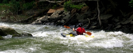 |
 |
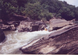
It's the fourth hour, below the Old Howard Place takeout, when things get hairy. As you can see by the photo at left, you're moving up to lower Class III. If your kids have already canoed the Little South Fork, Licking and Elkhorn with good coaching, and you coach them through here, you can get most first year paddlers down to the Narrows. The grand finale of the "upper lower" is The Staircase. It's a long 200 feet series of rapidly occurring Class II /III drops, each slightly angled in relation to the one before so you have to react quickly. What's happening is the river is descending a series of rock ledges. If the stream were totally dried up, you would be looking at an almost perfect staircase, although each "stair" extends far enough out to fit a canoe on before the next drop. It helps to pull over, get out and thoroughly scout and discuss this run before each kid tries it. They need to have a plan, to have their lines figured out so they're not thinking, only reacting, as they descend. We've run The Staircase many times, and taken first year paddlers through without problems. It's a great training exercise. But your kids have to be focused and have their fundamentals down. If you plan to camp overnight at the head of The Lower Narrows, which we recommend, you can rerun The Staircase several times, using the portage trail to the left (east). |
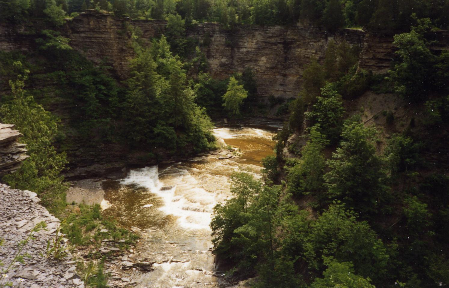
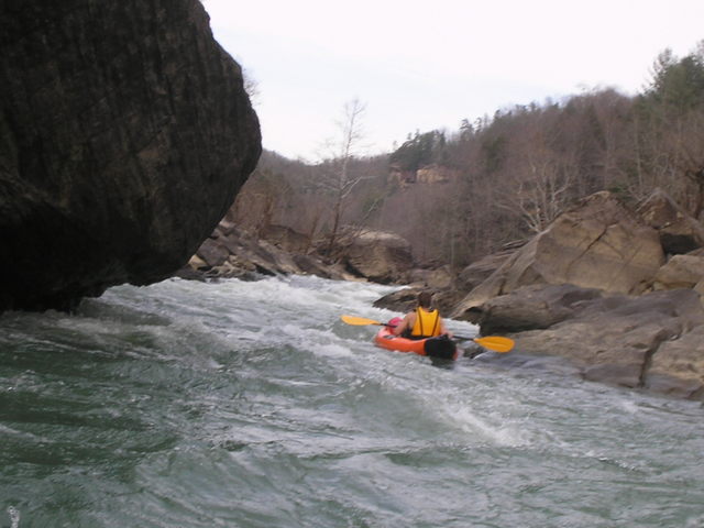
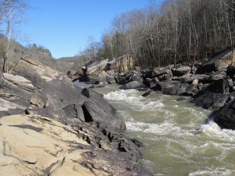
The worst that can happen on The Staircase is a kid capsizes. He'll be in shallow water, and he'll be washed down to a calm pool below. It's a great challenge, and you can haul each canoe back up to the top and run it over and over again on a warm sunny afternoon. Eventually, you can paddle on down that calm pool. After the lively water of the last two hours, the pool is almost scary. There's no sound, no ripple. All around you are huge boulders, some of which you have to go between. The water is very deep and crystal clear. It's a beautiful but surreal scene. And then you hear it. Faint at first, then slowly growing louder. You can't see anything, but it sounds like Niagara Falls is approaching. As you come out from between the last two boulders, you see the scene shown here. This is the Upper Narrows. As soon as you see this, you should move immediately river left. Between that graysih boulder and the lighter colored one past it is a gentle sandy beach. Pull up on that beach and haul your canoe out. You need to portage here. |
 |
 |
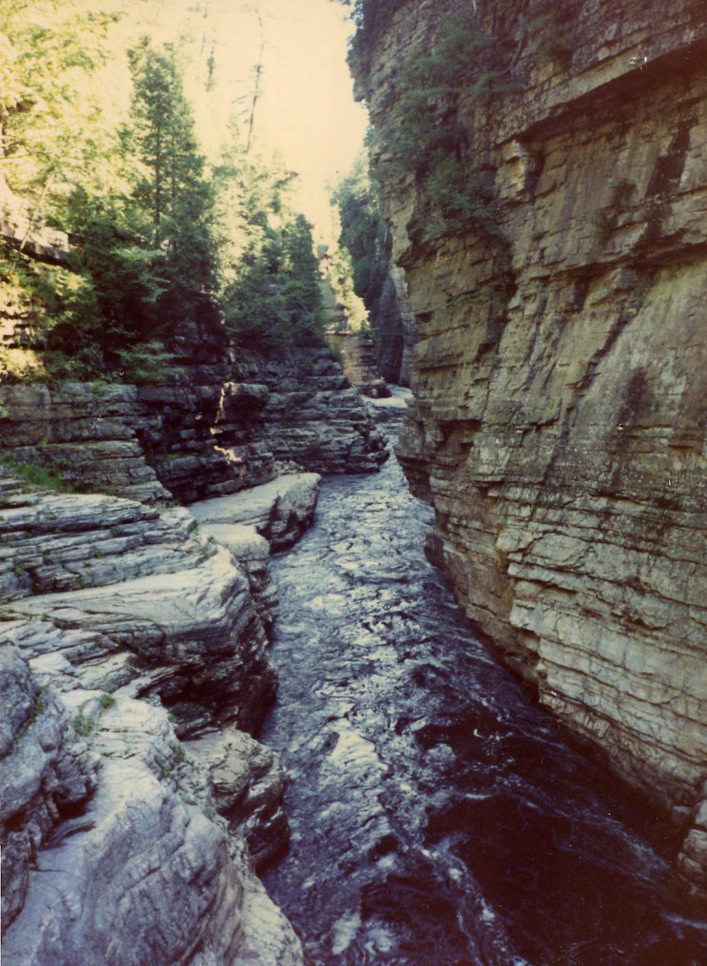
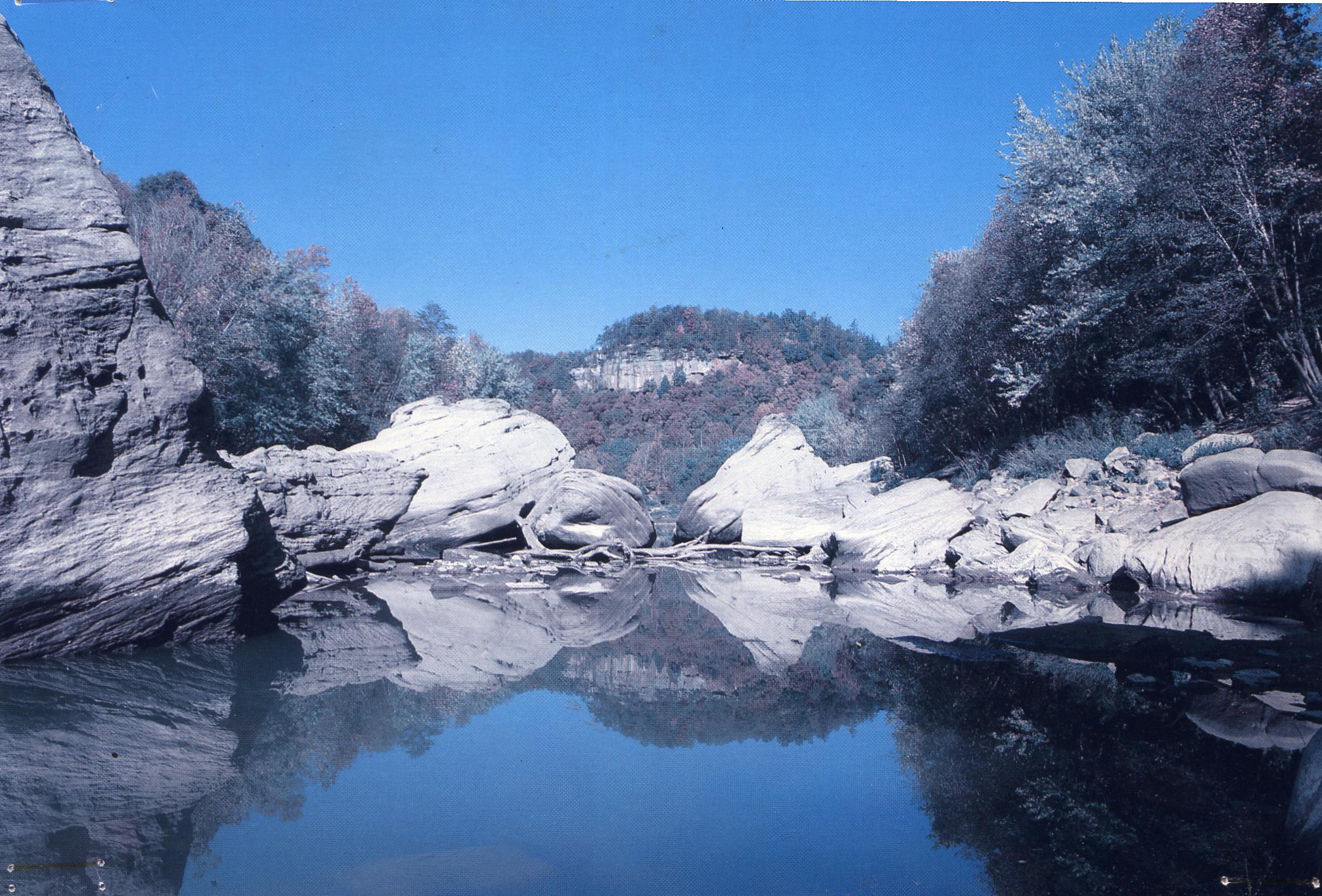
This is what it looks like from the other side. Immediately below is what it looks like from the end of the portage trail where you'll put back in. This is the single most dangerous drop in Kentucky. More paddlers have died here than everywhere else in the state combined. There are several problems, all occurring simultaneously. First, there's the drop. This is a powerful flow, the whole wide river squeezed through that 12 foot chute. Second, there's the hole right below. Centuries of that water pouring down have carved out a very deep hole and if you don't know what you're doing, you'll be carried down into it by the force of the drop. Meanwhile, there's a vicious hydraulic rotating back and down from that foamy downstream water. So once you get carried down into that hole, you can't swim your way to the surface because a powerful current is rotating down on top of you. But even if you can get to the surface, the current tends to carry you to your right, which, in this photo, is to the left, against that large boulder. The boulder is seriously undercut. So once against it, you'll be driven back under the rock and down. Meanwhile, it's quite possible your own kayak or canoe will be battered against you by the same current. This is a Class V situation, and a lot of Class V paddlers either barely escape, or do not escape at all. There are, of course, people who run it every day. They are either very, very good, or very, very lucky. We will admit that we have run this successfully. We didn't even tip our canoe. But we cheated. We ran it at the end of a three month drought. The water was so low it did not have its usual power. And we still had to struggle. This is our philosophy : We never, under any circumstances, allow a high school student or anyone less than proficient to run this. We portage it. Always. It's a beautiful trip and we don't need to run Beech Creek Narrows to make it beautiful. We have great fun carrying our boats to the put in, then coming back, sitting on the rocks and watching paddlers far more skilled try their luck. |
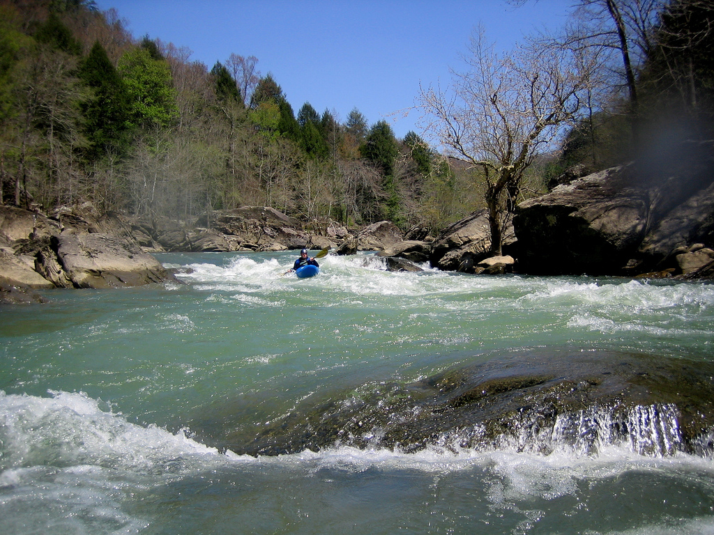
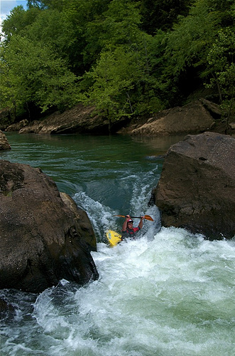
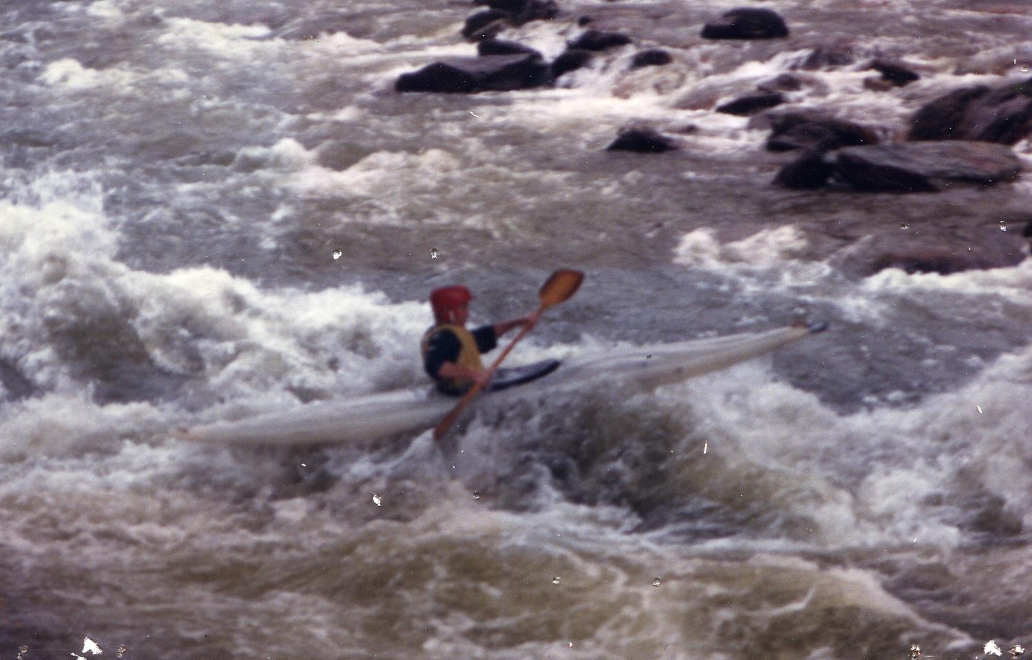
We've learned from watching the experts that the secret is you have to paddle hard and come off the top water with air under you, soaring out over the drop instead of riding the water down as the kayaker in the photo is doing. You need to land on that pocket of foam and as you land dig your paddle in hard so you're skimming downstream. The current cannot get a grip on your boat and start sucking you back upstream toward the hole. The typical paddler tries to ease over the top, so he can look down, get a good view, and then ride the water down into the trough. If he does this, he ends up like this guy, and he's in trouble. But even if you clear the hole and ride the foam on out, you aren't done. The current is trying to push you to the left, against this slanted rock in the foreground (right). That rock is badly undercut. Your boat will tend to be sucked under, rolled and filled with water in seconds. You can be pinned under there with your boat, or if you exit successfully, your boat is almost impossible to pull out even with several friends and half a dozen ropes. To avoid this, you have to paddle hard right (to the left in this reversed view) so you either bang into the large rock barely visible at the edge of the photo, or narrowly skim it. Then the current will rocket you downstream and out of the maelstrom. |
 |
 |
So we portage Beech Narrows, usually called The Upper Narrows. The river widens, shallows and calms down for one mile. You then come out in a huge pool with a landing beach on the far side and a narrow chute exiting to the right between two boulders. If you have beginners or low intermediates, head for the beach, haul out, and use the portage trail. For this is the entrance to The Lower Narrows. This is the single most technical stretch of whitewater in Kentucky. Unlike the Upper Narrows, the danger is not in your drowning. It is in your losing your boat, having it absolutely smashed, bent, twisted and ruptured by the force of water against rocks. And while you may not drown, if you end up in the water you may limp home with cuts, bruises, tears, and other injuries. This is a stretch where at every eddy, you need to pull out, climb over the rocks and scout the next stretch. You must have a line in mind, a route and if that fails an escape route. Things are going to happen fast out there, and you don't have time to think, only react. |
| You need a day to run The Lower Narrows. If you plan to do it, there are numerous good campsites between The Upper Narrows and The Pool, and several more to the right of The Pool and along the right bank of The Lower Narrows. You need a good night's sleep, a good breakfast and an early start. Figure on about six hours. Most of the smashed boats and injured paddlers were from trying to make this descent in two or three hours. They tried to make up the time by shortcutting the scouting and not letting their spotters get into place. |  |
 |
The Lower Narrows was already an incredible challenge, but it has become even more so in the last several years as the Army Corps of Engineers has lowered the water level in Lake Cumberland to repair the Wolf Creek Dam. The Lower Narrows ends in Lake Cumberland. With the dam at full height, the lake "drowns" the bottom mile of the Narrows. Now, with the lake down, the Narrows is back to its 1936 length. |
Once you get past the Narrows, either by portaging or running it, you have a pleasant one mile paddle to Bee Rock Campground. You can plan to spend the night here, or be picked up at dark. Gravel Route 192 runs from Bee Rock west to Somerset and east to Keavy (near Corbin) and I-75. A lot of river runners bring wives or girlfriends along and pitch camp at Bee Rock, are shuttled up to the put at the Route 1956 Bridge the next morning, and then spend one more night here after completing the run. It makes for a nice Memorial Day, July Fourth or Labor Day weekend. You could tack on another one or two day run. From Bee Rock down to Lake Cumberland is about six hours of flatwater paddling (since the lake backup drowns the river under you), and you could keep on going to the town of Burnside or Burnside Island State Park, which has a beach for pull out. There is camping along Lake Cumberland and at Burnside Island. Be aware, though, that the wind may create wave chop on Lake Cumberland and you may encounter powerboats. |
 |
|
|||
|