| Route 66 | Cities | Beaches |
|
|
Restaurants |
Pine Mtn Trail |
Little Shepherd Trail | Kingdom Come State Park |
Lilly Cornett Woods |
|---|
Kingdom Come Plateau |
Cumberland Valley |
Breaks Interstate Park |
Pine Mountain State Park |
Blanton State Forest |
Bad Branch |
|---|
| Big South Fork National Recreation Area | Kentucky Ridge State Forest | Pine Mountain Settlement School | Kentenia State Forest |
|---|
Getting to Pine Mountain depends on what you plan to do there. At 150 miles long, it can be accessed at several different points. Only one of these points features an interstate highway. People driving down from Lexington should figure on three hours in good weather with little traffic. You should gas up in Lexington, and you might consider packing a lunch to eat along the way. There will be long stretches of no gas stations and no restaurants no matter which way you go, and even the occasional stop you do pass will be fast food. |
 |
 |
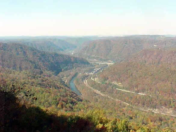
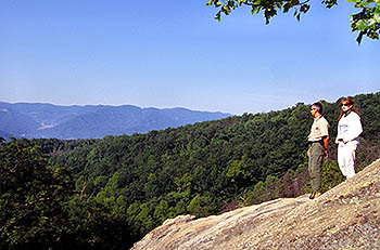
If you want to see The Breaks Interstate Park and the Eastern flank of the mountain, you should leave Lexington on I-64 heading East toward Morehead. Exit onto the Mountain Parkway and follow it to Salyersville. Take 114 and 460 to Prestonsburg, 460 on to Pikeville and Regina, then 80 to The Breaks. From Prestonsburg on you'll be driving along the Levisa Fork, then the Russell Fork, of the Big Sandy River. There's a lodge, cabins and camping at The Breaks, with a good restaurant and various activities. Shown here at left is the Russell Fork flowing in a horseshoe pattern around the easternmost promontory of Pine Mountain. Most people say this is the beginning of Pine Montain. Others insist it actually starts a few miles further into Virginia. Notice the sharp ridge extending from the promontory above the river and off the right side of the photo. That's Pine Mountain, sloping steadily up to its full height, which it will then maintain for 140 miles. Also notice the high ridge south of the river, along the left side of the photo. That's Cumberland Mountain, which will run parallel to Pine Mountain for 100 miles and eventually become the spine of Cumberland Gap National Park. |
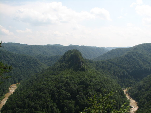
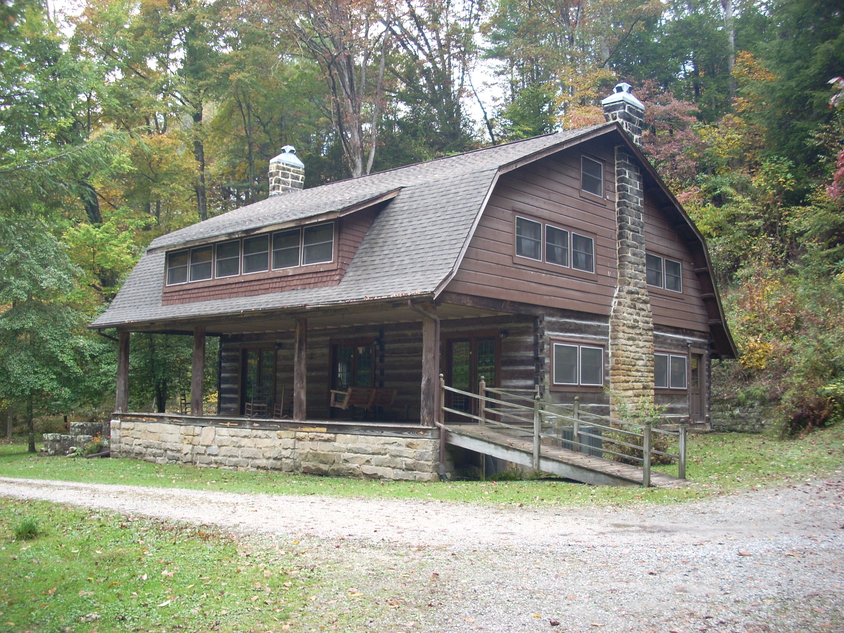
If you want to visit Kingdom Come State Park and the coal sites of Harlan County, you should go South from Lexington on I-75 to Corbin (home of Harlan Sanders and the very first Kentucky Fried Chicken restaurant; there's a museum there). From Corbin take State Route 25E to Pineville, then take 119 ("Thunder Road") East. From Pineville on you'll be driving along the southern edge of Pine Mountain. At Cumberland turn South on Route 160 for just a few miles into Benham, where you'll find the Benham School House Inn. Kingdom Come State Park turns off 119 a mile east of where you turn off toward Benham. There is no lodge at Kingdom Come State Park, but you can camp there. If you're not camping, your best option is the School House Inn. There is no lodging available anywhere on the mountain. |
 |
 |
If your destination is the Pine Mountain Institute (Pine Mountain Settlement School), you should start off South on I-75, but you won't go as far as Corbin. Instead, go off at the London exit and pick up the Hal Rogers Parkway east. Follow it to Hyden. Turn off on Route 118, then pick up Route 421 South. As you come into Hyden on 118, at the top of the hill, you'll pass a gas station on your left. Fill up here. It will be the last gas station you'll pass. You have to have enough gas to drive to the mountain and back, plus perhaps take one or two of the scenic drives along the valley or the ridge. There is no gas at the mountain. Coming South on 421, just South of Bledsoe, turn left on Route 221. Follow this for 12 miles. You're driving along the base of the mountain on the North Slope. Turn right on Route 110, and immediately turn right into Pine Mountain Institute. There is lodging and meals here by advance reservation only. |
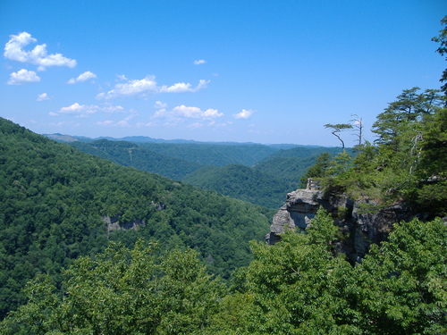
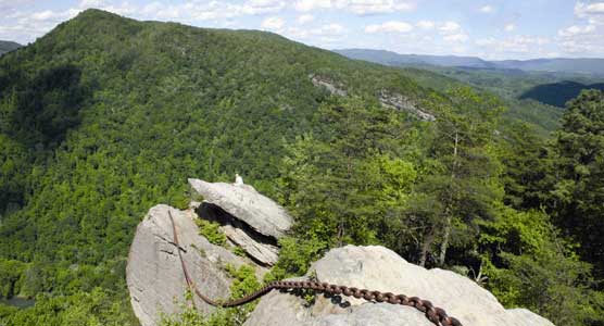
If you're heading for Pine Mountain State Park, travel down I-75 to Corbin, take 25E through Pineville and look for the state park entrance on your right. That's the famous Chained Rock shown at right. Pineville, far below, had long lived in fear of the huge rock breaking away and crashing down on the town. So in 1932 men hauled a huge railroad chain up the unpaved road, dragged the far end of it out to the rock and fastened it securely with long bolts driven deep. There's a hiking trail to the edge of the ridge, from where it's possible to climb out onto the rocks. It takes nerve and skill to get there, but the view is breathtaking. Pine Mountain State Park offers cabins, camping, a lodge with a fine restaurant, a pool, golf course, hiking trails and magnificent scenery. |
 |
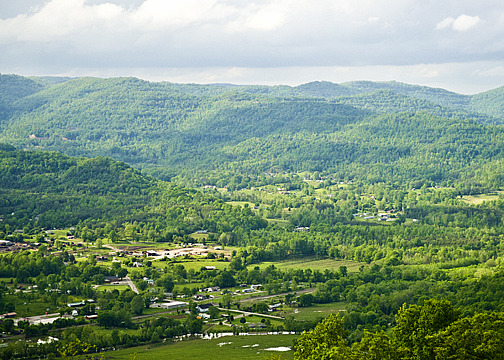 |
At its far western end, Pine Mountain comes down at the small town of Jellico, right on the Tennessee Kentucky line. It then ends at Big South Fork National Recreation Area, a famous backpacking, white water rafting, horse packing wilderness canyon. You can park at Henderson Settlement School at Frakes, 20 miles west of Pine Mountain State Park on route 190, and backpack along the ridge for several days until you reach Jellico. There are motels and restaurants there where you could end a trip or begin one heading back the other way. There are also Indianhead and Jellico Mountains to climb, each requiring about a day's hike. Or you could use Jellico as a trailhead for adventures westward into the Big South Fork. This western end of Pine Mountain is notable because it's the only place the mountain is crossed by a major highway : I - 75. It's a major climb and a major descent on the other side, and in the Winter ranges from difficult to officially closed. But it does make for a convenient two hour trip down I-75 from Lexington. |
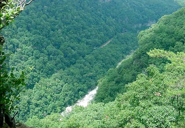
| The Big South Fork is a deep, forested canyon with one of the nation's great white water rafting rivers running through it. The river is only accessible at a few places. Otherwise, you're on your own in a wilderness gorge inhabited by the usual Pine Mountain animals plus Wild Boars, sometimes referred to locally as "razorback hogs." One popular trip is to backpack into Charit Creek Lodge, a wilderness retreat with cabins and dorm style rooms. Rick Egedi and his family run Sheltowee Trace Outfitters for the rafting trips. To reach the Visitor Center go down I-75 to Williamsburg and taker 92 over to Pine Knot. | 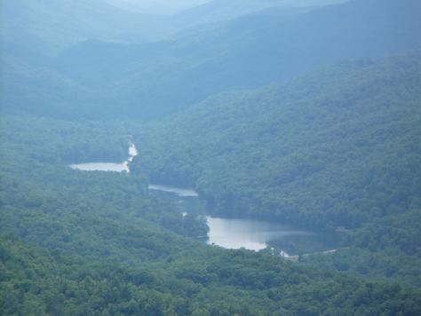 |
|
|||
|