Mt. Ida
| Route 66 | Cities | Beaches |
| National Parks
Mt. Ida |
|
| Getting There | Lodging | Restaurants | Hiking | Backpacking |
In our opinion, and that of the vast majority of hikers, Mt. Ida is the best hike in Rocky Mountain National Park. The views are spectacular, you're guaranteed to see extensive wildlife, the hike is not particularly difficult or technical, and the trailhead is easily accessible. But it's a serious hike and you need to come prepared. The trailhead is just off Trail Ridge Road. From the Estes Park side, you'll drive to the top, to the Continental Divide and the Alpine Visitor Center, and drop down the west side. After a few minutes of descending through alpine tundra (see right) you'll come to the Poudre Lake trailhead on the left (south). From Grand Lake, drive north up the Kawuneeche Valley. As Trail Ridge Road begins to climb you'll come through the five hairpin turns and switchbacks and a few minutes later the Poudre Lake trailhead will be on your right (south). |
 |
| Mt. Ida | Sky Pond | Emerald Lake | Fern Lake | Bluebird Lake | Shadow Mountain | Cascade Falls |
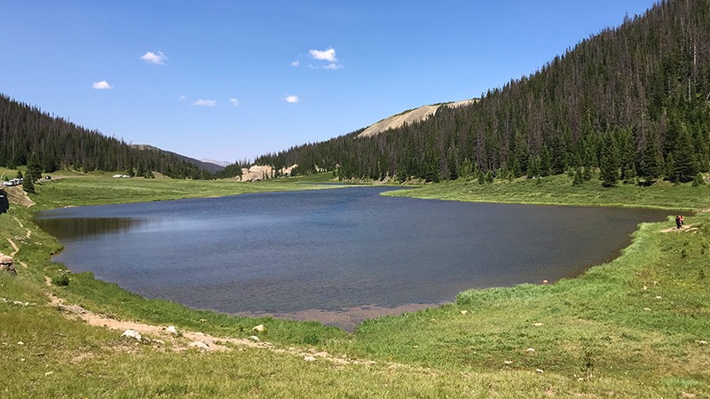 |
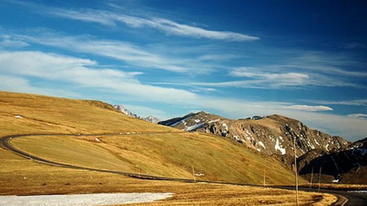
You're going to reach the summit of Mt. Ida at 12,889 ft. The winds up there will be 50-70 mph and probably cold. You may also encounter rain, snow, sleet and/or hail. So you'll need a good rain parka and a warm undergarment. You'll need sunglasses, binoculars, gloves, facial cover like a balaclava, and trekking poles. If you want to photograph the Bear, Mountain Lion, Fox, Elk, Deer, Marmots, Picas, Sheep, Chipmunks or Ptarmigan you'll see, you need a telephoto lens. The Marmots, Picas and Chipmunks will come within a few feet of you, but the others will keep their distance. You should be hiking past Poudre Lake (photo, left) no later than 9 a.m. This is because serious storms sweep across the Continental Divide around 3 pm every day, and you need to be back down before then. You can be on the way down, but you need to be off that high plateau (photo below). Assume four hours to reach the summit. |
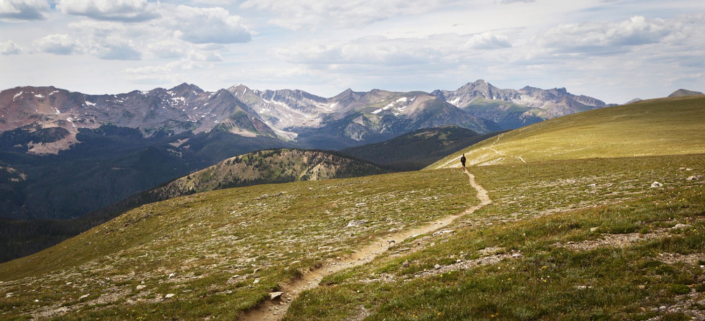
The trail circles the south end of Poudre Lake and then about half a mile in comes to an intersection. You want the right fork. The trail will pass through trees for the first mile, then head up. Depending on when you hike it, you may see a magnificent display of wildflowers. You're at about 11,350 feet here. On the way up, the trail alternates steep climbs with level segments, so you can catch your breath. To the West, you'll see great views of the Never Summer Wilderness. As you climb higher, you may find yourself hiking through herds of Elk or Bighorn Sheep. At about 2.8 miles you'll come to another intersection, this one marked by a large rock cairn, and again you want the right fork. This cairn sits at about 12, 150 feet. |
 |
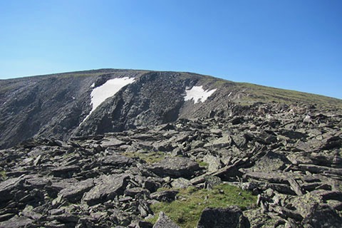 |
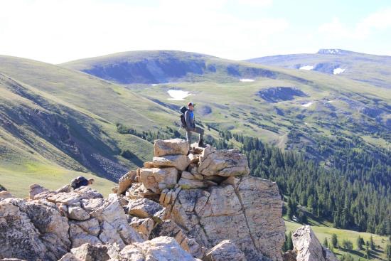
At about 3.5 miles you come to this scene. The trail effectively stops here, because the five cairns marking its progress across this debris field are hard to find. But that's Mt. Ida at the top of that ridge. So you can pick your way across these boulders and rock fragments. If you keep to your left you'll have views down into Glacier Basin. But the easiest route, which avoids the boulders and the largest of the rocks, is to bear across to the right, then climb up from there. The flowers you're seeing are Arctic Gentian and Alpine Sunflowers. By this time you may be learning almost horizontally into the wind and may be tempted to say you made it and turn back. But don't. You've come this far and you owe it to yourself to push onward to that summit. There's no other place in the park where you can find these views. |
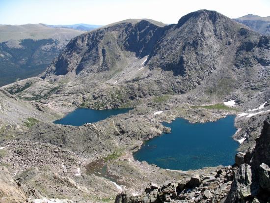
You'll find yourself looking down on the Gorge Lakes (photo, right) to the East. In this photo are Azure Lake and Inkwell Lake. To the west are the Never Summer peaks, to the north the Mummy Range (still in the park), and on the Eastern horizon are Terra Tomah Mountain, Mt. Juliet and Cracktop Mountain. That's Long Peak to the Southeast. Looking Southwest, directly below you, is Julian Lake. Further southeast, you can see Big Meadow, Shadow Mountain Lake and Shadow Mountain.Descending, once again, you'll face that rock and boulder field with no obvious trail. Just find the trail coming across the wide plateau, and head for it. But be careful. Don't try to hurry and get careless and sprain an ankle on those unstable rocks. The average hiker covers this trail up and back in about six or seven hours. They take three or four hours to reach the summit and two to three hours for the return. This includes rest stops and photo or viewing stops. This should not be your first hike after arriving from the low country. You need a day or so and another hike or two to allow your blood to add the hemoglobin needed at this high altitude. Hikers often get altitude sickness on this hike and have to turn back. A new tactic is to carry small oxygen bottles so you can grab a breath during rest stops. |
 |
|
|||
|