| Route 66 | Cities | Beaches |
|
|
Red
River Gorge |
Mammoth
Cave |
Cave Run |
Sheltowee Trace |
| Shawnee Trail (Ohio) | Cumberland Trail (Tenn.) | Knobstone Trail (Indiana) | Big South Fork | Pine Mtn |
The most disorienting trail in the seven state Ohio Valley region is the River to River Trail in Illinois. This is because the public image of Illinois is of a large, flat prairie state with corn fields, barns, silos, windmills and cities like Chicago, Peoria and Champaigne Urbana. What few people realize is that south of I-64 is a different Illinois. There sprawls the Shawnee National Forest, a rugged landscape of bizarre rock formations, deep canyons, high plateaus, caves, cliffs, lakes, waterfalls, natural arches, dense forests and a networik of hiking trails. The longest of these trails is the 160 mile River to River Trail, which begins at Cave in Rock on the Ohio River and ends at Devils Backbone State Park at Grand Tower on the Mississippi River 10 miles south of St. Louis. This trail takes three weeks to hike and winds through five different ecological zones. It's divided into 15 sections, each with its own director and trail crew for maintenance. |
 |
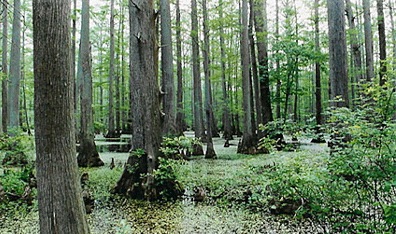 |
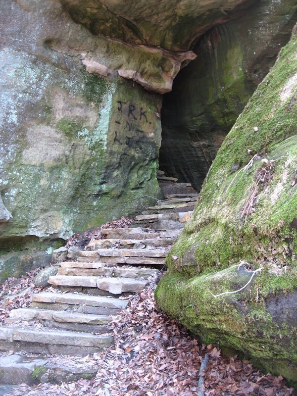
Shawnee National Forest is spectacular, one of the little known treasures of the Midwest, and the River to River Trail showcases most of its crown jewels. It starts at Cave in Rock (specifically Battery Rock just east of that), then proceeds through the Garden of the Gods, Hayes Creek Canyon, Cedar Lake, the Cache River Wetlands (photo at left), Ferne Cliffe State Park, Giant City State Park, Lusk Creek Canyon Recreation Area, Crab Orchard Wildlife Refuge, Bald Knob Wilderness, Camel Rock and Panther Den. The land is a patchwork quilt of state parks, wilderness areas, national forest and state forests. Along the way are state park lodges, public and private campgrounds, cabins, and even a few rustic motels, so through hikers can stay in established campgrounds, lodges, motels or cabins almost every night. With careful planning day hikers could also complete the trail in 8-10 mile segments. |
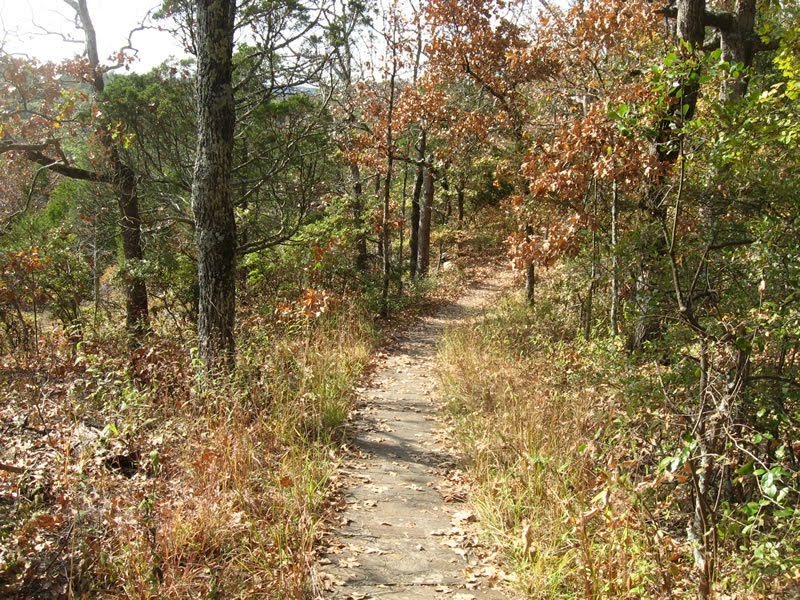
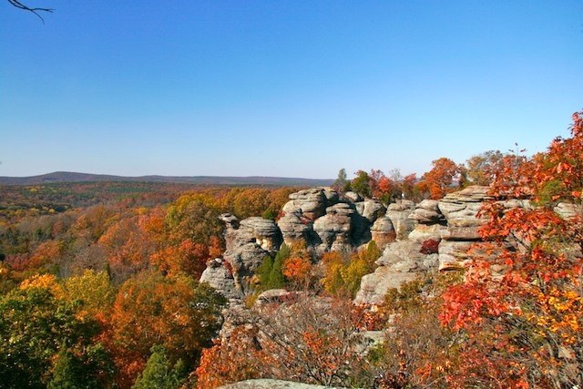
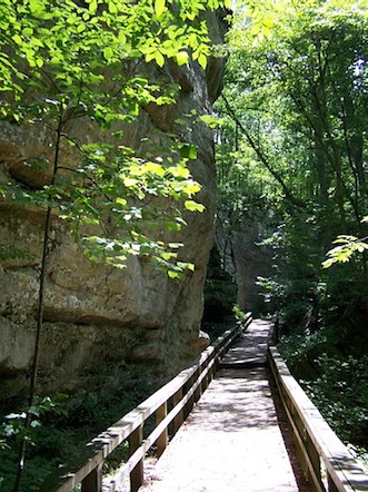
| First time visitors will not be prepared for the deep, lush canyons where the sun never penetrates, the high, open ridges with 50 mile vistas, or the tangled rockpiles. The Shawnee Forest is a bit like Disney World. At Disney you walk across a bridge, through a gateway or around a bend and pass from Adventureland to Tomorrowland to Frontierland to Fantasyland. Here you climb or descend a staircase or round a bend and pass from cool, green forest to hot, dry rock outcrop, from house sized boulders to cypress swamps that look like the Louisiana Bayou. If you can't afford a long trip, you can come here and in three weeks experience a very close facsimile of Bryce Canyon, the Petrified Forest, Garden of the Gods, the Atchafalaya Swamp and Smoky Mountain National Park. | 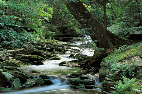 |
 |
There is water along the way but you have to plan. The ridges are high and dry. Water is down below, in the streams, lakes, waterfalls and springs. And even though the landscape is pristine, you do have to purify the water. This is a rugged terrain, so expect lots of steep climbs and even steeper descents. Some of them are tempered by switchbacks but that's not always possible because of cliffs and boulders. The River to River Trail is rougher on knees than the Red River Gorge. A good set of hiking poles is helpful. |
The Shawnee is THE place to go for backpackers, horse packers, day hikers, cavers and rock climbers from Paducah, Evansville, St. Louis, Indianapolis and Champaigne Urbana. Expect lots of company on the trail on weekends. Weekdays are quieter. But if you want a lodge room, cabin or developed campsite, you should make reservations well ahead. This area is famous for oppressive heat and humidity in High Summer, so try to come in April, May, early June, September, October or early November. |
 |
 |
Nature lovers will find plenty to admire, photograph and in some cases avoid. There is probably more Poison Ivy per square yard here than anywhere else in North America. Trail crews keep it back off the main route, but if you go wandering for a good photo angle, rest stop or potty break, watch carefully. Timber Rattlesnakes are also plentiful here. They like the sun, especially warm sunlit rocks. Left alone they're pretty peacable, but if you get too close and they perceive of you as a threat, they tend to get hostile. Copperheads and Water Moccasin are also common. Long pants are a precaution against both Poison Ivy and snakes. Ticks are common in the Summer months; keep checking yourself and each other. This is one of the great birding locations in America. Particularly watch for Red Shouldered Hawks, Bald and Golden Eagles, various Owls, Great Blue Heron, Blue Winged Teal, Great Egret, Mississippi Kite, Wild Turkey and Yellow Warbler. The Shawnee Forest is a key stop on the Mississippi Flyway, so in Spring and Fall look for numerous migrating birds. And then there are the mammals : Wildcat, Fox, Coyote, River Otter, Cougar, Raccoon, Porcupine, Voles, Groundhog and Deer abound. You're almost guaranteed not to see Wildcat or Cougar but you can see their tracks in sand or mud along stream crossings, and you may hear their cries at night while they're hunting. Fox are also pretty secretive but Coyote are fearless and may circle your camp or even trot along parallel to the trail as you hike, keeping a curious eye on you. They keep a safe distance but they're just there, shadowing you, which unnerves some people. |
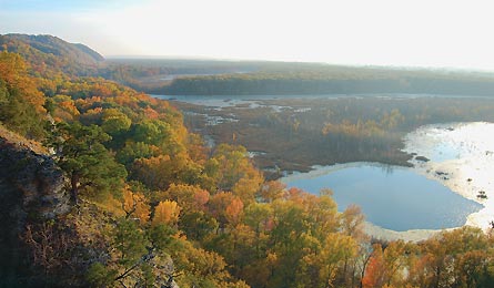
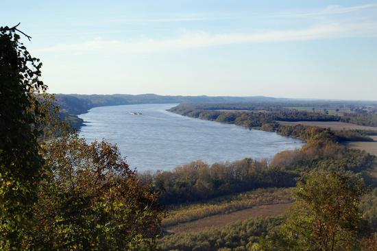
On about the third afternoon (heading westward) the trail passes right through Eddyville, a village of about 150. On the edge of Eddyville is Hayes Canyon Campground. This is heavily oriented toward horse campers but there are nice campsites with tables, fire pits and grills, hot showers, and wireless internet access, an important feature since most of the trail is out of cell phone or internet range. There are also cabins here with full kitchens and baths. On about the 12th afternoon (heading westward) the trail passes right down the main street of Alto Pass, a historic little frontier town with a current population of 300. In addition to several outstanding antique shops, Alto Pass is home to Skyline View Cabins, which look out over the Little Grand Canyon. One has a hot tub. Even better is Broken Wheel Ranch, which you'll hike right through. They have several cabins and a small restaurant ("The General Store"). Alto Pass also offers several small wineries, one of which has a restaurant. At right is the view as you hike the final day of the trail, coming down to the Mississippi River. The RtR Trail stops here at Devils Backbone State Park, but the Discovery Trail follows the levees up along the river and crosses the bridge into downtown St. Louis. |
 |
|
|||
|