Hiking
| Route 66 | Cities | Beaches |
|
Hiking |
|
| Getting There | Lodging | Restaurants | Hiking | Backpacking | Horseback Riding |
|
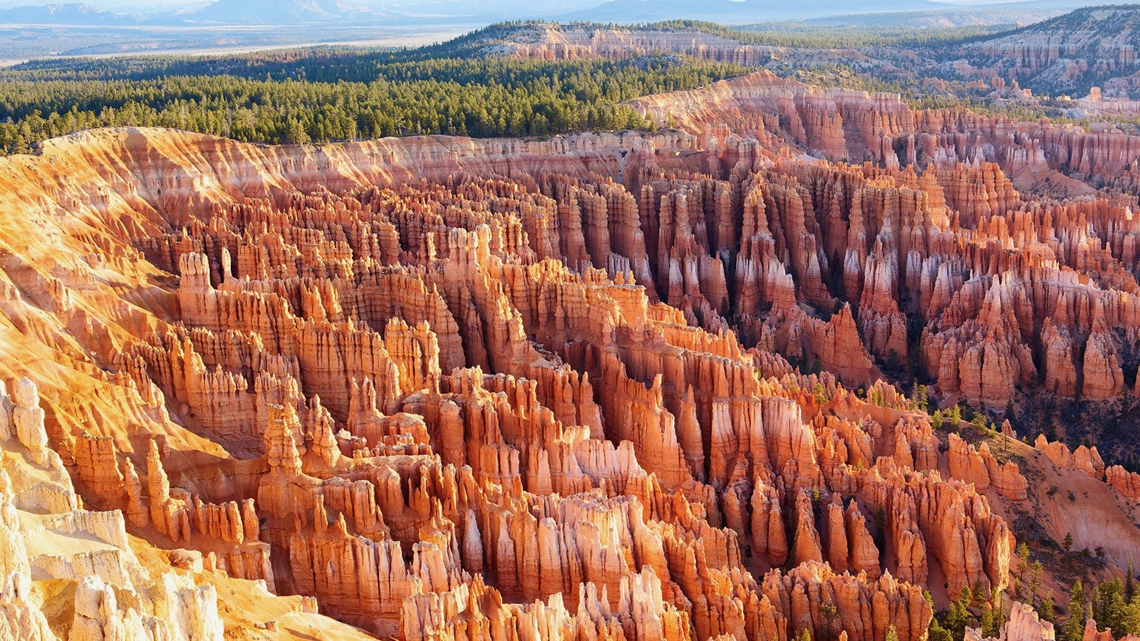
Bryce is a day hiker's park. It offers seven of the most unique day hikes in the world. Hikers come here from everywhere to check these trails off their bucket list. Two thirds of the day hikes begin and end within a short walk from the Lodge, making them the most accessible trail system of any national park. These are not particularly long trails. The scenery is very concentrated, meaning you see spectacular formations every several yards. However, the fact that these trails are so accessible actually makes them dangerous. Every day, people set off on these trails without the necessary preparations. You need sunblock. At this high altitude, the Sun beats down at full strength, and all these white, biege, red and orange rocks reflect it back up at you, so you are in effect being broiled. You need multiple water bottles, preferably filled with ice, then water. You need actual hiking shoes and not flip flops, Keds, or other flimsy footware. You need very good sunglasses and a broad brimmed hat. You need chapstick for the dry air. A major problem here is that almost all the trails (except for the few starting down at Tropic) begin at the top and drop steeply down into the amphitheater. They wander around the formations for a few miles of fairly level terrain, but eventually they head back up, and that last climb is long, steep and in full Sun. Every day, people who are not in good condition and are not good hikers head down these trails and cannot climb back up. Know Your Limits. You should do daily hiking back home to get yourself in good condition before coming here. Ideally, you should climb a long flight of stairs or a steep hill every day back home, or perhaps spend time on a stepper. You might give some thought to your camera. In this bright sun, intensified by thin air and light colored rocks, your automatic sensors may be overwhelmed. A good filter might be a wise investment. Even if you don't normally use them, this might be the time to invest in either a good hiking staff, or a pair of hiking poles. They might keep you from slipping on the sandy, pebbly descents or help you on the long, steep and slippery climbs back up. And be sure to carry a good trail map. You can get turned around and confused as you twist and turn in this maze of hoodoos. With a dozen trails crisscrossing, you need to be careful. Be aware that you will probably not get a cell phone signal down in the amphitheater. Only an InReach device can allow you to call back up to the rim. Don't get us wrong. Bryce is one of the great day hiking destinations in the world. But you have to take it seriously. They have park rangers here who specialize in search and rescue, and they go down after people every day. |
| Rim | Queen's Garden | Navajo | Peekaboo | Fairyland | BristleCone | Riggs Spring | Hat Shop | Swamp Canyon | Tropic |
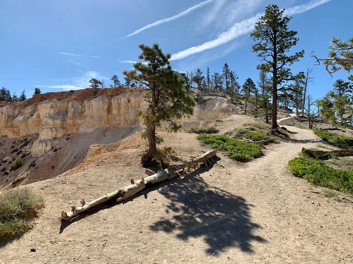
The Rim Trail is a great introduction to Bryce. It gives you an overlook of the Amphitheater from every different angle, allows you a day to adjust to the altitude and heat, and stretches your legs after several days of travel. Ideally you take the shuttle to the Bryce Point trailhead. You'll be stopping often to gaze in awe and take photos, so the hike will take most of a day even though the entire trail is only 5.9 miles and the main part that 90% hike is only 3.7 miles. The first segment, 1.5 miles to Inspiration Point, is the most natural. It's on dirt and winds through bristlecone pine forest with vistas opening out to your right. The next 2.2 miles, to the North Campground Shuttle Stop, is paved and includes frequent benches for admiring the scenery. At 2.7 miles from Bryce Point you come to the lodge, where you could stop for lunch. That would leave the segment to the North Campground for the afternoon. We highly recommend hiking the trail from Bryce Point northward. As you can see in the photo below, the trail steadily descends toward the lodge, Sunrise Point and Fairy Land Point. |
|
 |
Bryce Point is at 8300 feet. That's significantly higher than Denver, Dubois, Flagstaff or Jackson. Given this altitude and the 100+ heat, hiking that steady downhill is a lot easier than hiking steadily uphill would be. As you can see by the photo, sometimes the forest thins out, mostly due to past fires, but other times it closes back in. The final part, from North Campground - Fairyland Point, is again natural, on dirt, through forest. It's extremely scenic, with views of Boat Mesa and Fairyland Canyon you can't see otherwise. However, unless you spot a vehicle at Fairyland Point, you have to hike 1.5 miles out to the Visitor Center to catch the Shuttle. This is a level walk through open pine woods. The beauty of the hike along the rim makes it well worth it. On that last 1.5 miles you're also very likely to see wildlife, as Deer, Antelope, Elk, Porcupine and Prairie Dogs frequent the area. The Rim Trail is a very civilized, almost decadent, hike. There are benches placed periodically. The Shuttle stops at six points so if you get hot or tired you can opt out and ride back to the lodge or to Ruby's. |
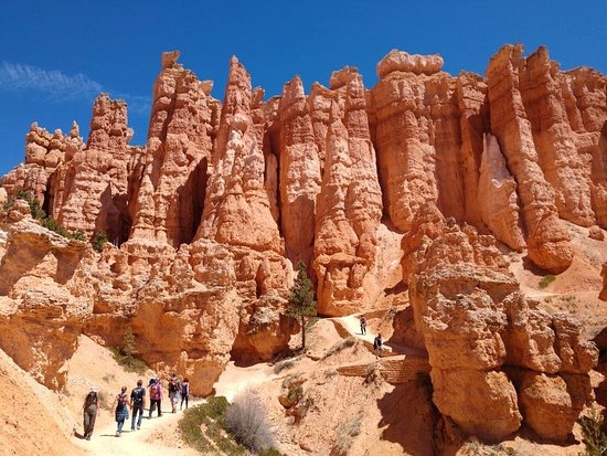
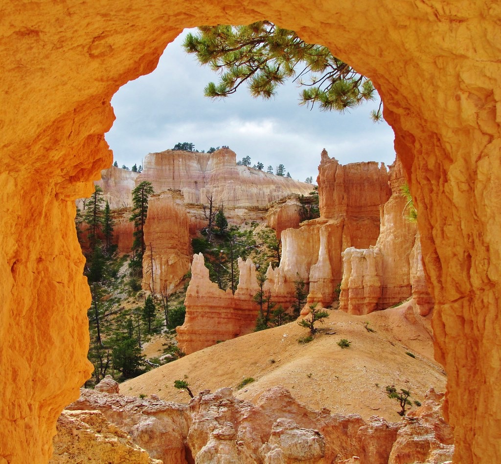
The Queen's Garden Trail is the classic first below the rim hike. The trailhead is at Sunrise Point. You descend steadily for 320 feet until you reach the collection of hoodoos and spires seen in the photo at right. The distance from the rim down to the turning point is a mile. The problem, of course, is that you then have to climb back up those 320 feet. Yes, the climb back up is still just a mile. But it's a good workout, especially at this altitude in this heat. You'll pass several spectacular formations, including Gulliver's Castle, the Queen's Castle and Queen Elizabeth, which you reach at the very end of the hike downward. You'll get views of Boat Mesa, The Sinking Ship, and the Aquarius Plateau to the northeast. Bristlecone Point, Mt. Canaan, and Navajo Mountain appear due east. You pass through that wall of hoodoos in the photo via a tunnel, and there's a second tunnel further down. As the classic first hike downward, this trail is very popular, so expect lots of company. But it's still a good hike, well worth the time and effort. Most people take about two hours, with frequent camera stops and a few snack and water breaks. |
 |
|
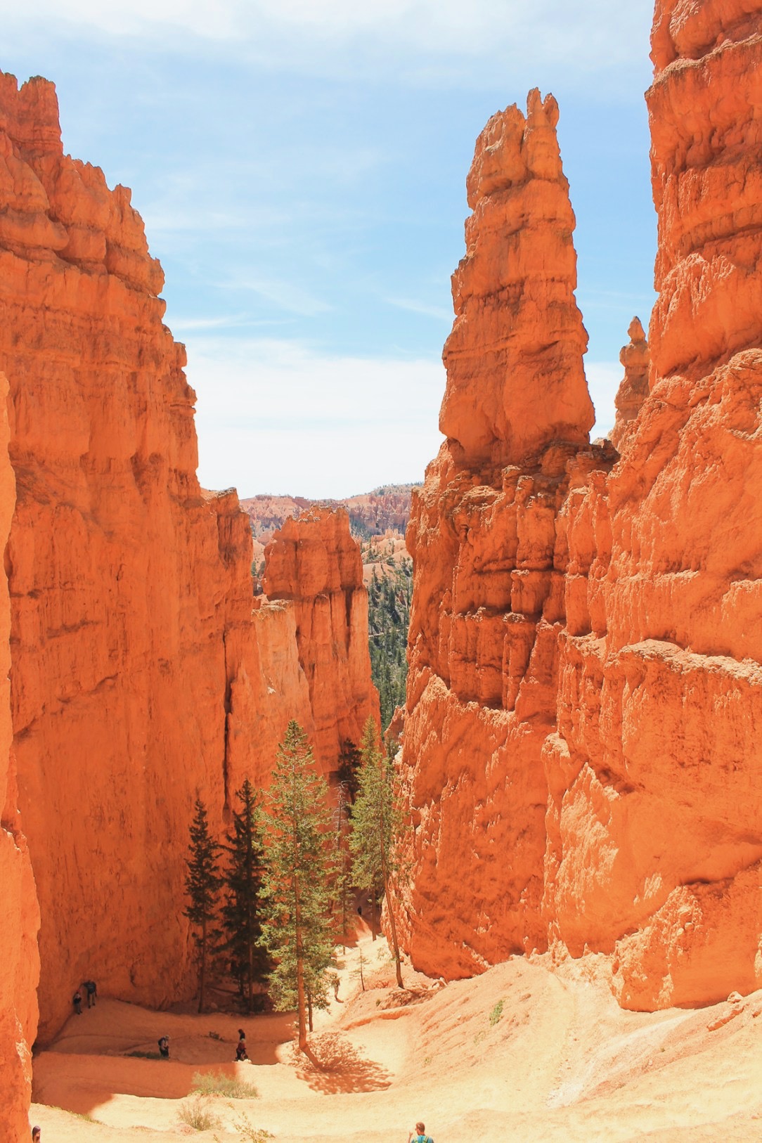
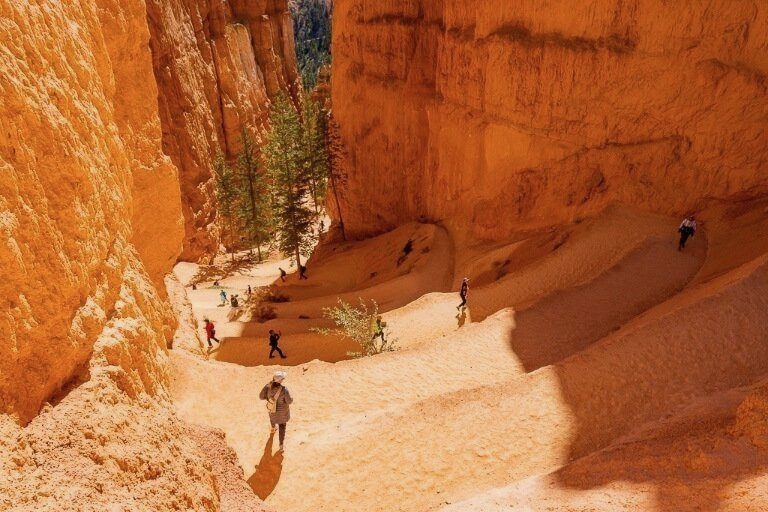
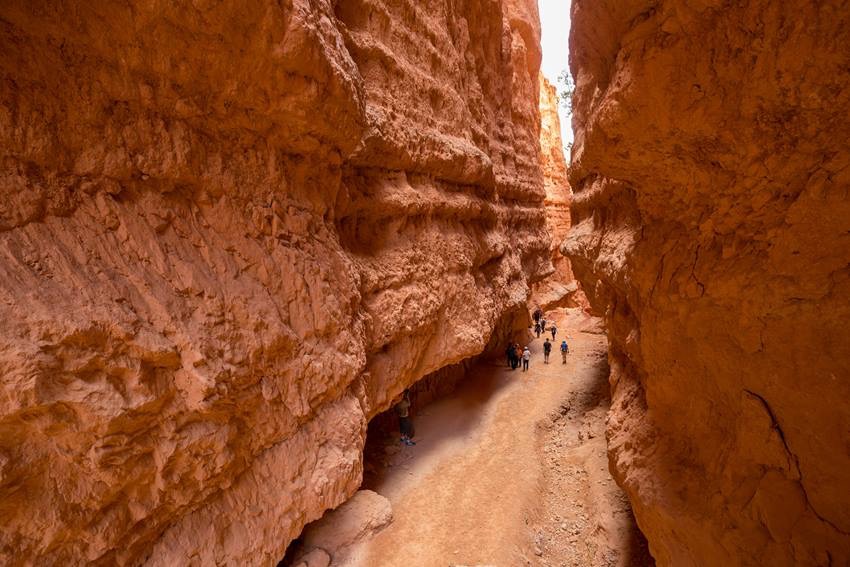
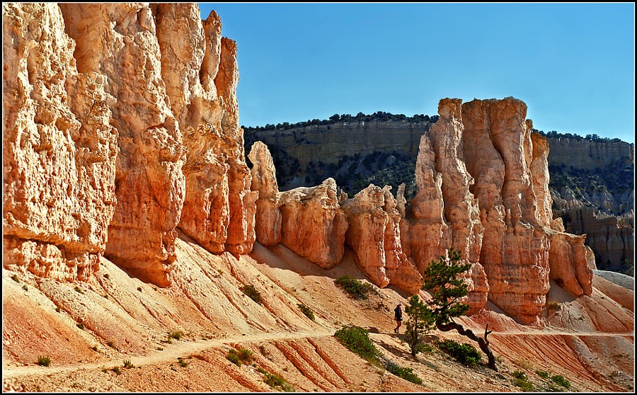
The Navajo Loop Trail is the big one. This is the trail that when you get back home, everyone is going to ask if you hiked. There are longer trails and more difficult trails but no trail is more spectacular than The Navajo Loop. It starts with an incredible set of switchbacks (photo, left) as you descend to the very roots of the canyon. You navigate a slot canyon (below) and circle through a series of huge formations (below left). The trailhead is at Sunset Point. The trail is only 1.4 miles total, as you drop 521 feet and then climb back up. But there are formations to see : Wall Street, Thor's Hammer, Juliet's Porch, etc. Allow about two hours, figuring on numerous stops for photos, water and to catch your breath. At the bottom, the Navajo Loop runs into the Queens Garden Trail and the Peekaboo Loop, so you can mix and match for a longer hike. |
 |
|
 |
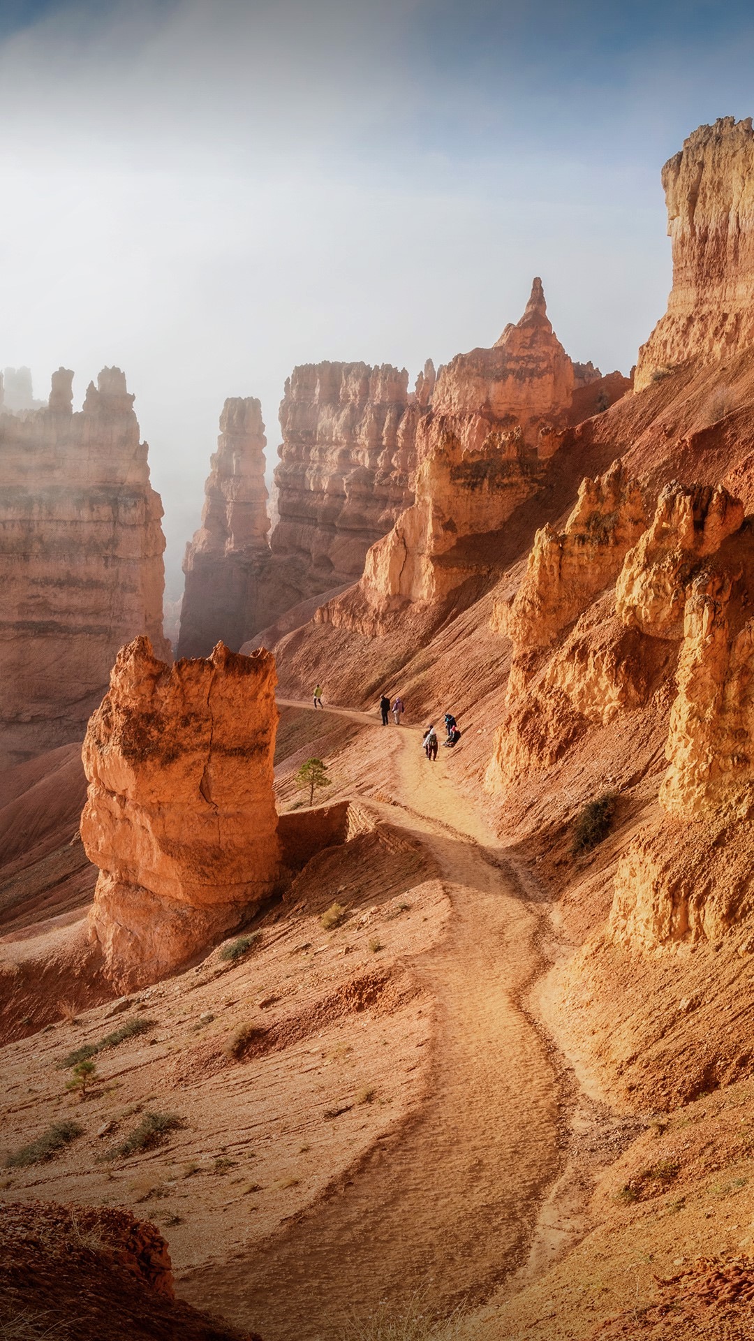
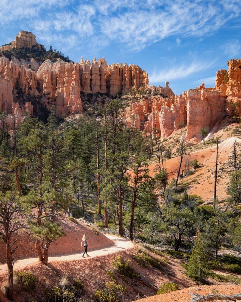
The Peekaboo Loop Trail is so named because of the tunnels, arches and windows you see along it. Some of them you hike through or look through, and others are above you or off to the side. This may be the most photo- genic of the Bryce Trails. It's 5.5 miles long, a complete loop with a short spur to bring you down and take you up to the rim. The trailhead is at Bryce Point. You hike down a tenth of a mile and turn left on the Under The Rim Trail, a 3-4 day backpacking trail coming from Yovimpa Point at the south end of the park. You turn left, hike 0.9 mile, then turn right onto Peekaboo. You'll see the Wall of Windows, the Three Wisemen, the Organ, the Cathedral and the Silent City directly in front of you, and look out toward the Aquarius Plateau, Mt. Canaan, Boat Mesa and the Kaiparowitz Plateau. At one point you pass through a small cave. This is a combination hiker and horseback riding trail. As such, you must be careful of horse droppings. This annoys many hikers, so they avoid it. Don't. This is a beautiful trail, well worth the inconvenience of watching your step. Since three hour horseback rides stop here for their break, Peekaboo is the only trail in Bryce with portajohns. Allow 3-4 hours. You'll drop 600 feet, then gain it back. Experienced hikers combine this with the Navajo Loop Trail to form the famous "Figure 8 Hike," exiting at Sunset Point and walking back along the Rim Trail to Bryce Point and their car, or catching the Shuttle at Sunset Point. This makes a 6.0 mile, 4-5 hour hike. |
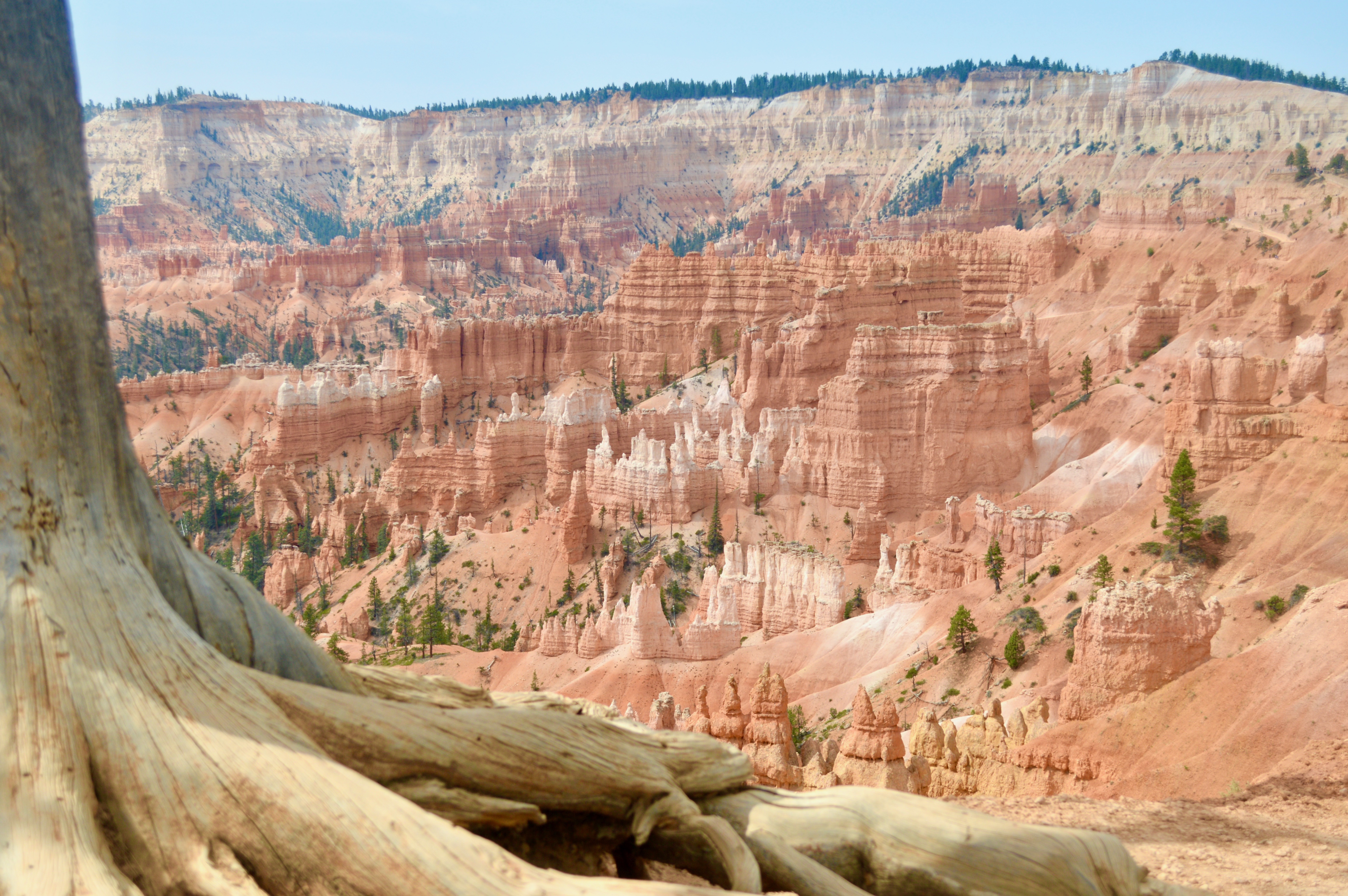
The Fairyland Loop Trail is a different kind of hike than the others in the Bryce Canyon Amphitheater. It's longer, 8.0 miles. It's more like your hikes back home in that you're hiking out and back instead of hiking steeply up and down. Scenery is also different. You're looking out at vast landscapes (right) rather than above you and below you at individual formations. The outermost mile or so of the loop let you look back at the entire panorama of Bryce, Fairyland and neighboring mesas, canyons and plateaus. You can begin this hike from either of two trailheads. The easiest is Sunrise Point, since the Shuttle stops there. Or you can drive to Fairyland Point, near the park's entrance. |
 |
 |
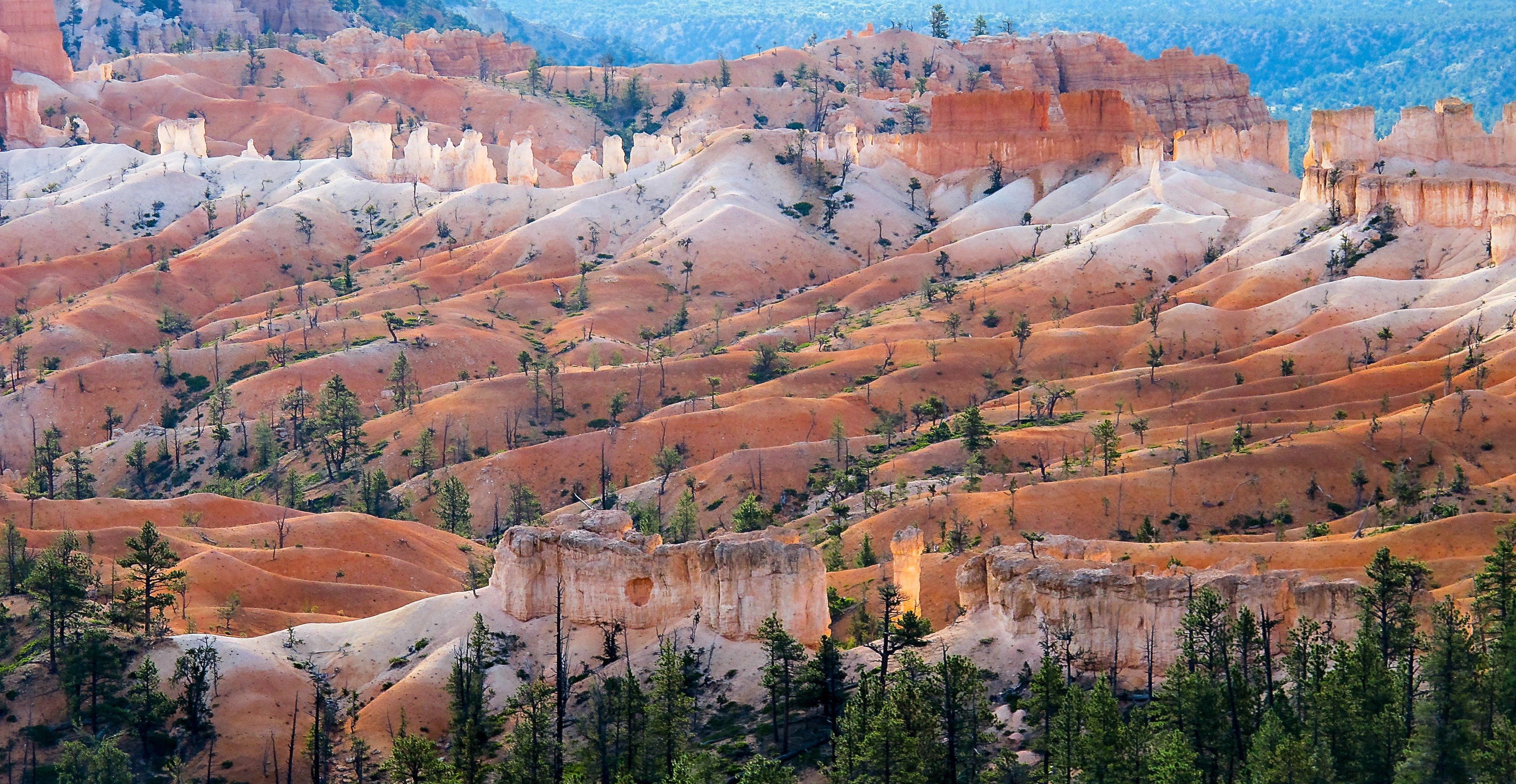
You're going to descend 750 feet over the first few miles, then hike on relatively level terrain for the middle two miles before beginning the long, gradual climb back to the rim. To give you an idea of the elevation check the photo below. That's Sunrise Point in the upper left corner of the photo. You'll need at least two bottles of iced water, some snacks, and a good lunch. Plan on a midmorning stop halfway out, a long lunch stop, and a midafternoon stop halfway back. The ideal lunch stop is at the Tower Bridge formation, which is a 200 yard side spur off the main Fairyland Trail. The formation looks amazingly like London Bridge. We recommend hiking in a clockwise direction. Begin at Sunrise Point, follow the rim to Fairyland Point, then descend into the canyon. |
You'll be hiking through lots of Douglas Fir, Juniper and Limber Pine. The trail gradually switchbacks downward, sometimes following streambeds, although they're usually dry. You'll be circling Boat Mesa to your right the entire hike, while the scenic vistas open to your left. You'll see The Sinking Ship, the Chinese Wall and Tower Bridge, plus several dozen hoodoos, cliffs and outcroppings. For as popular as this trail is, and for as many people who hike it, you'll feel like you've escaped the crowds when you're on it. That's because the eight miles absorbs a large number of hikers without seeming crowded. Plan on 4-5 hours. If you're hiking this in June, July or August, we highly recommend starting early, maybe 7 or 8 a.m. That would allow you to finish at around noon, before temperatures rise over 100. In the morning, there's some lingering cool air flowing down from the canyons and there are some shadows. By noon, the sun is almost overhead and there are no shadows, and those morning breezes have died. The official park guide lists the Fairyland Loop as strenuous, mostly because of the heat, altitude and the climb back to the rim. If you hike the other trails first and leave this until the end of the week, you'll acclimatize to the altitude and heat and work your legs and feet into condition. Be sure to take rain gear with you. Hard as it might seem to believe, Bryce gets a lot of late afternoon thunderstorms, especially during late July and early August. They don't last long, but you may find yourself huddled against one of the rock formations. |
 |
| The BristleCone Trail |
| The Riggs Spring Trail |
| The Hat Shop Trail |
| The Swamp Canyon Trail |
| The Tropic Trail |
|
|||
|