| Route 66 | Cities | Beaches |
|
|
| We recommend Burntside Lake as your gateway into the Boundary Waters, especially for a first trip. We do so because we recommend the cabin basecamp, and Burntside offers more cabins than any other lake. We like the fact that Burntside is a big and complex lake with 100 islands and 50 campsites and you could spend years here adventuring by canoe and never even portage. But for portaging into the wilderness, we think Slim Lake and Crab Lake, the official entry ports off Burntside, are two of the best in the whole Boundary Waters. So all things considered, we stand by our Burntside choice. However, this is a big, brawny lake, one to be taken with great seriousness. A person can get lost in this maze of 100 islands. You will have to use map and compass at all times and learn to orient yourself by landmarks and sun position. The wind picks up considerable strength across the eight miles of open water. It can whip up whitecaps quickly, and if you get caught in a headwind, it can effectively stop you or threaten to push you backward no matter how hard you paddle. You will learn to use the islands and coves as screens, darting behind or between them to find quiet water. | 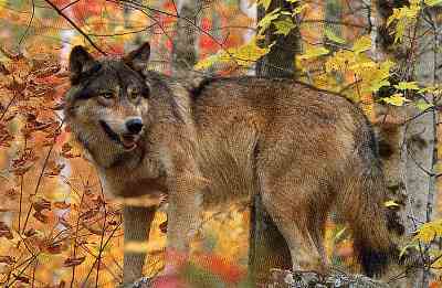 |
 |
Burntside Lake itself is not part of the wilderness. Its Western and Northern shores are, but the Southern and Eastern shores are lined with cabins and many of the islands have them. However, many of the islands do not and are available for camping. Our favorite island for camping is State Island, over toward the Eastern shoreline. The Northeastern side of that island has beautiful level sites looking out on the lake with nice rocks and beaches for wading or launching canoes. There's good tree cover and plenty of downed firewood. You should approach this lake like you would a very large forest. It needs exploring in an organized manner, in ever widening circles. You need time to learn the landmarks and idiosyncracies. |
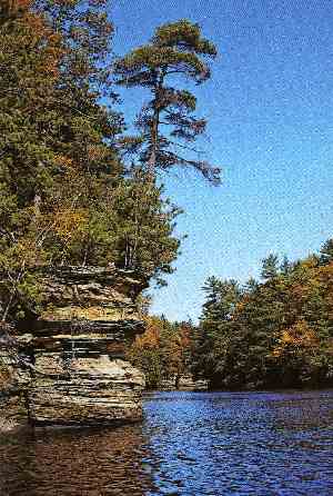
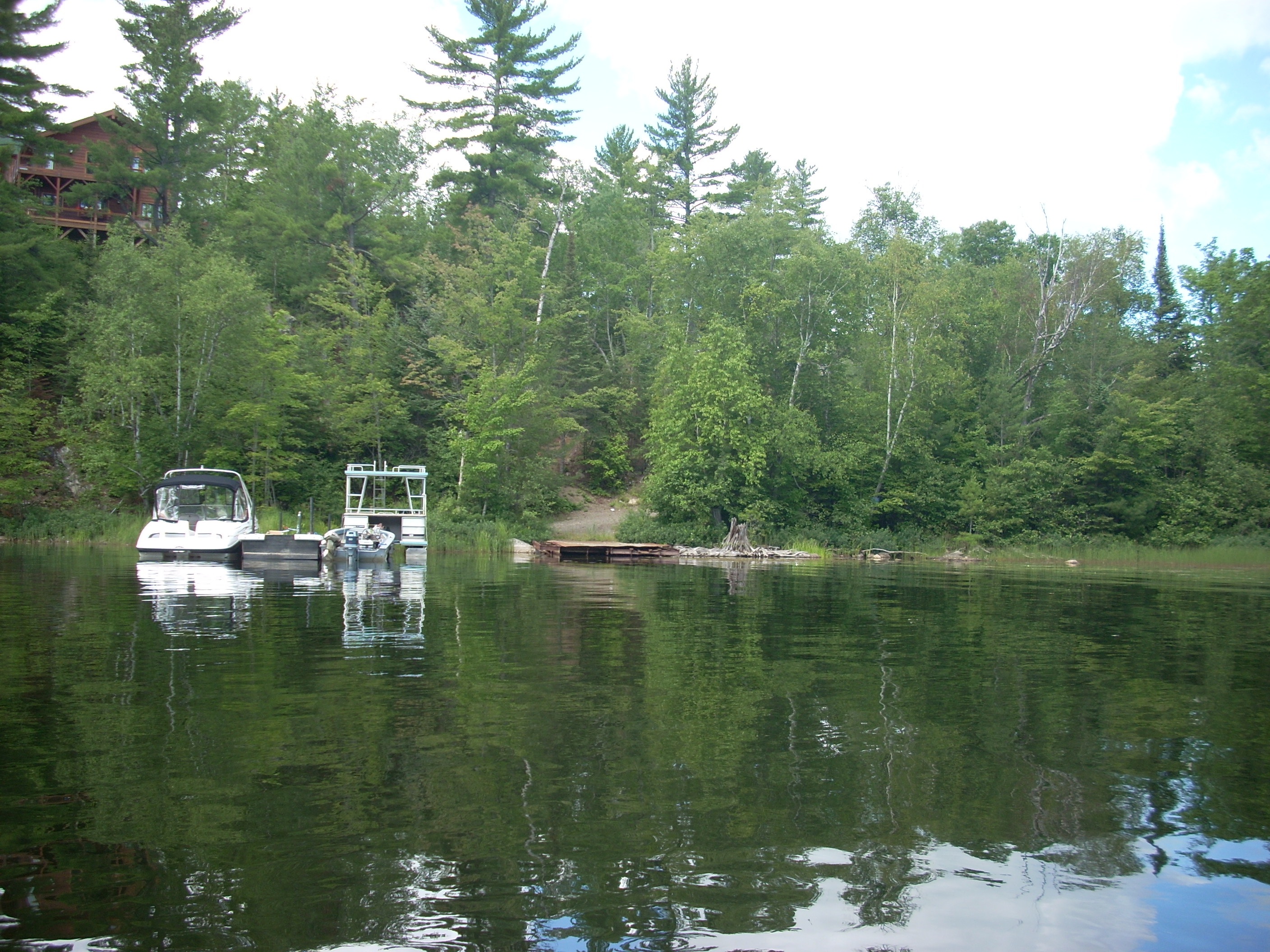
| On our first day, we like to paddle along the Southern shore to the far Western corner. The scene at right is The Narrows. Just past this passage, you will bear left around the promontory and turn South, past Kalevo Bay and Outlet Bay, which will bring you to the Burntside River flowing out of Burntside Lake to Shagawa Lake. Paddling on, you come to Tamarack Bay, which is the far southwestern corner of the lake, and a good lunch stop. The water here is always much calmer than the rest of the lake. We like to paddle up the western shore, which is part of the wilderness, until we come even with the promontory. We'll then turn eastward, paddle across the open water, back through The Narrows, and follow the shore home to our cabin. This trip presents you with your first orienteering challenge. Coming up that western shore, you have to be able to read the map and recognize Dollar Island and The Promontory, so you can turn East at the right time. This trip will take half to two thirds of a day, but winds will push you home. | 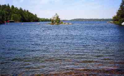 |
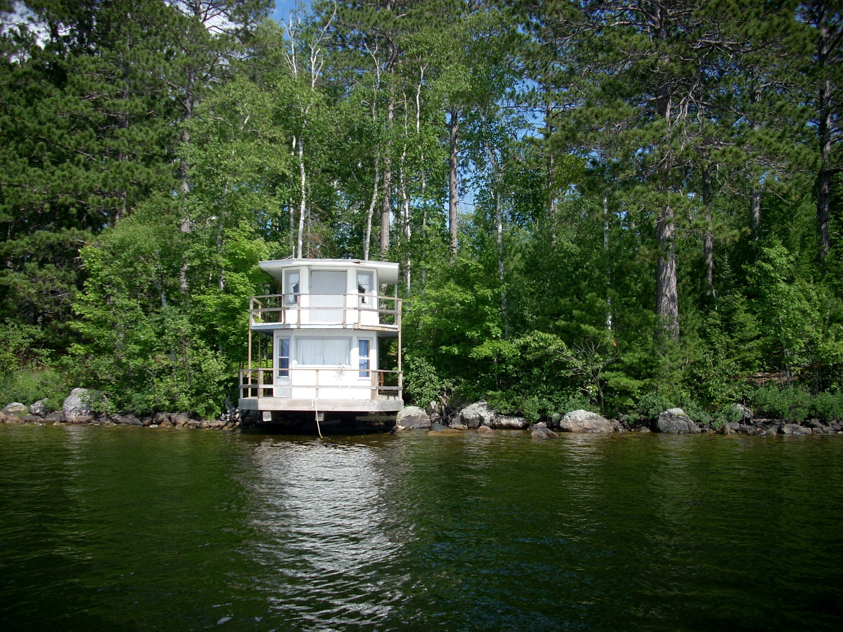 |
Along Kalevo Bay you'll find a houseboat converted to a guest house. The owner used it on Bass Lake. When the government included that lake within the Boundary Waters Wilderness, he had to remove it or they would burn it. So he had it loaded on a large boat trailer, trucked it down to the public access ramp at Burntside, refloated it, and steered it around to his property here. He raised it out of the water onto a specially built drydock. He already had a house on the land, so this became a guest cabin for children and now grandchildren. Regulations require that homes be built at least 100 feet back from the water, but boathouses, saunas, docks and drydocks can be built directly on the water. Since technically this is a boat, sitting on a dry dock, it is legal, so long as the owner continues to renew the registration and keeps a current license plate on it. |
| On the western shore of Hoist Bay the boiler stack from a steamboat still juts out of the water a century after the boat was abandoned by Weyerhauser Timber Company. This bay was where logs were hoisted out of the water onto waiting railroad flat cars running on the Duluth & Western Railroad. Logs from the far reaches of the lake were loaded on the steamboats and hauled here because it was much more efficient than floating them in huge masses and letting the current move them here. They did that with logs from the North Arm and Crab River. For most of the 20th century, stray logs littered the shore and many still rest on the bottom. But families used them for firewood and construction, and after 100 years they're gone. The D & W tore up the tracks to salvage the steel and roads were built over the old trackbed. This was the richest timbering operation in the world, but all that remains is this abandoned steamboat. From a canoe, you can easily see the remains of the boat resting on the bottom. | 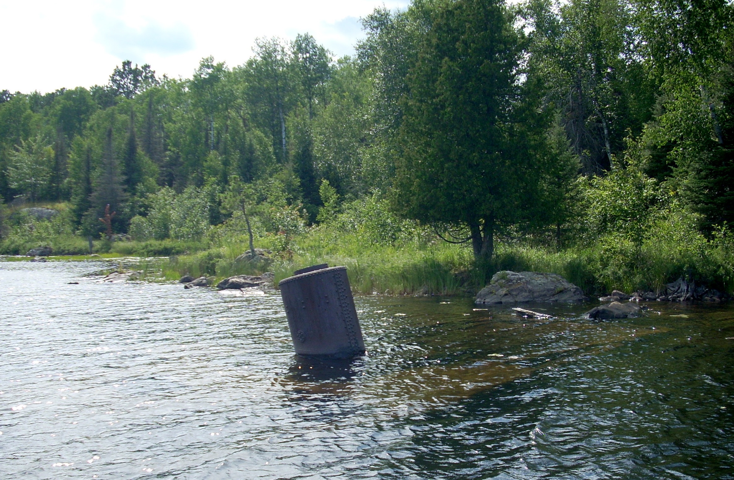 |
 |
On the second day, we like to paddle down along the Southern shore to the far Eastern corner. The photo at left looks back westward from near the shore. What looks like an island in this photo is actually attached to the Southern shore by a slim neck of land. There are no cabins on the semi-island, so it could be used for either a lunchtime stop or an overnight camp. We follow the shore around, turning back westward, and follow it along the north shore two miles to Hartley Point. From there, it's half a mile across open water to David Miller Island, only 100 yards from the south shore downwind from Burnt side Lodge. You could arrange to be picked up at Andersons Resort on the eastern shore |
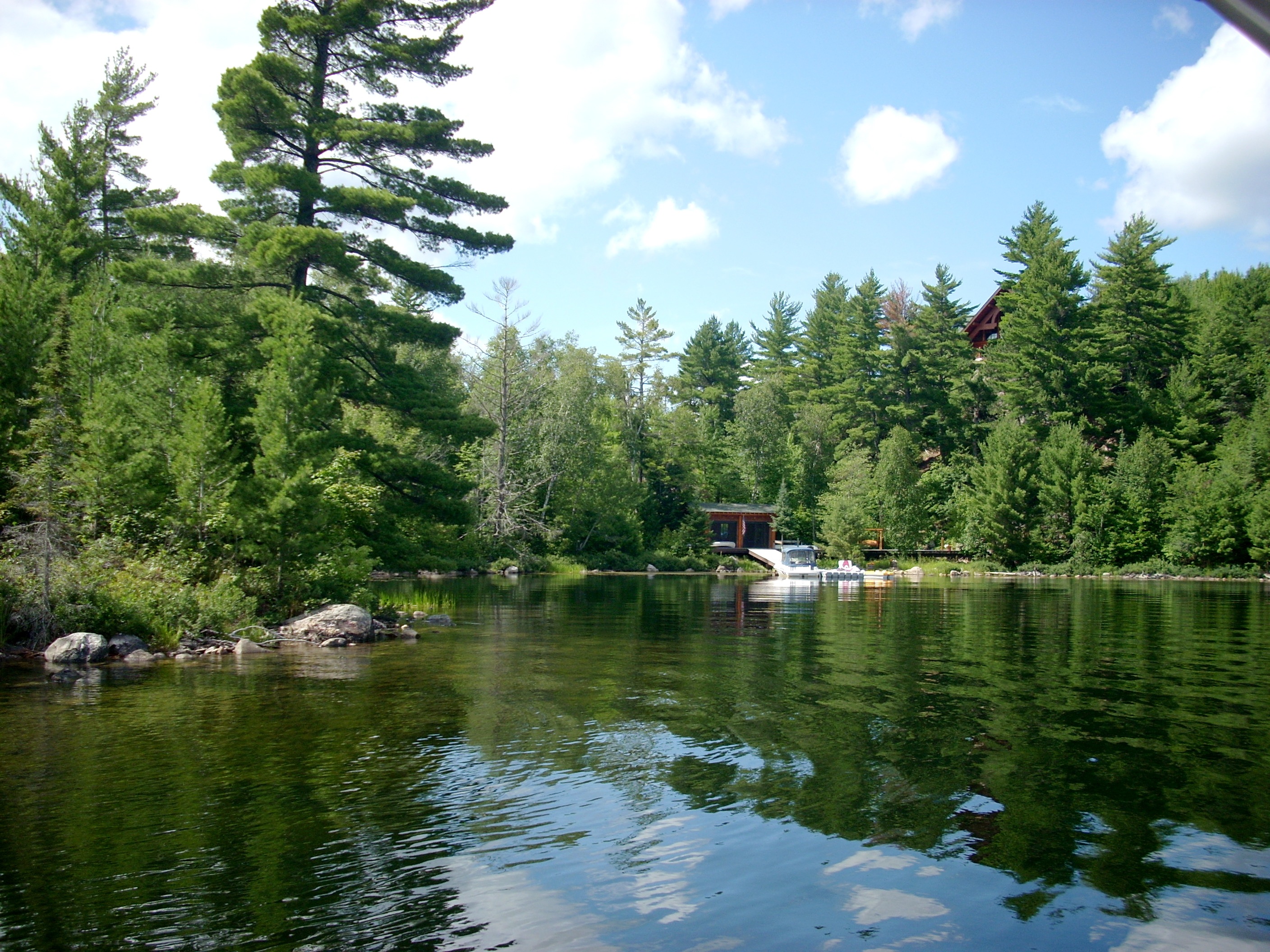
| The third day we like the Inner Loop. From Van Vac or Burntside Lodge, you paddle East down the Southern Shore, then turn North and paddle past Miller Island, Lockheart Island, Evans Island, Indian Island, Blueberry Island, Lost Girl Island, Brownell Island, Oliver Island and Waters Island, crossing back to the Southern Shore at The Narrows, above right, and paddle back to your dock. This is an easy three hour morning cruise. But it allows an easy day to rest after those first two rather strenuous days, and allows an afternoon for swimming. Lost Girl Island has mythical status. Back in the 20s, a Burntside Lodge summer employee took a canoe and a sack lunch on her day off and and headed across the water. When she did not return, they went searching. They found her canoe pulled up on the shore. Her clothes were laid out in a neat row on a boulder, along with a towel. All were neatly folded. Her lunch and paddle were in the canoe. They have never found any trace of the girl. | 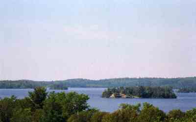 |
 |
On the fourth day, we like to run the Burntside River. This is an easy trip but requires preparation. You must arrange with your lodge to pick you up and bring you back to your cabin. You can be picked up either at the highway bridge or three miles more at Lady Bug Lodge on Shagawa Lake. Paddling to the bridge from Van Vac is seven miles, and to Ladybug Lodge is 10 miles. Just follow the south shore of Burntside Lake all the way to where the river exits the lake. Paddling the river is easy. The current is steady but not rough. There are shallows and rocks, but this is Class I all the way. It's a scenic river and there are lots of attractive lunch stops. |
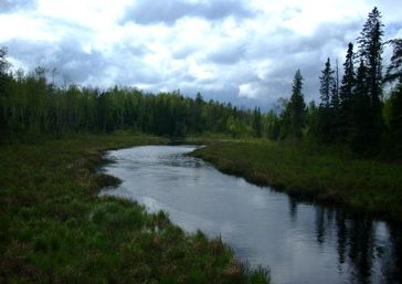
On the fifth day, we like to explore the Dead River. Very inaptly named, this is neither dead nor a river. It is a very narrow stream draining a lush valley. You can paddle out from Burntside Harbor and Indian Island, past the shoals, past Blueberry Island, Ripple Island and Snake Island, to the North Shore. Turn right and follow along the shore as it curves into the gently flowing river (right). It takes you northward to several beautiful campsites and eventually to other lakes : Twin Lakes and Everett Lake by paddling and Shipman Bass Lake and Fenske Lake by portaging. You could make this a long day trip or a one or two nighter, camping at two different locations and exploring portages and side lakes. From Burntside Harbor you can reach the mouth of the river in 60-90 minutes, depending on wind and wave conditions and which route through the islands you take. Whether daytripping or overnighting, you could also arrange for you and your canoes to be picked up at the Fenske Lake Portage, which crosses the Echo Trail, still a paved road at that point. To reach that pickup, you will have to paddle all the way up the river, carry your canoes across the short 10 rod Everett Lake Portage, paddle the length of Everett Lake, and carry your canoes 10 more rods up to the road. You could leave Burntside at 9 a.m., explore everything over there, enjoy a leisurely lunch, and still get home for dinner. |
 |
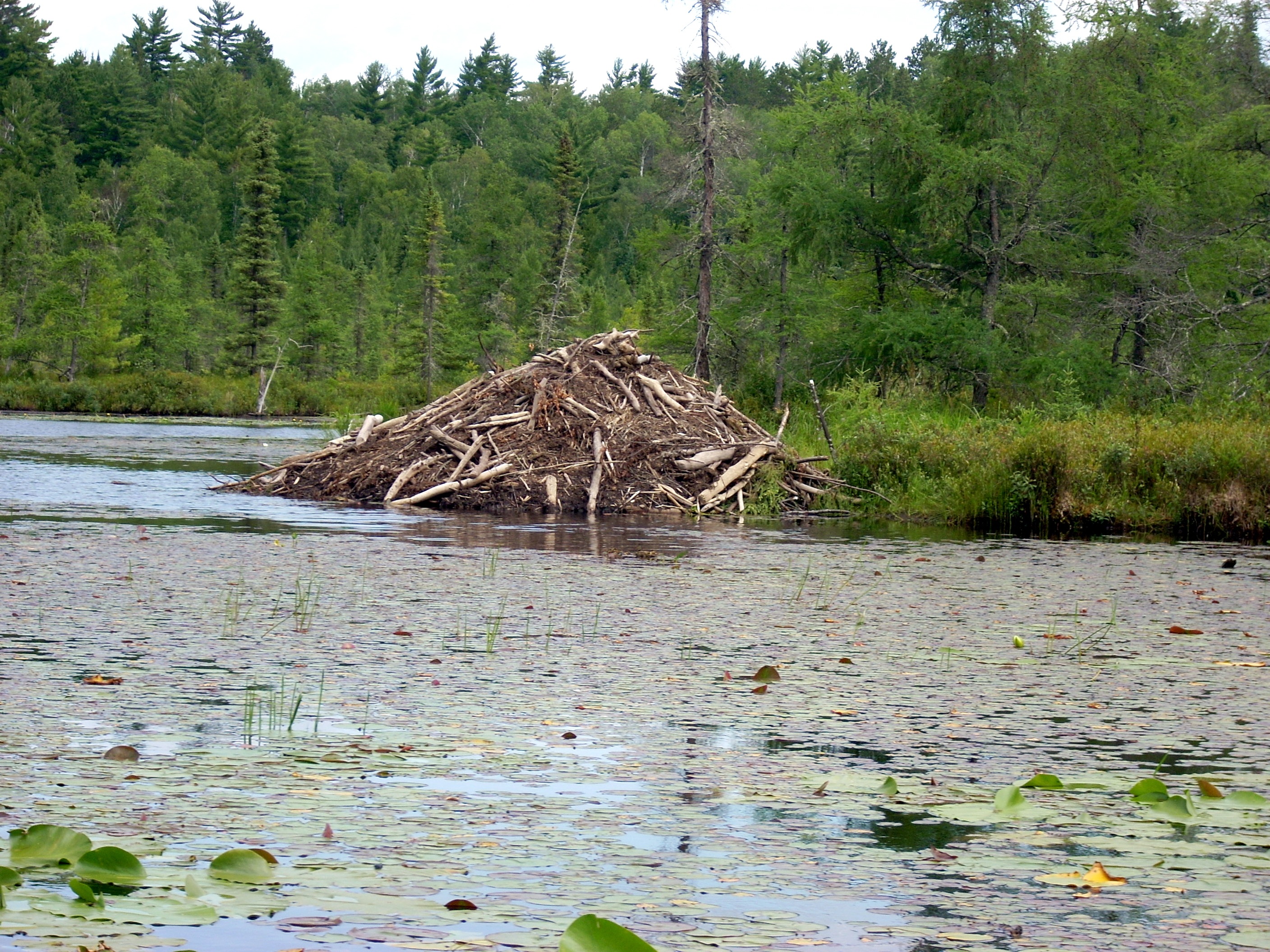 |
One of the advantages of making the Dead River an overnight is that it allows you to be there from dawn to 8 am, and from 7 pm until dark. At those times, the moose come to the water for feeding. For all their size, they are basically aquatic grazers, and the plants along both shores are lush. There are also two beaver dams, a large one (shown at left) and a smaller one downstream around the bend, hidden in tall grass on the eastern shore. Dense mats of lily pads (notice the white flowers dotting the mats in the photo above) harbor frogs, fish and other aquatic life. As best the wildlife management specialists can tell, no wolves make their permanent home along this valley, but they visit frequently to prey on the moose and beaver. There are federally maintained campsites which you could also use as great lunch stops. They have steel fire grates and latrines. They begin at the beaver dams. Just left of this larger one, look for the shallow, grassy stream leading back to Twin Lake. One site is to your right as soon as you leave the main Dead River channel, and the other is on the right at the top of the lake. There are three more about 15 minutes further up the river, one on your left, and two on the right. You have to pay close attention because the map is misleading. It portrays river, streams and lakes as much bigger than they actually are. |
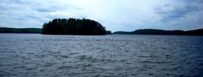
| For our next trip, we like the North Arm. This is a long paddle, and we like to do it as an overnighter. You could do arrange to be picked up at the YMCA camp, easily accessible off the Echo Trail, but it's a fine day trip. The North Arm is shown here looking from the canoe from offshore near the YMCA camp. As you can see, it does kick up in high wind, but on a windy day you can use the islands for protection crossing the main lake, then hug the western shoreline coming up the North Arm. On a normal day, the North Arm is glassy. You could eat lunch or dinner or even stay overnight at the YMCA camp. | 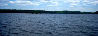 |
 |
You have two choices on this trip. You can portage through Short Portage Bay, or you can paddle around Duck Point. If you're in one of the heavy aluminum canoes, you're better off paddling around. But if you have one of the Old Town or Wenonah models, the portage is easy. As a matter of fact, finding the portage trail is the hardest part. Start the same way, paddling out from Indian Island past the shoals to Blueberry Island, go between Ripple and Lost Girl to Snake Island (left), turn left and follow Snake around to the mainland (right), and turn left (west). Immediately you will find yourself in a deep embayment. This is the tricky part. | 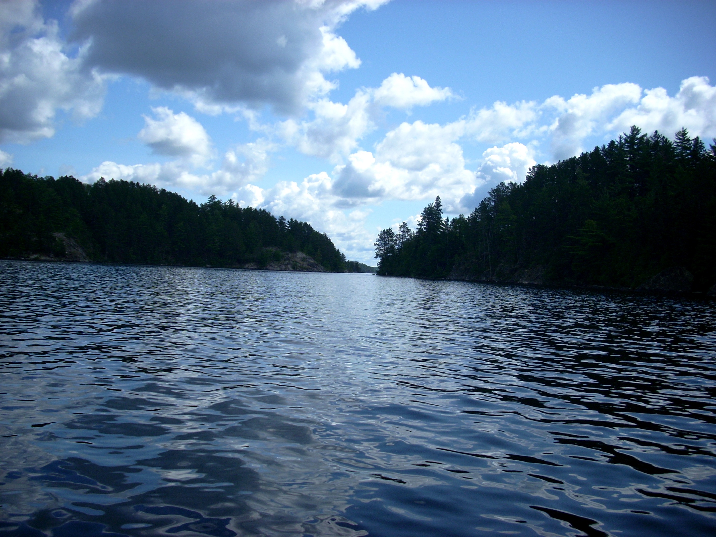 |
| What you are looking for is this cove. It is on your left as you enter the embayment. The map incorrectly shows it further in than it really is. The portage trail begins at the right corner. It is only about the length of a football field and does not involve any major elevation. Now pay attention to avoid embarassing yourself. The two photos below are common mistakes people make. Do not paddle all the way to the back of the embayment and try the obvious trail seen here to the right of the two docked boats. This is a golfcart trail maintained by the owner of the house on the ridge at left. Do not retreat to the very next cove as seen in the second photo, with the house close to the water. There is what looks like a portage trail in the left corner, obscured here by the pine tree. It's not. Keep retreating back along the west shore of the embayment until you see the scene at right in this photo. Now, once you complete the portage and are back in your canoe, you paddle west for about 10 minutes to get out of Short Portage Bay, which is very deep. An island almost blocks the entrance. You want the right channel, which places you along the east coast of the North Arm. | 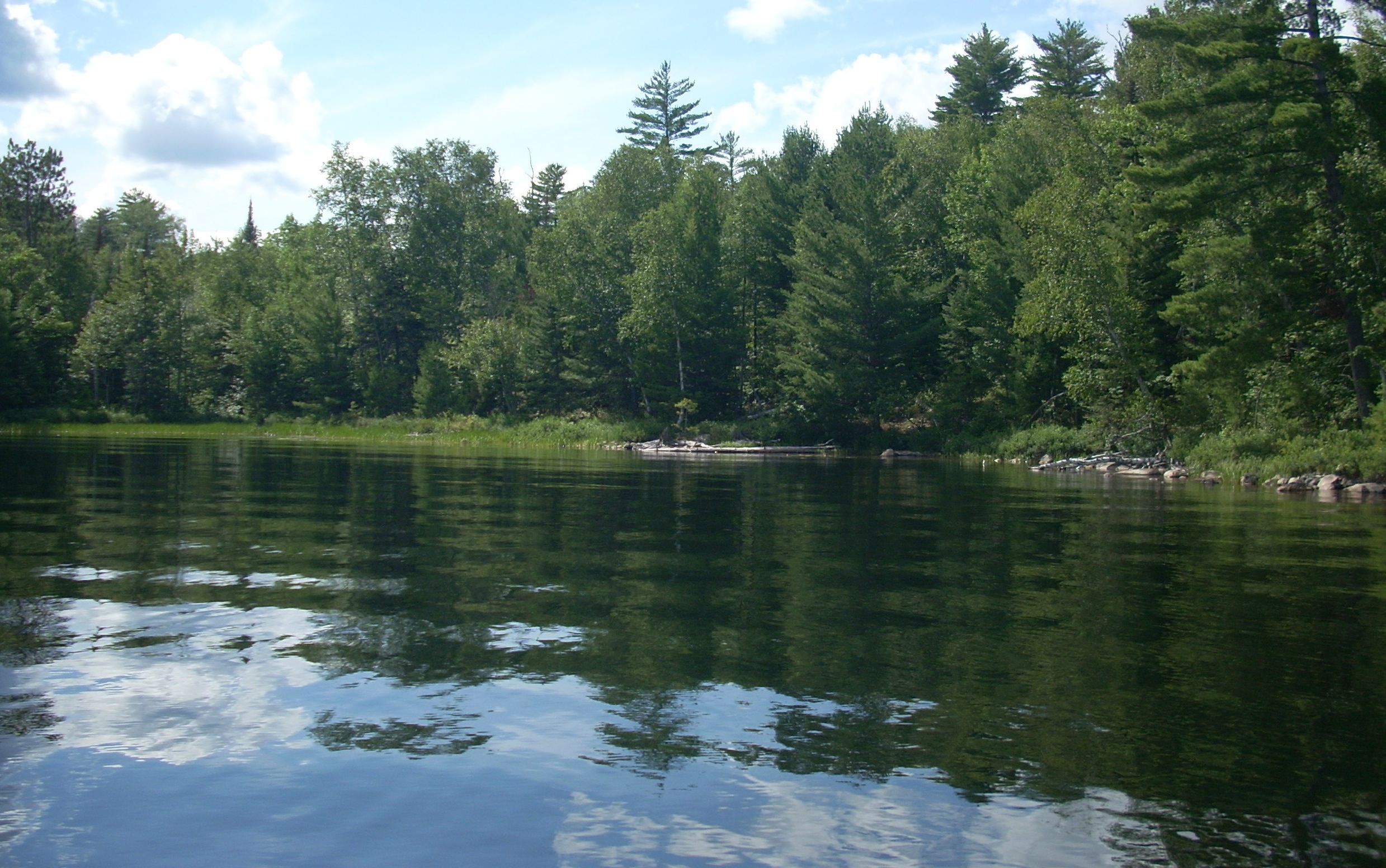 |
 |
 |
 |
However, if you prefer to paddle around, as you pass Indian Island and the shoals, veer left (west) of Blueberry, cut between Lost Girl and Brownell, and right (east) of Honeymoon Island. That will send you along Duck Point and straight up the North Arm. There are four federally maintained campsites on the North Arm, which double as fine lunch stops with their steel fire grates and latrines. For camping, we really like the one tucked back up the deep but unnamed bay to your right just as you round the peninsula (just over the steep hill from Chant Lake, which you could portage into). But for a lunch stop, we use one of the three on the main channel, two on your left and one on your right. The last one, to your right just before the portage trail in to Twin Lake, usually fits your schedule better if you left before 10 am. |
| There are islands of all sizes on Burntside Lake and many have cabins on them. Of the ones which do not, you can usually camp on them for a night or two unless they have a No Trespassing --- Private Owner metal sign (usually red) posted. If you ask Nancy Tubbs at Van Vac or Lou or Lonnie at Burntside they can usually tell you the owner's name and address and sometimes even supply the phone number. We have found that a letter requesting permission to camp there for a night or two with a promise to leave no trace usually brings positive results. Of course, this does require some advance planning. Some islands, such as State Island, Long Island and Dollar Island, are owned by the government and you can obtain permission to camp there from the forest service in their headquarters across the road from the international wolf research center on the other side of Ely. |  |
|
|||
|