| Route 66 | Cities | Beaches |
|
| Shakertown |
Berea College has been a Kentucky treasure since 1855. With a current enrollment of 1500, Berea was the first college in the South to admit blacks and to be coed. Berea students do not pay. Each student works for the school in exchange for a full scholarship, currently worth $25,500 a year. Students choose from 27 majors. Berea's 140 acre core campus is where the Blue Grass meets the Appalachians. The school's holdings include a working farm and the 8000 acre Berea Forest. There is a Forestry Department and various outreach programs (Berea students major in Biology, Natural Resources or Agriculture, then earn graduate degrees in Forestry from the University of Kentucky). The Berea College Biology, History, Geology and other departments also use the forest for classes, research and activities. A college tradition since 1860 is October Mountain Day. The entire college, including students, faculty and administration, joins at the foot of the mountains for a county fair type celebration of Appalachian heritage. Everyone then hikes up to the top, where they eat lunch. Berea College sees the Appalachian Mountains as its mission, and the Berea Forest is central to that mission. |
 |
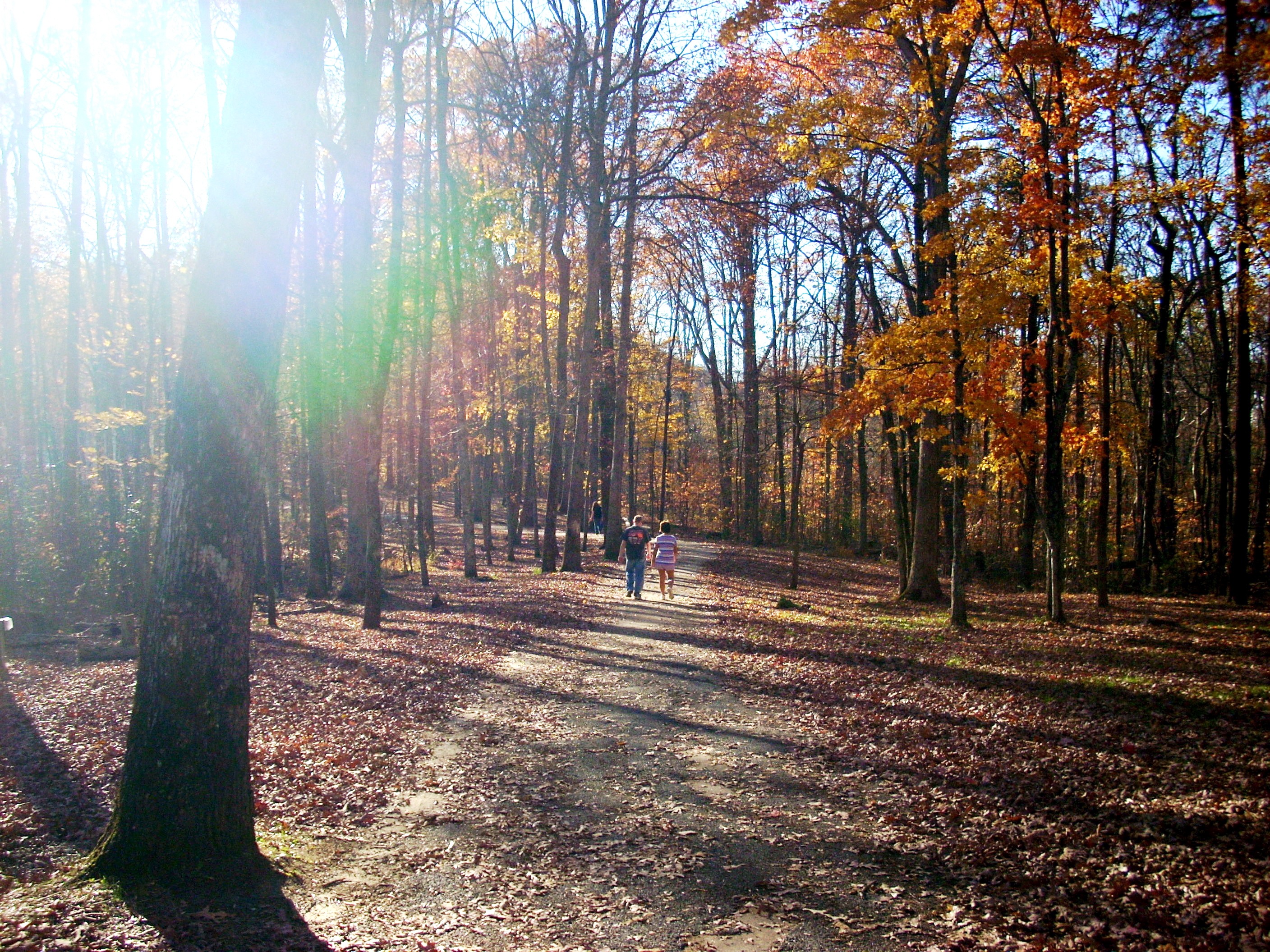 |
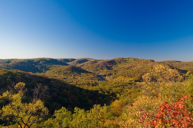
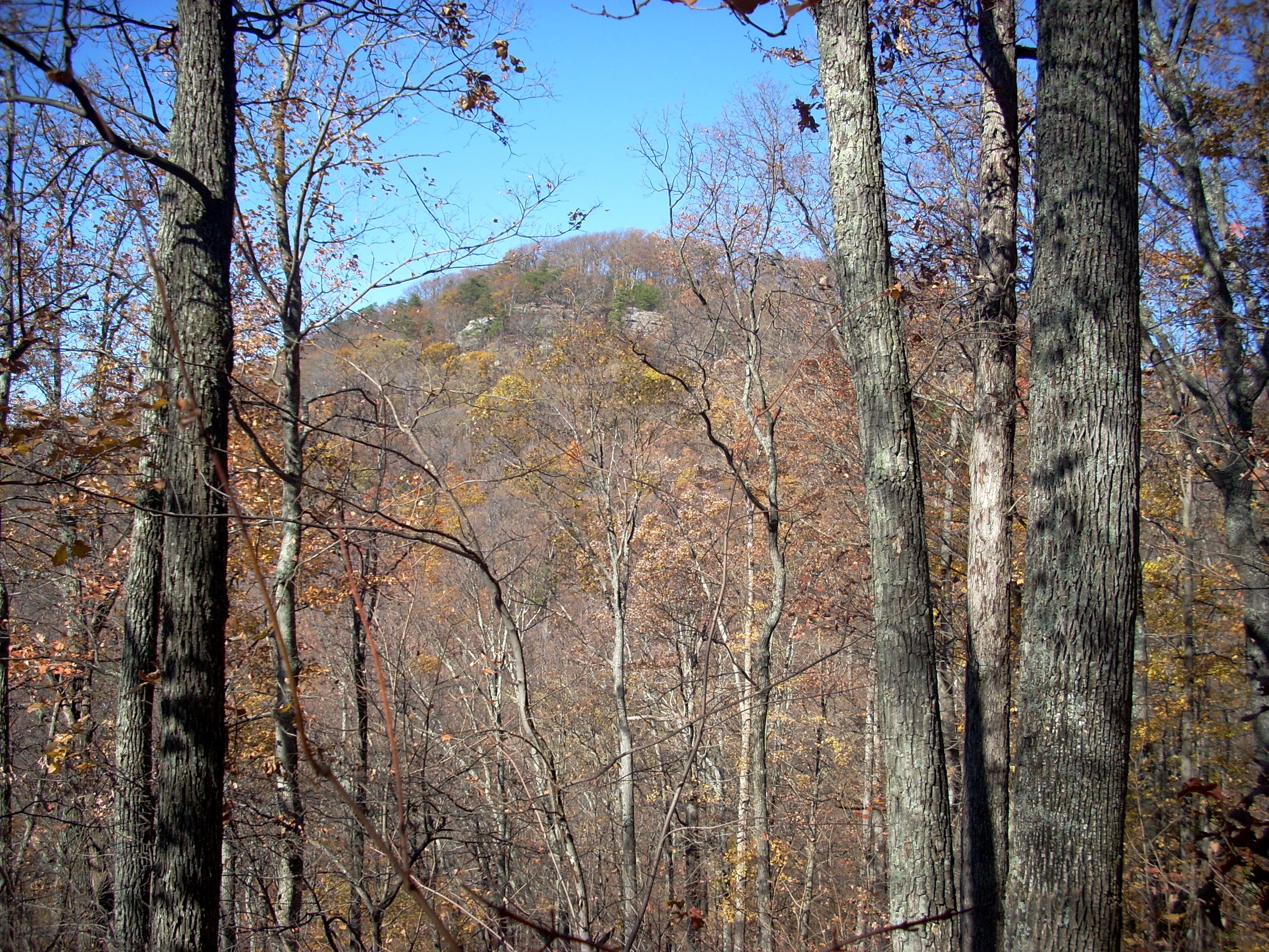
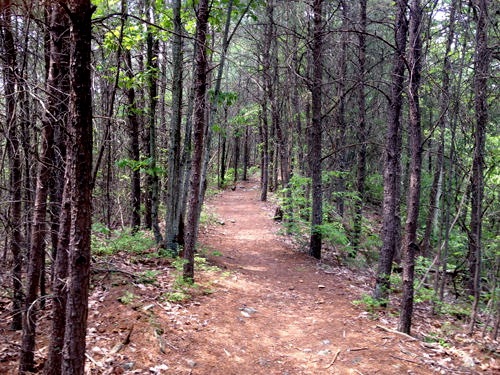
When you first arrive at Indian Fort Mountain, you'll park in a huge lot, although on weekends it may be surprisingly full. Then you'll stroll through a picnic area with tables, electrical hookups and other amenities. To your right will be a roofed shelter with rest rooms. The trail through here is paved. Eventually you reach the end of the pavement and start hiking into the forest. The trail begins climbing steeply. We highly recommend hiking sticks or a good pole. In the Spring it will be damp and the rocks and roots will be slippery. In the Fall the leaves will be so deep you won't know exactly where the rocks, roots and steps are. It's a pretty demanding hike up the mountain. The Pinnacles is a seven mile loop. It is the most strenuous hike in Central Kentucky because two segments of it are more rock climbing than hiking, although they don't require ropes or special skill. Scrambling might be the better word for it. |
| Halfway up the mountain you'll reach a T intersection. There's a bench and sign. The trail to the East Pinnacle, Eagle's Nest, and Buzzard's Roost goes right (east). The trail to Indian Fort Lookout and the West Pinnacle goes to the left. For the main Pinnacles hike, you go left. | 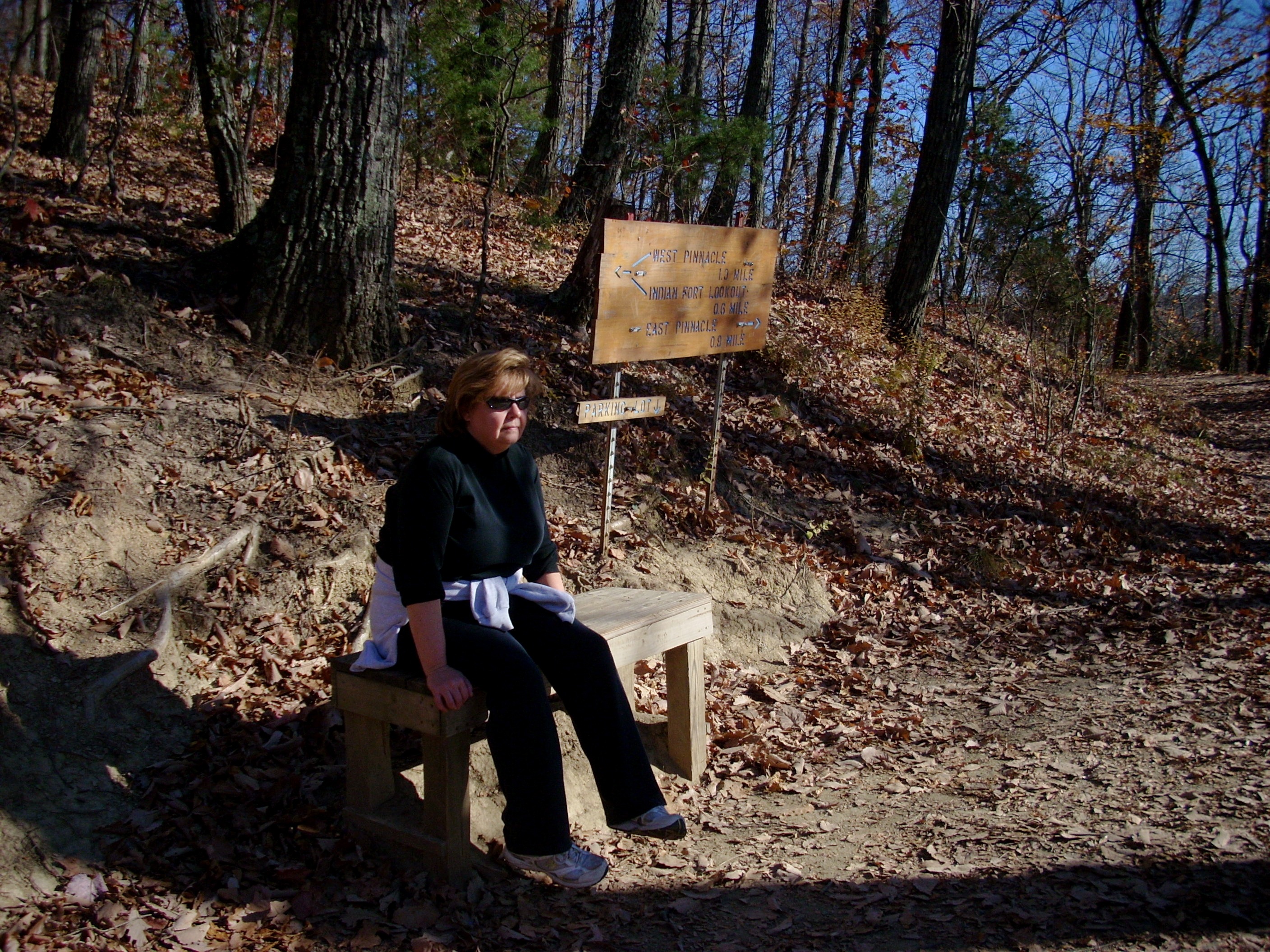 |
 |
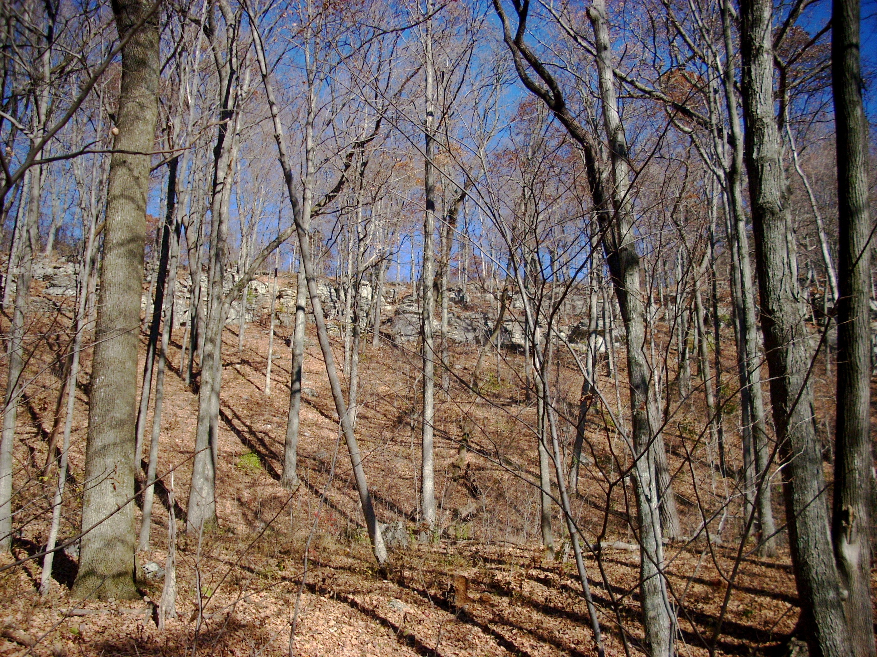
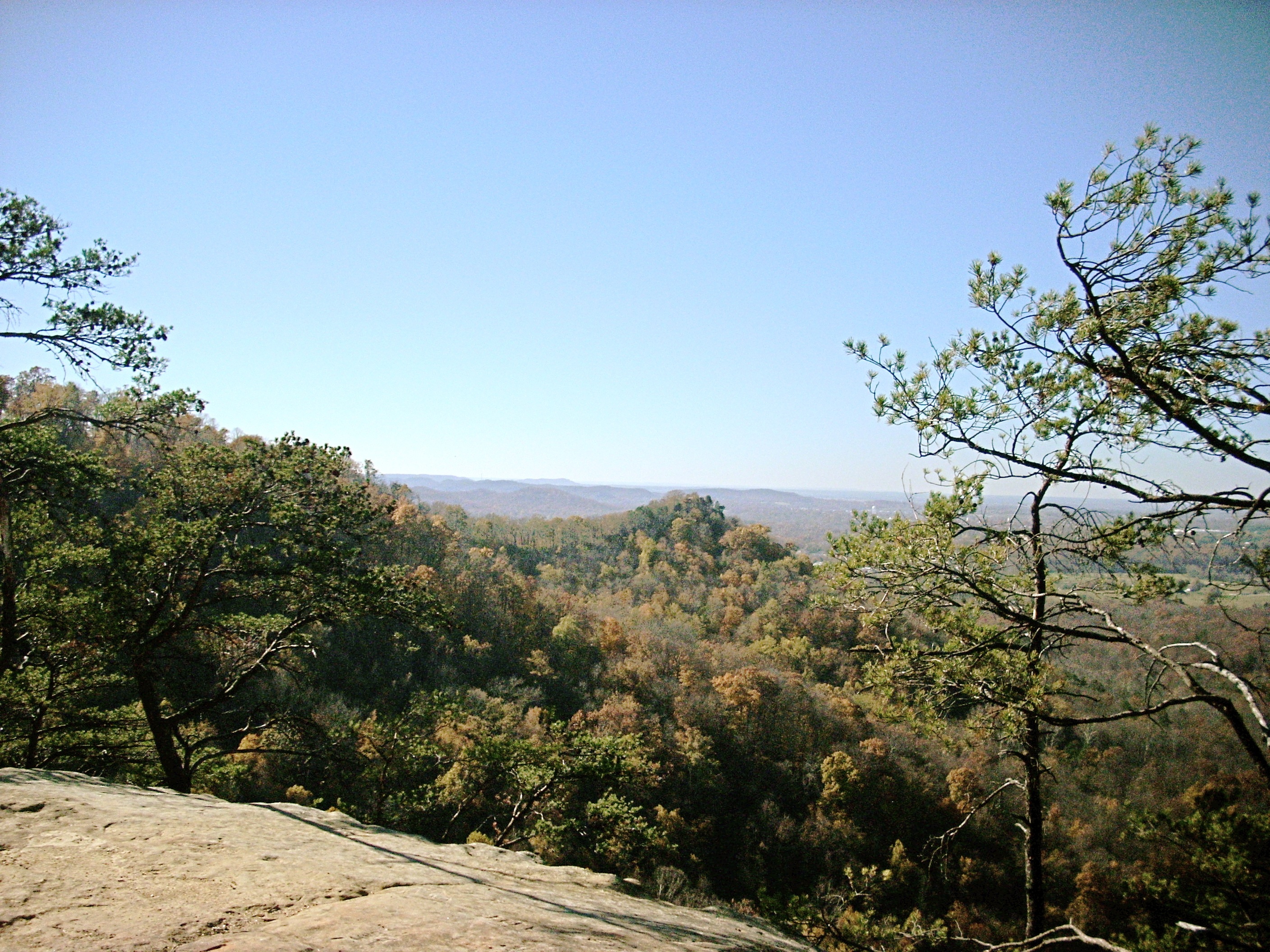
This puts you on Sacred Shadow Trail. It's a beautiful segment, which remains almost perfectly level for a mile as you wind around the shoulder of the mountain. This view looks up at Main Dome, which looks reasonably gentle here but will be the most difficult segment of the day. You'll cross it coming back across the top from the West Pinnacle to Indian Fort Lookout. |
These photos are taken in late November, so the leaves are gone and you can see the rocky spine of the ridgetop. You'll come back across the top of that ridge in an hour or so. A mile from the T intersection, you'll come to another junction. There are two interesting side hikes you can take. The first one, which turns left about 30 feet before the main junction, is the West Pinnacle Trail. It becomes the Devil's Hollow Trail, and curls all the way around below the West Pinnacle until it dead ends at the farm that nestles in the valley between West Pinnacle, Main Dome and Indian Fort Lookout. Even though you have to turn around and come back, it's a neat hike which allows for some great photo ops looking UP at those three rock formations. The second, which turns left directly at the junction, is the Walnut Trail. It also curls around below the West Pinnacle, but does so higher on the hill than the Devil's Hollow Trail and basically hugs the cliffline with some views. |
 |
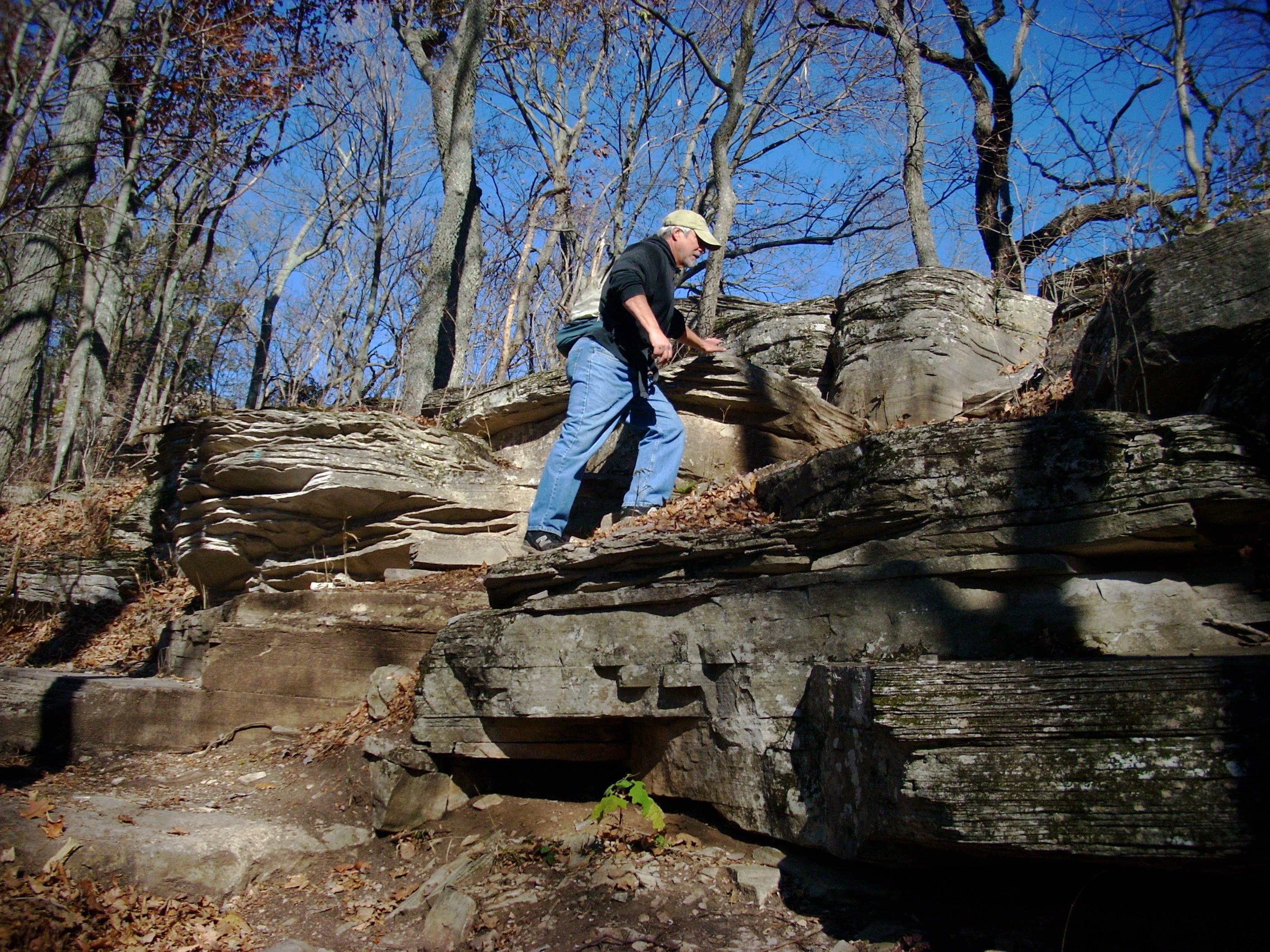 |
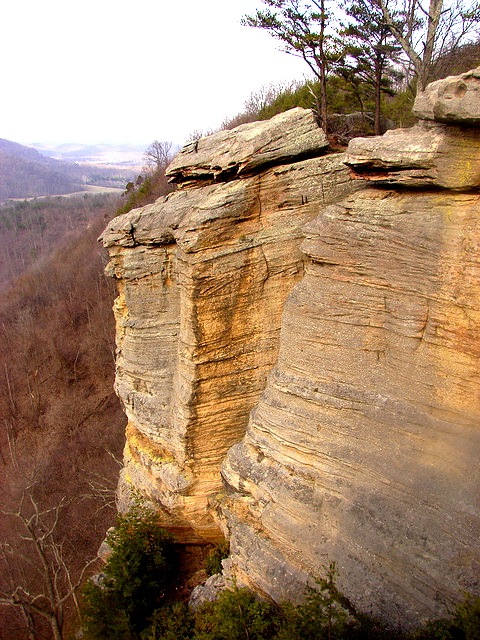
But the West Pinnacle Trail heads up the hill. It's quite a climb, as you can see at right. As you go higher, it becomes steadily more of a scramble over boulders and rock layers. In the Spring, when everything is damp, it can be really difficult. Once you reach the spine of the main ridge, you turn left and continue to pick your way up the rock shalves until you reach the base of the Pinnacle itself. |
| Here, you have to lay down your hiking sticks and staffs and use your hands to help pull yourself up. The climb does not require ropes, thanks to hand and foot holds the Hopewell, Adena and Shawnee tribes carved into the rocks long ago. But it is challenging. The photo shows Dave pulling himself up to the very top. It's a good place for your first rest stop. | 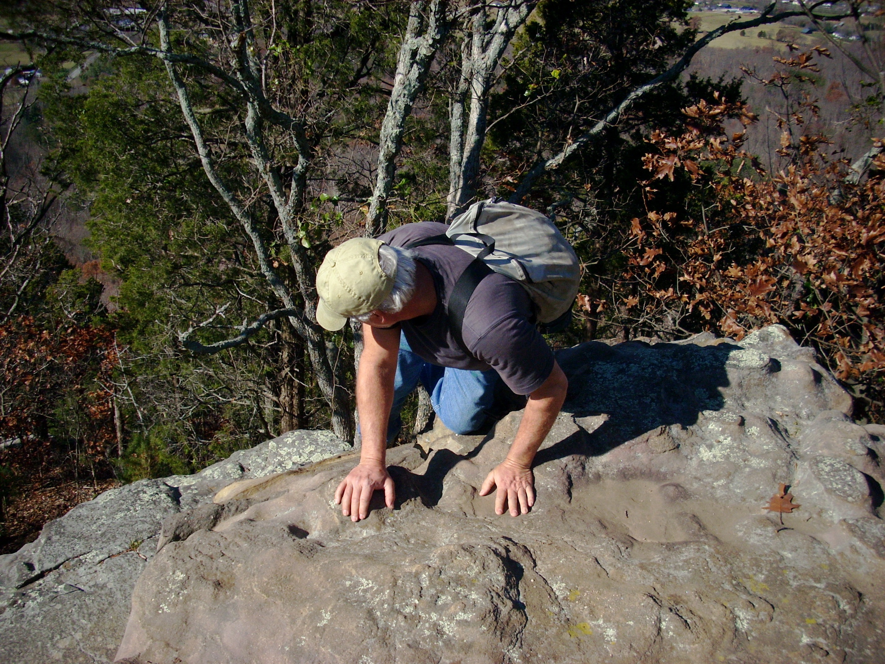 |
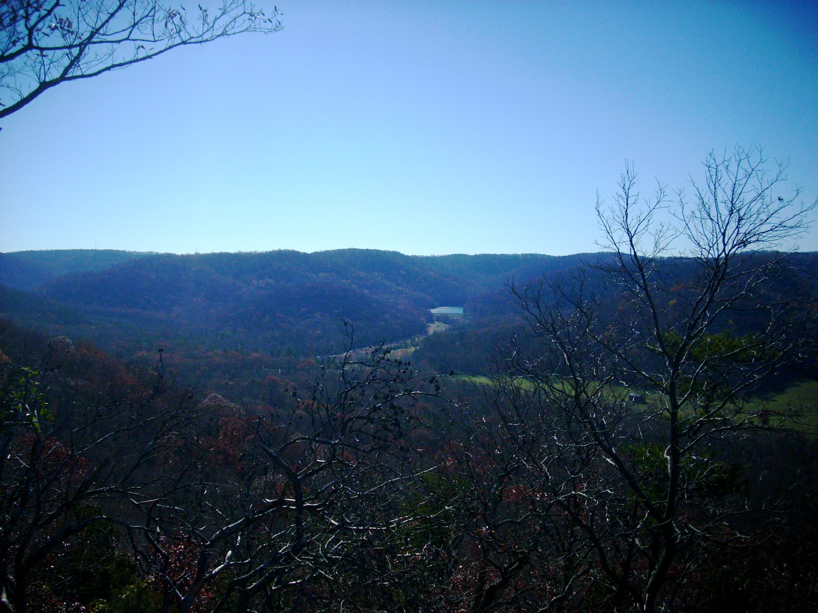 |
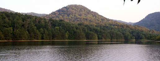
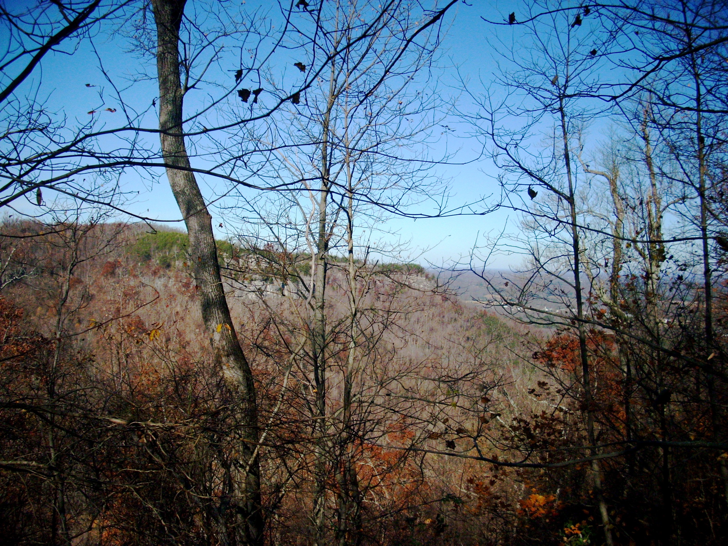
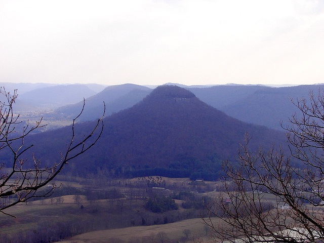
This is a typical view from the West Pinnacle. Here we're looking South, into Jackson County. Hikers who started the day wearing jackets or sweaters usually take them off here. The sun warms all the pinnacles and overlooks, even in late Fall and early Spring. That water in the distance is Owsley Lake. It's the water supply for the town and college of Berea. It produces 798 million gallons of water annually. The forest is also the watershed for that water.To protect its quality, the 1300 acres of timber surrounding the lake are not commercially harvested. |
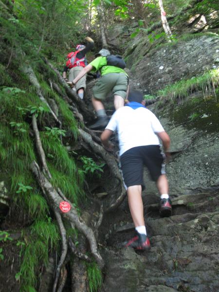
The next segment of the trip, the Main Dome Trail, is the most challenging mile in Central Kentucky. After you carefully descend the West Pinnacle, you follow the narrow rocky ridge eastward, actually descending for about a quarter of a mile. As the West Pinnacle Trail drops off to your right, you keep going straight along the ridge. You immediately face several problems. First, the trail is very poorly marked. Second, since it's so difficult, not many people hike it, so you have a hard time picking it out. Many people have tried to hike it and given up because they couldn't find it. Third, it's not well maintained, so you encounter downed branches and occasionally whole trees blocking the trail, and some of them are at very awkward places where you can't easily get around so you may have to go through the branches. Finally, as you climb the Main Dome, the going gets tougher and tougher until you find yourself climbing crevices and clefts in the cliffs, as seen at left. You never need ropes, but you do need to use roots, branches and thousand year old hand and footholds. This photo shows a group ahead of us inching their way up. We often see families bring a rope. The father climbs first, then throws the rope back down for Mom and the kids to use. However, we've also noticed that kids usually climb these places more easily than their parents. Eventually, you reach the top of Main Dome and find a more normal trail, which descends slowly until you come to the West Fort Lookout. |
 |
 |
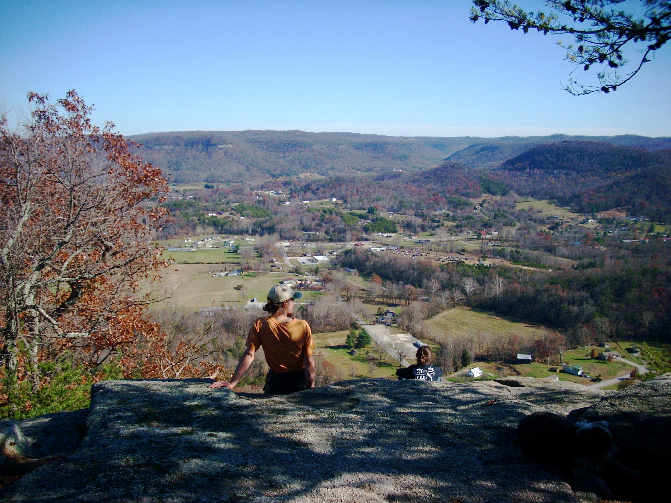
Looking South from West Fort Lookout. This is a beautiful valley, especially in the Fall. All of that land out there belongs to Berea College, but there are no trails except for the ones here on Indian Fort Mountain. From West Fort Lookout it's only about an eighth of a mile along the cliffs over to Indian Fort Lookout. |
 |
The trails around the top of the mountain follow the cliffline so there are some pretty spectacular views and you have to watch your step. There are no clouds of Ladybugs like up on Pilot Knob, but there are Fence Lizards and Skinks basking in the sun and scurrying off into the leaves when you approach. All of this land was underwater during previous epochs, so there are fossils embedded in the rocks. By now the college has collected all the good ones, so you won't find any to take home, but you can enjoy seeing the ones still there.
|
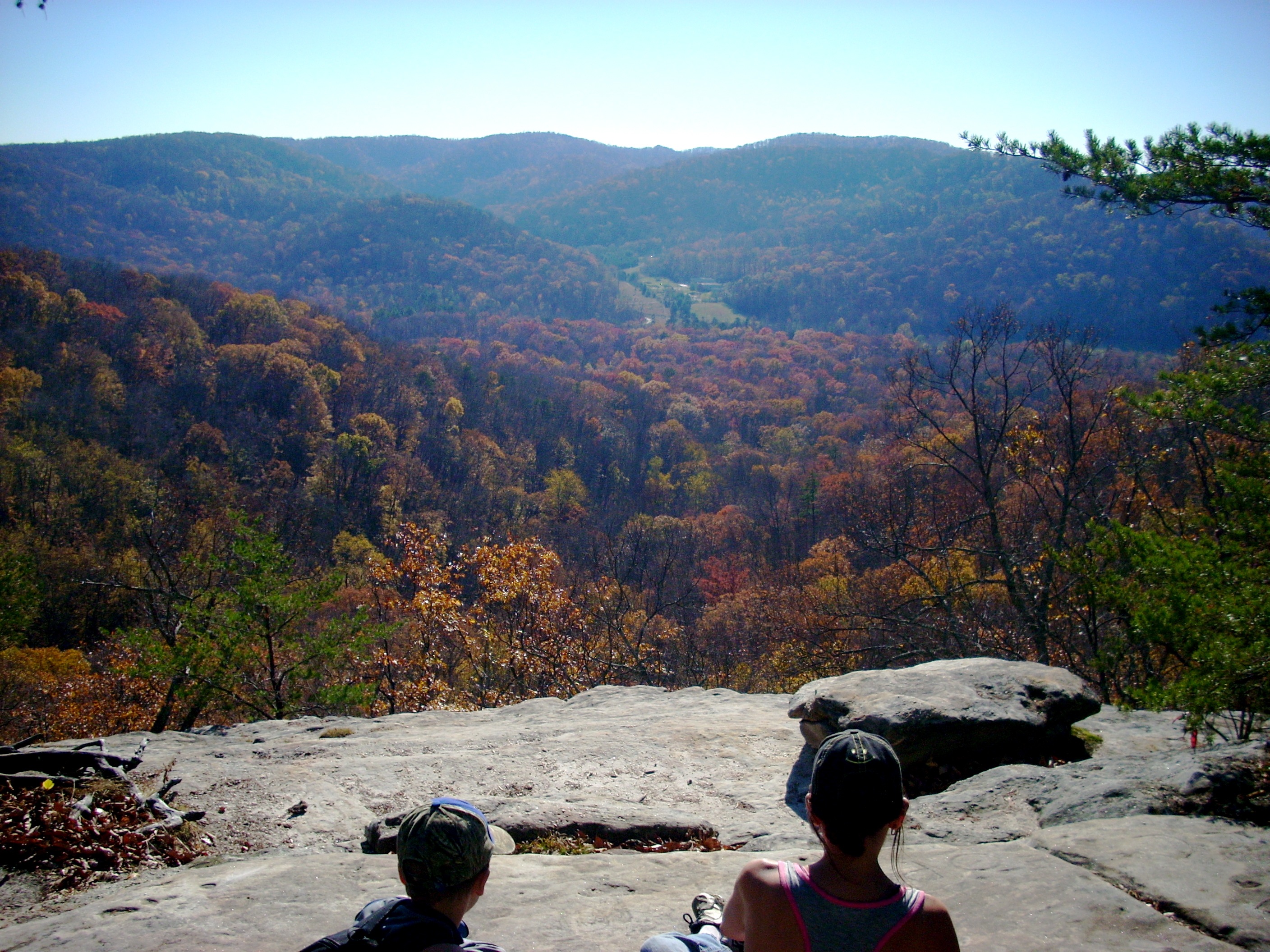
| This is the view from Indian Fort Lookout. There are squarish rocks behind this photographer, which make nice seats for a long lunch stop. The reason we think this is the best vantage point of the six on the mountain is the distance you can see. To the left is Berea College, to the right Eastern Kentucky University and in the distance the Lexington skyline. Ironically, we think this is a much better panorama of the Blue Grass than you see from Pilot Knob. It could be said that Daniel Boone picked the wrong place for his famous first view. We know groups that come down here once a year from as far away as Cincinnati, Louisville and Indianapolis, just to hike this seven mile trail and enjoy these panoramic views. You could make a strong argument that this is the most beautiful day hiking trail in Kentucky. | 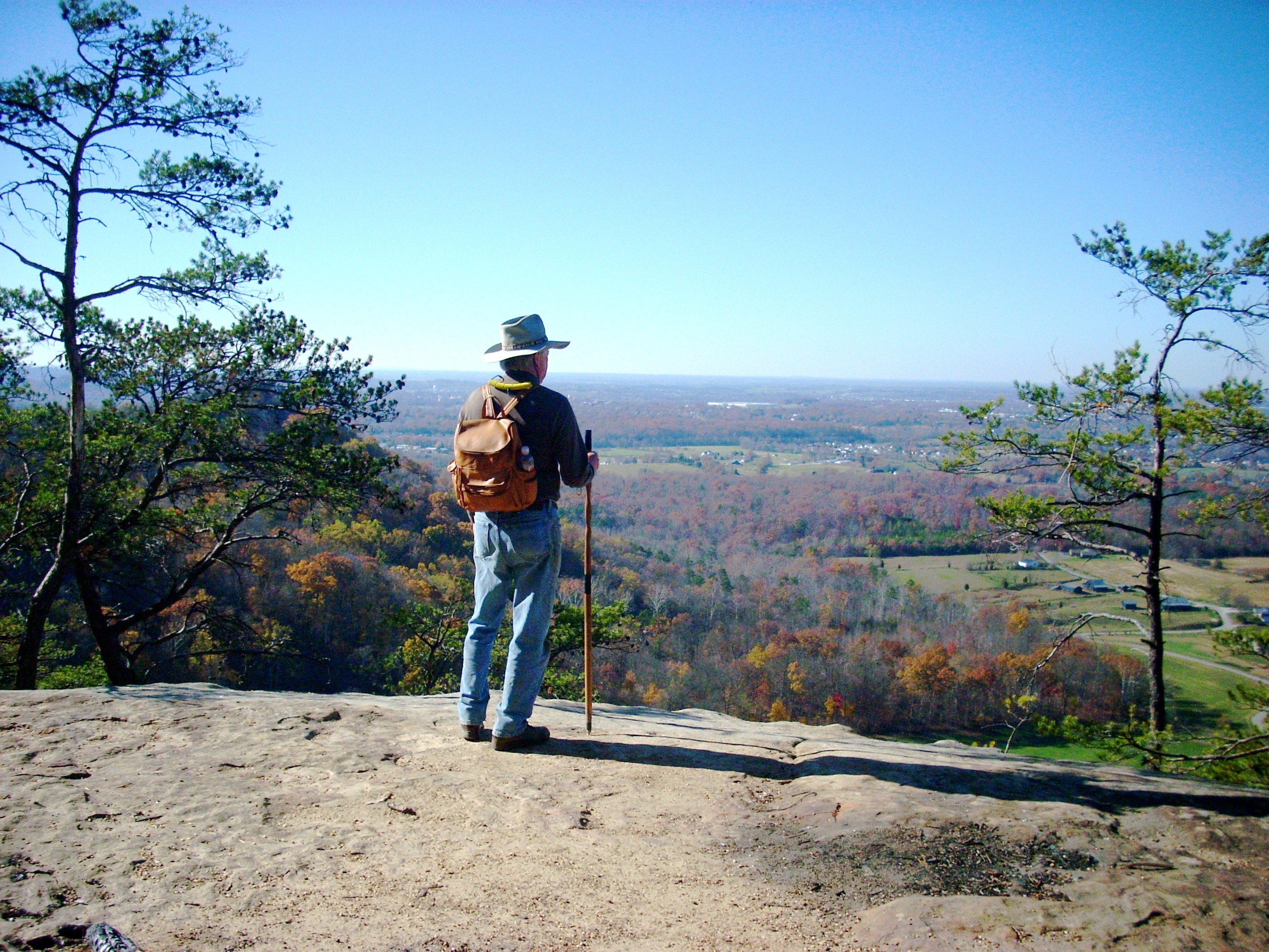 |
 |
This is the view looking Southwest from Indian Fort Lookout. That's West Pinnacle way out there. The higher landform to its left is Main Dome. |
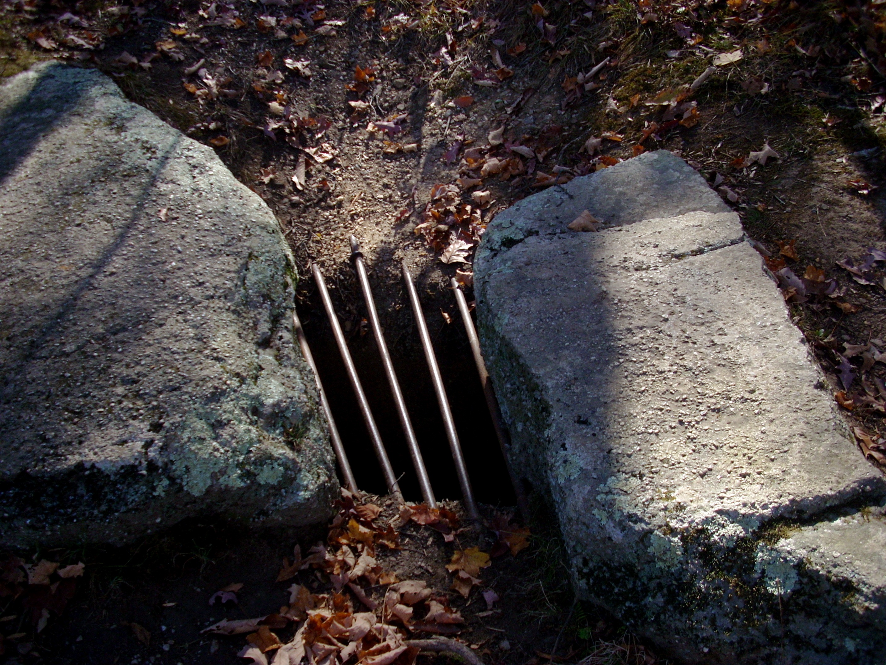 |
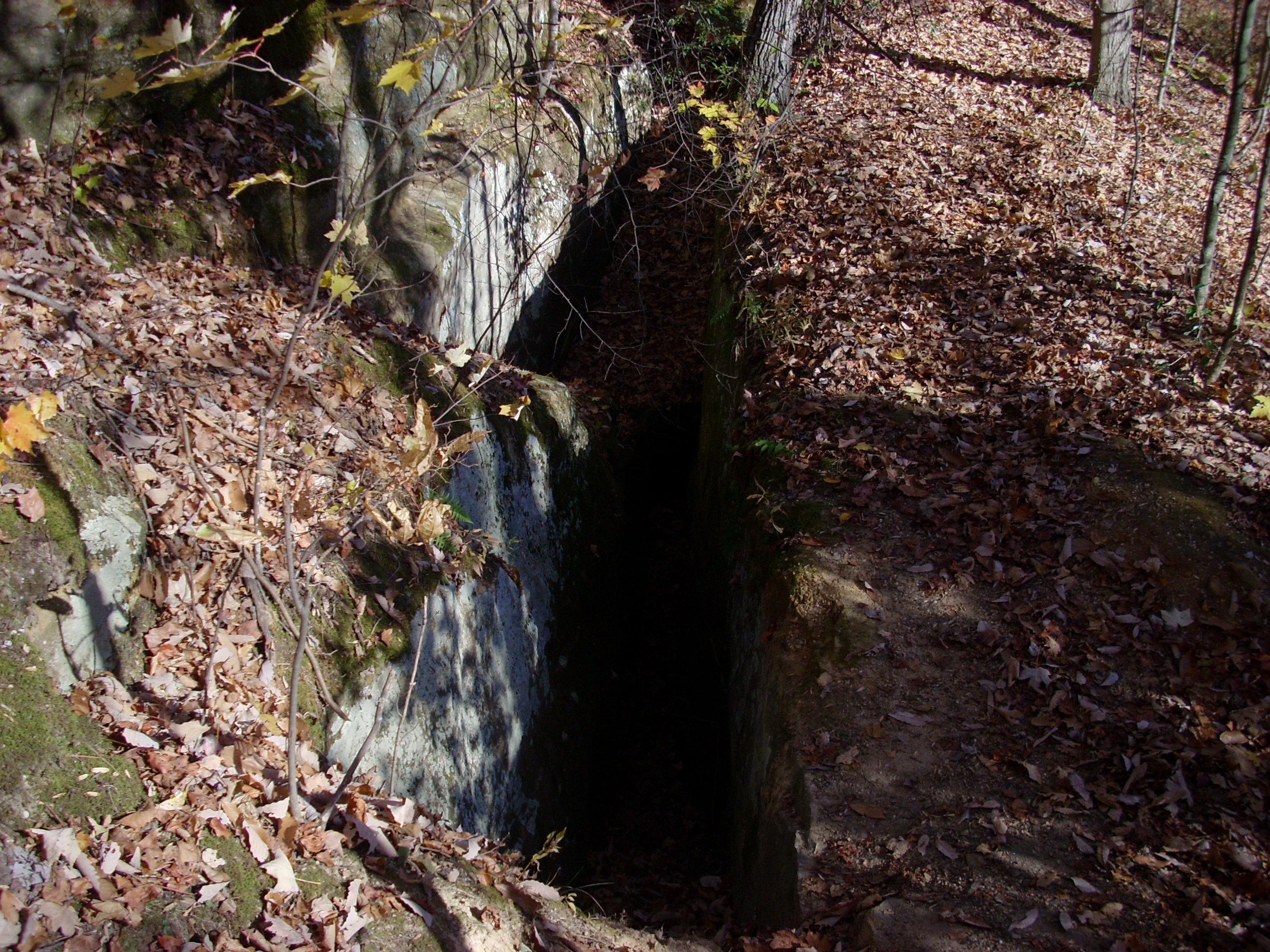
Indian Fort Mountain is honeycombed by tunnels which Native Americans used to scurry back and forth between observation points, defensive installations and large caves where groups lived, at least during attacks. From the time the first White settlers homesteaded farms in the area until recently, kids growing up in Madison County had fun crawling through these tunnels. Fearing someone would eventually become trapped in there, Berea College finally sealed off the tunnels. As you hike the trails, you'll often find openings with these bars across them. College officials admit there are probably hundreds of tunnel openings and they have only sealed off a few dozen, but they think they've got the ones people are most likely to find. This tunnel opening is right along the trail 100 yards east of Indian Fort Lookout. As you pass it, you're entering an area called The Devil's Kitchen. |
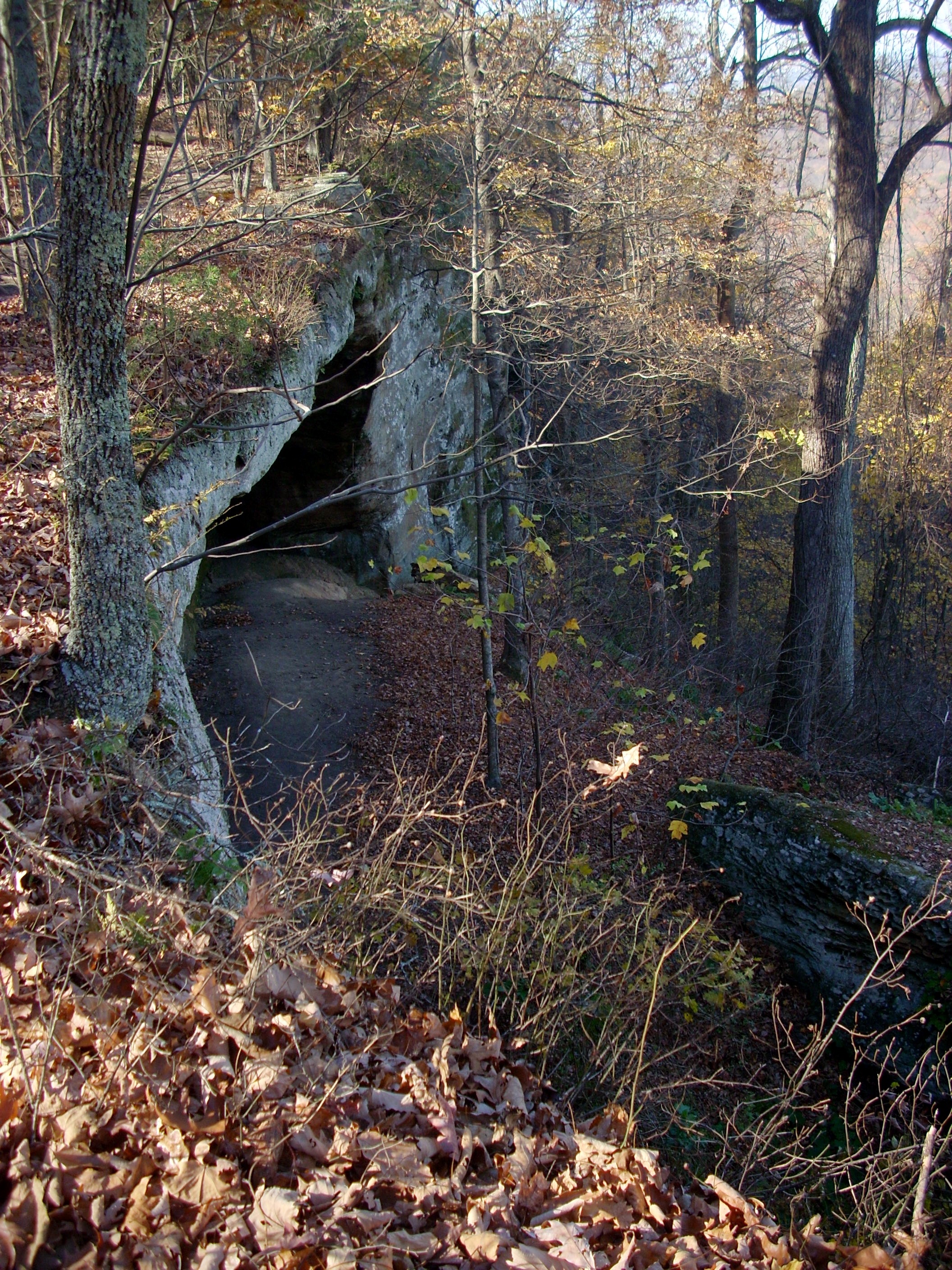
As you walk along the cliffline up on top, you'll be passing over top of numerous large caves. One of the largest is just beyond the tunnel seen above. There are fireholes, grinding holes, wall art, and other indications of habitation. These caves have remained pretty much unmolested because they're so hard to get to. Here, you can look down at it, but without rappelling it's almost impossible to get to. The Hopewell, Adena and Shawnee reached this and the other caves by tunnels from inside the mountain. One reason these caves made such great shelters was that the caves faced away from the wind and weather. It could be pouring rain or blowing snow and not a drop or a flake would fall inside the caves. There are further cliffs below the caves, so enemies approaching from the valley floor could not easily climb up to them. If a Native American tribe stocked enough food, there would have been no limit to how long they could hold off an attacker. When Thomas Walker reached Kentucky, the Shawnee still lived here. They welcomed Walker and showed him the mountain. Cooking fires were in use in all the caves and smoke filled the valley and wafted up to the trail above. Walker dubbed the area The Devil's Kitchen and the name remains to this day. |
 |
 |
Just East of the Devil's Kitchen you'll come to a train juncture. One trail drops over the side and descends steeply to rejoin Sacred Shadow Trail on the way back to the parking lot. You should ignore that and stay on the ridge, toward East Pinnacle, Hawk's Nest, Buzzards Roost and Eagle's Nest. The trail here is nearly level, heavily wooded and soft treaded. |
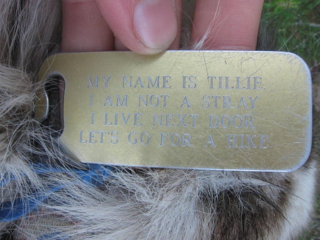
| At some point during the day you'll probably meet Tillie. She's the resident dog. Actually, her owners live in the modern log house to the east of the parking lot. They're the caretakers of the property. Tillie hikes the mountain 10-12 times a day with different hikers. She's now 13 years old, but all these years of hiking have kept her in great condition. Tillie tends to join up with one hiking party, but if they stop for too long, she'll transfer to another party as they come by. When you stop at one of the overlooks, Tillie will roll over with her legs up in the air and invite everyone to rub her belly. Frequent Indian Fort Mountain hikers bring a small lid or dish and at rest stops pour Tillie a drink. Some of them also bring a small helping of dog food and give her a snack. Tillie disdains cheese, grapes, apple slices and other typical hiker foods. |
 |
 |
You'll come to a trail junction where the Robe Mountain Trail turns left. If you have time, it leads to two other spectacular overlooks : Buzzards Roost and Eagles Nest. The photo here shows both through the trees. That's Buzzards Roost clearly visible through the opening at almost the exact center of the photo, and Eagles Nest to the left, closer, partially obscured by the trees. Since you partially retrace your steps, if you hike to both overlooks you'll hike 2.2 miles from the junction. The trail is almost perfectly level since it's all ridgetop hiking. The forest back on Robe Mountain is the most beautiful of the Berea Forest property and since few people go back there it's more isolated. You tend to see more deer and other game. |
| On the way to Hawk's Nest and The East Pinnacle, you cross this temporary meadow. A major forest fire completely levelled the forest here several years ago right down to the scorched earth. Year by year, hikers will be able to see Nature returning the area to forest. This is also the intersection of the trail coming up from that T intersection. Dave stands at that junction, in front of the sign. That's Tillie looking down the trail toward the T. Ahead is the rising land toward Hawk's Nest. | 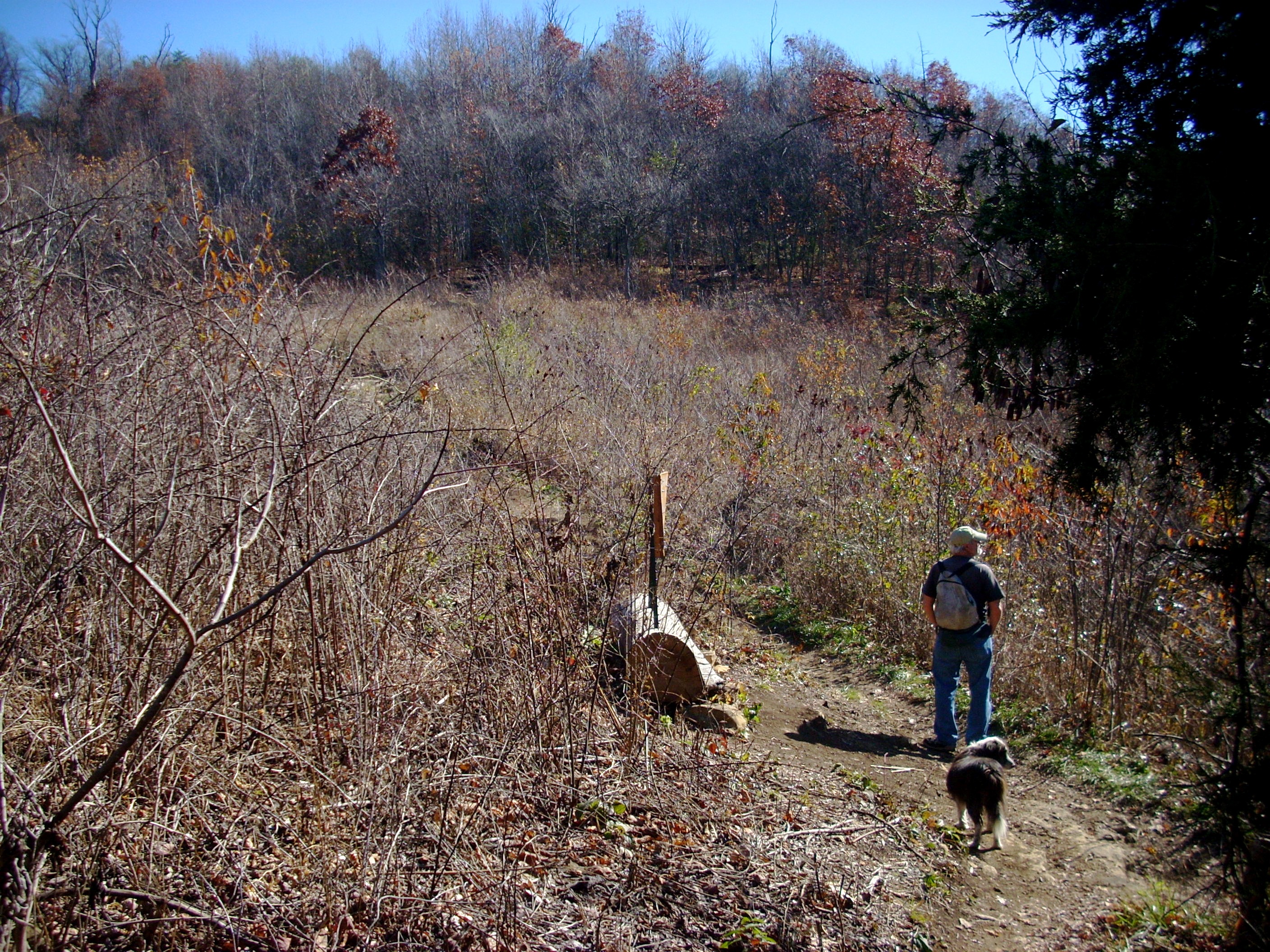 |
 |
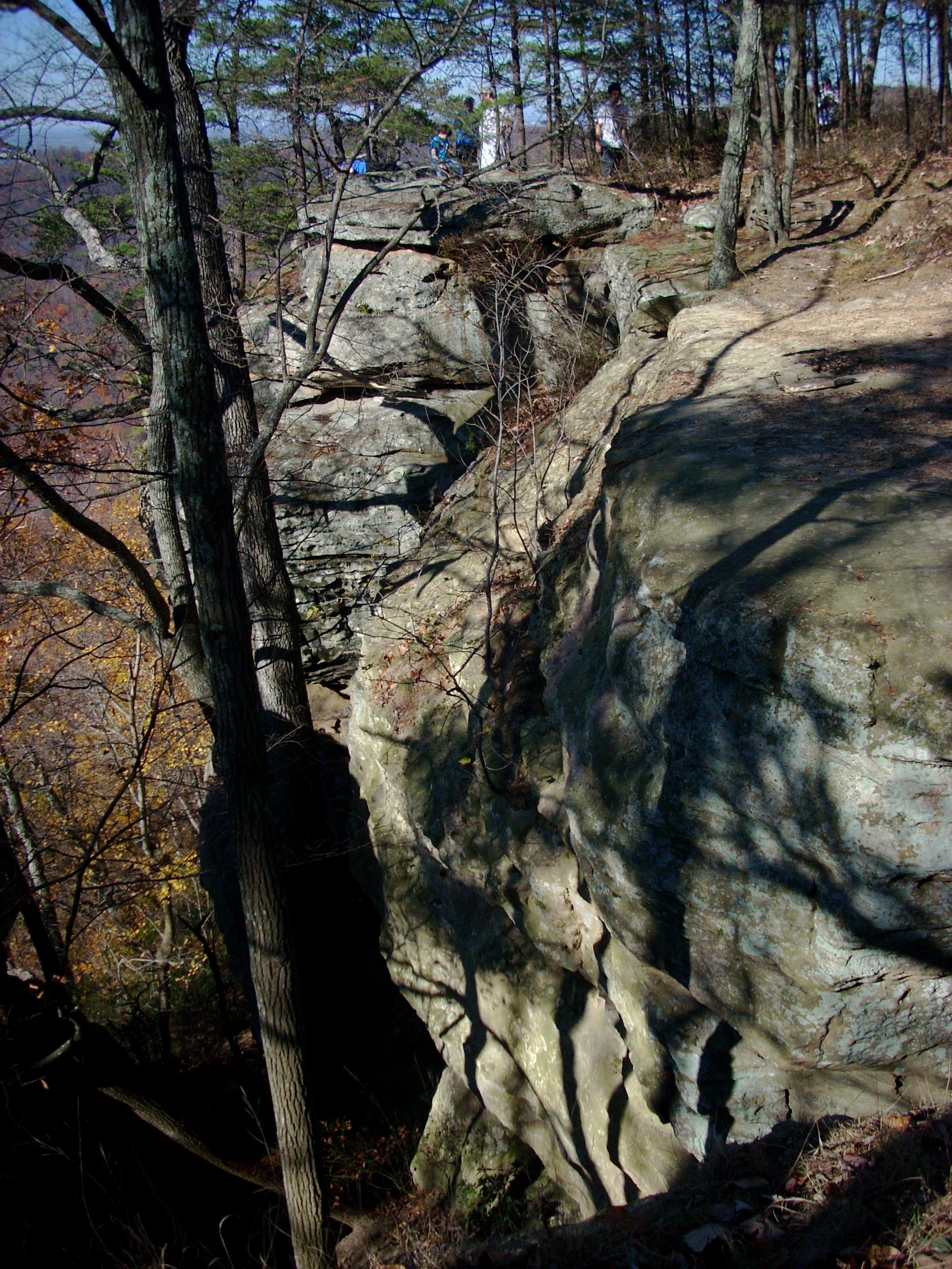
As you hike around Indian Fort Mountain, you'll see these huge crevices, giant cracks. Geologically, these are blocks pulling away from the mountain. Many of them opened up shelters angling back under the house sized boulders. Archaeologists have explored these crevices and found fire holes, grinding holes, cave art, and other signs of Native American habitation. They have also found neat sets of arrowheads laid out on rock shelves, suggesting in time of attack warriors may have used these as vantage points to fire down on the enemy. The wooden shafts and the bows have long since rotted away, leaving the arrow heads. Some of these crevices are interconnected by tunnels and caves which honeycomb the mountain. |
| Hawk's Nest is a popular stop for observing the large Red Tailed Hawks which spend the day riding the rising thermal currents. As many as six or eight hawks at one time are out there spiralling up and down. As difficult as the seven mile Pinnacles Hike is, it's always interesting to see how many families with young kids make it up to the overlooks. | 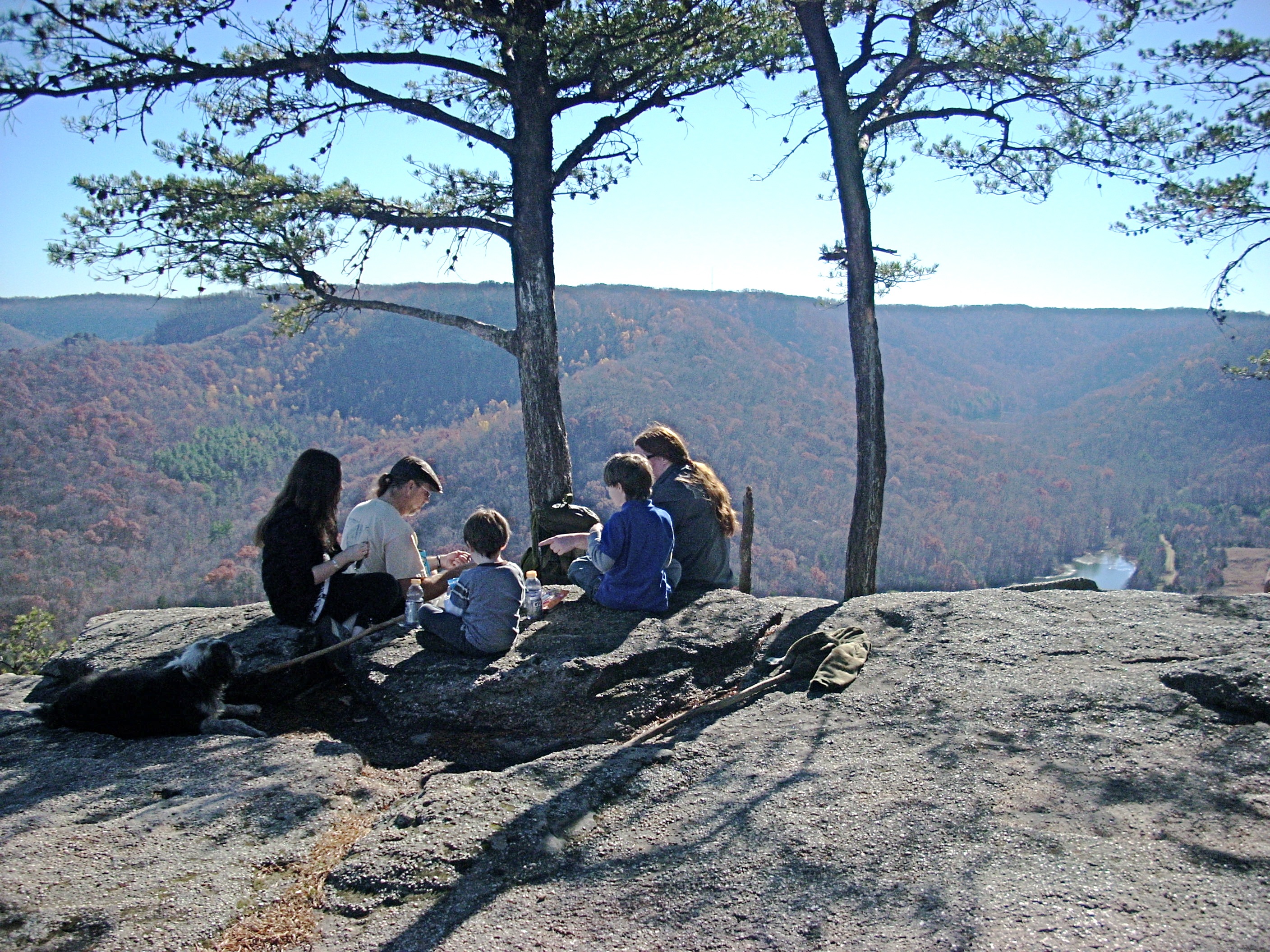 |
 |
The East Pinnacle faces directly east. Those hills in the background are in Estill County. Most people hike the trail clockwise so it gets easier as they go, which means the East Pinnacle is their last stop. Therefore, hikers tend to linger here as long as possible, soaking up the sun's rays and enjoying the view. |
| The trail from East Pinnacle back down to the T intersection is a mostly level and sometimes slightly downhill cruise. You'll be hiking through a young forest because this area was clearcut years ago and is still growing back. | 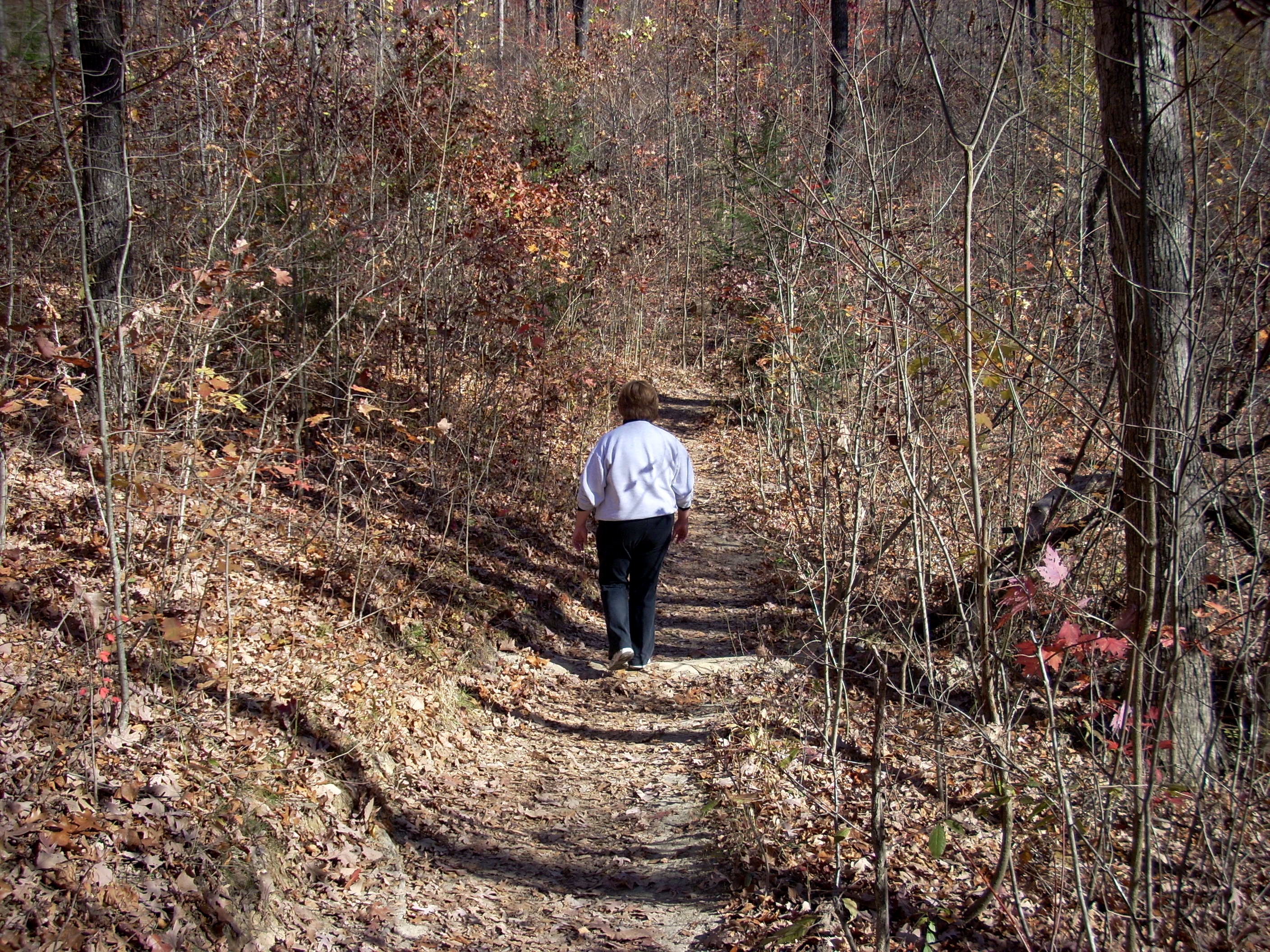 |
 |
Since the late 1800s, modern forestry practices have been tested and studied in the Berea Forest. As Berea acquired the land, tract by tract, it was not in good condition. It had been overcut, overtilled, overgrazed, and often burned over many times. Fortunately, Berea Forestry Professor Silas Mason was perfectly suited to restore this land. His specialty was in Old Field and Young Forest Regeneration. He had studied this topic at Kansas State and at several sites in France, Switzerland, Germany and Prussia. He knew the soils, colonizer species, grasses, and trees involved in the long process of reforestation. And so Mason set about recreating a Southern Appalachian forest on these 8000 acres. What you see today is the result of hard work by Mason and the faculty members who followed him. And this is still a working forest. Berea harvests trees both for sale and for use on the campus. In the 20th Century, 16 million board feet of timber have been cut for commercial use from the Berea Forest. |
| Berea Forest is also a historical and archaeological site. The Hopewell, Adena and finally Shawnee lived here. The heart of their settlements was Indian Fort Mountain. The mountain is very steep and has many cliffs but also many breaks in the cliff line. At every cliff break, a carefully constructed stone wall blocked access to anyone climbing up from below. Behind every wall were several piles of rocks about the size of bowling balls. Archaeologists believe these were to throw down on any invaders attempting to scale the mountain. Elsewhere on the mountain, springs emerge. At each spring, there is a dam built to hold a pool so someone could dip a clay pot and fill it with water. Up on top, there are several lookout stations facing in various directions. And on the slopes and base of the mountain are many other Adena ruins. This is one reason hikers are required to stay on the trails. Indian Fort Mountain is still a very active archaeological site. The clefts now used for trails have been cleared of walls and rock piles but there are many others off trail. There are also minor Civil War sites in the Berea Forest. Small units from deeper in the mountains to the East camped here en route to and from the Confederate victory in the Battle of Richmond. | 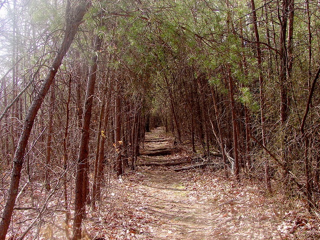 |
 |
Berea Forest is about an hour from Lexington. Take I-75 south, take Berea exit 76 and turn left (east) on state highway 21. This will bring you into the town of Berea. After passing the small business district and the core Berea College campus, come to the intersection where Hwy 25 splits off left at the Boone Tavern Hotel. Turn RIGHT onto Hwy 21. This will put the Boone Tavern Hotel on your LEFT. From this point drive three miles on Route 21. Look for the large parking lot extending up the hill on your left. |
Comment or
Question ?? Join us at The
Forum. |
Read our day to day adventures at the Blog |
Or contact us at trekkerforrest@aol.com |