Mammoth Cave
| Route 66 | Cities | Beaches |
|
Mammoth Cave |
|
| Shakertown |
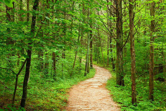
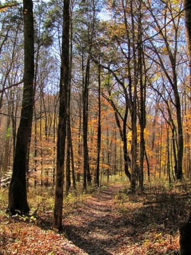
Mammoth Cave National Park is famous for having the largest and most complex underground system in the world. Explorers have spent a century pushing back the frontiers and still have not completely mapped the cave system. Vacationers come from every state and most foreign countries to see the cave for themselves, taking the various guided tours. But what the media rarely talk about is the extensive above ground trail system. You can mix and match these trails to create day hikes, overnighters and multi day backpacking trips. The trails themselves are outstanding. They are very well maintained and, as these photos show, they are wide and trimmed back, almost like roads in the woods. In all, there are 73 miles of trails. And the forest they wind through is beautiful. It's an old forest, called The Big Woods locally. Much of this is original forest, 53,000 acres of never cut hardwoods. The Big Woods holds mostly Tulip Poplars, Beech, Maples, White Oak, Black Oak, and three kinds of Hickories. It was originally left alone because of the rough terrain : it has rivers surrounding it and steep cliffs, sinkholes, caves, ravines, bogs and other barriers which made it so difficult loggers in the 1800s and early 1900s just went elsewhere. By 1926, when they had finished logging elsewhere and had the modern equipment needed to attack The Big Woods, the National Park Service had moved in and the forest was protected. |
 |
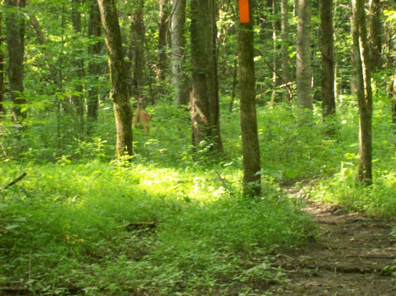 |
The trees aren't the only protected species. Flocks of Wild Turkeys, herds of Deer and other animals live in The Big Woods. Notice the deer peering at us in the photo at left. Paw prints of the Red Wolf are found in the soft mud and sand along the rivers and streams, although sightings are rare since the Red Wolf is nocturnal and they keep their distance from humans. Evidence of Cougars keeps turning up, and locals, frequent backpackers and even park rangers, have recorded sightings. The Cougar's nighttime cry is also heard by backpackers in the more remote areas of the park. Cougar are big, adults weighing from 100 to 150 pounds. But, like the Red Wolf, Cougars operate at night, and keep their distance from humans. Less rare are the Wildcat ("Bobcat"), whose tracks are plentiful and which are often seen in the backcountry. Much more commonly seen are Raccoon, Skunk, Fox, Possum, Voles, Muskrat, many varieties of snakes, lizards, salamanders, turtles, and over 100 kinds of birds, although many of the birds only drop by on their migratory routes. Fish are also common in the rivers. |
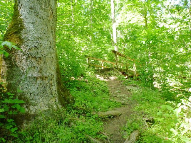
The core trail system is North and West of the Green River in the Western half of the park. The Eastern half of the park is devoted mainly to various cave entrances, to a wheelchair accessible nature trail, to entrance roads and ranger stations. Park Headquarters, which includes cabins, a lodge, the Visitor Center, a restaurant, the Back Country Office, exhibits, the main campground, and the historic main cave entrance, is located where the river separates the Eastern from Western halves of the park. To get to the trailheads, you take the Green River Ferry across to the Western half. If you come with a group, you will probably want to camp over on the Western side, at the Maple Springs Group Campground. The main trailheads are along the Maple Springs Loop and at Good Spring Church. There are parking lots at both places. Of course, backpackers will begin from Maple Springs Loop or Good Springs Church and hike on through, emerging two or more days later at one of the trailheads along the northern and far western rims of the park. Day hikers will mix and match trails to create loops which return to Maple Springs Loop or Good Springs. You could also drive on to the northern and far western rims, park there and dayhike in, but those will be linear in-and-out hikes. All of these day hikes take you into The Big Woods. There will be plenty of water along the way, but you'll have to purify it, given the presence of Giardia Lambda. Some of the trails are almost perfectly level, but some involve steep drops and rises. We recommend hiking Mammoth Cave trails in the Spring or Fall. The Big Woods is heavy with deer ticks in the Summer, and the heat and humidity become oppressive. |
 |
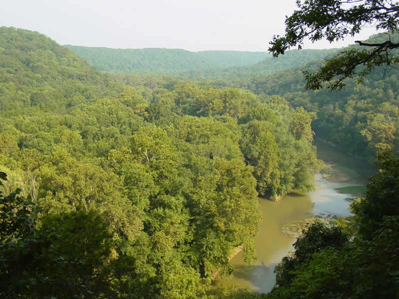 |
Our favorite Mammoth Cave day hike is the Turnhole Bend Trail. The photo at top right shows the trail high on the ridge, and the one at left shows the Green River curling around Turnhole Bend. The trail ends on that sandbar lower center. If you get your water here, you'll need to filter out the sediments, then run it through your purifier. As a day hike, you could either have lunch up on the ridge, or down along the river. Remember, though, that it's a steep half mile down to the river, so you'll have to climb back up to the ridge before beginning the afternoon hike back. Either in April or October, Turnhole Bend is a beautiful place. This photo is taken in mid Summer; notice how low the river is. Including the drop to the river, Turnhole Bend Trail is 4.0 miles, making an 8.0 mile round trip. But, not counting the drop to the river and steep climb back up, the trail is almost perfectly level. We park at the Good Spring Church. Take the Good Spring Loop Trail out a quarter of a mile, then turn left on Turnhole Bend Trail. On the way back, we like to turn right on either the Buffalo Trail (shorter) or the Sal Hollow Trail (much longer) for a little variety. Both trails end at Maple Springs Loop Road. You then hike a mile out Good Spring Church Road to your vehicle. |
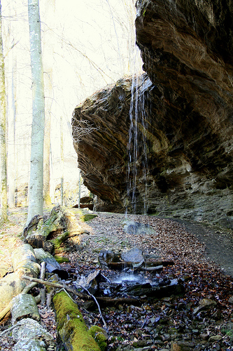
An outstanding circular trail is the 8.0 mile Good Spring Loop. This is the most heavily hiked major trail at Mammoth Cave. It is the core of the entire hiking system, because all the other trails use it as a starting point or intersect it at some point. In the Spring extensive wildflower stands bloom at several points along the way. You come past two scenic "tricklefalls," one shown at right. The water does need purifying due to Giardia Lamblia but it's ice cold in the Spring and Fall and still very cool in mid Summer. You park at the Good Spring Church. The trail passes right by the church building. The Good Spring Loop displays not only a beautiful forest but a great cross section of Karst topography. The forest it traverses has been here a long time and the floor is very open, allowing long views across ridges and down into valleys. The terrain is not too rugged, but does include a lot of variety. You start off (assuming you hike the trail in a clockwise direction) by following Haney Ridge out 3.0 miles to the Big Clifty Bluffs. You'll be looking down into the Dry Prong Valley to the right (north). Underground here is a major cave passage, which drains the water from Dry Prong Creek. At Big Clifty, the trail descends to the valley floor and crosses the Dry Prong streambed. To your left, at Buffalo Spring, the water which should have been flowing in Dry Prong emerges from the cave, joins the water from Wet Prong flowing in from further West, and becomes Buffalo Creek. You have scenic vistas looking South across the Green River toward numerous sinkholes. At several points along the descent and ascent, you have overhangs which could offer good protection if you get caught in a rain. Meanwhile, the trail climbs rather steeply out of the valley and levels out on Collie Ridge, where it joins the Collie Ridge Trail and heads northeastward. This is a really spectacular trail, high on a narrow ridge, with views down into Dry Prong Valley to the right and Wet Prong Valley to the left. Eventually, you'll turn sharply right and descend to the upper Dry Prong Valley. You'll cross two dry streambeds, then climb steeply back to the ridge and level out as you approach Good Spring Church. |
 |
 |
The third great day hike in Mammoth Cave is the 8.0 mile Raymer Hollow Trail. You park at the Maple Springs Loop Lot. This time you walk north along Maple Springs Loop Drive until you come to the trailhead on the left. The Raymer Hollow trail will take you deep into the Upper Dry Prong Valley, an isolated corner of the park few people ever see. Even though this is probably the most beautiful trail in the whole park, you probably won't meet another hiker the whole day. The trail's name comes from Raymer Hollow, a side valley off the upper Dry Prong Creek. Raymer Creek is also usually dry. There is a great isolated campsite along the Raymer Creek bed, so this would also make a fine overnight. The Raymer Hollow Trail looks like a giant Z, with the top end coming out on the Collie Ridge Trail. The easiest choice is to turn left on Collie Ridge, hike South for half an hour, and turn left on the Good Spring Loop. This will bring you back to the Church. You can just walk down the road to your parking lot. If you have a friend who doesn't want to hike but is willing to drive the shuttle, you could turn right on Collie Ridge and hike North three miles to the Lincoln Trailhead on Ollie Ridge Road. Your friend can drive North on North Entrance Road, turn left onto 1827, and again turn left onto Ollie Ridge Road. The Lincoln Trailhead is just one mile down Ollie Ridge Road. It's the same distance either way. It just depends on whether you can set up the shuttle or not. The Raymer Hollow Trail is in forest the whole way. Most of the sightings of Cougar and Red Wolves in the park have been in this Upper Dry Prong and Raymer Hollow area. Coyote and Wildcat are also very plentiful here. Day hiking, you're not going to see or hear any of these animals. But you should keep your eyes open for tracks, tufts of hair, droppings and other signs. One species you probably will see up here is Wild Turkey. You'll hear them gobbling and grunting. |
| Sal Hollow Trail is an 8.7 mile loop beginning and ending at the Maple Springs Parking Lot. The Southern half of this trail is particularly scenic and includes the waterfall at right. For the most part, the Sal Hollow Trail sticks to high ridges overlooking the Green River, but it descends into deep valleys to cross Stillhouse Creek and Sal Hollow Creek, then climbs back up to the ridges between. The trail passes Ganter Cave, Stillhouse Cave and several smaller caves, plus numerous sinkholes, disappearing and reappearing streams, and other Karst features. The outermost point along the trail is the Sal Hollow Creek campsite on the flood plain of the Green River, which can also be used as a lunch stop. It's more than halfway but you can eat a leisurely lunch knowing the return trip will be shorter and easier. That return trip slowly climbs back up the west side of Sal Hollow until it reaches Sal Hollow Ridge, which it then follows. You'll come to a three way junction and have a choice of return trips. Good Spring Loop will take you back to the Good Spring Church, and you can walk down the road to your parking lot. Or you can take Buffalo Trail, which comes out directly across the road from your parking lot. | 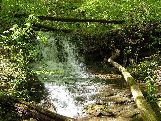 |
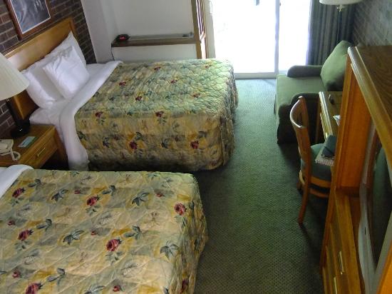 |
You have five lodging options for a weekend or week of hiking at Mammoth Cave. You can camp at the central campground, or, if you want to be right at the trailheads, at the Maple Springs Group Campground. You can stay in either the rustic Woodland Cottages or the slightly more upscale Hotel Cottages. Or you can stay in the Mammoth Cave Lodge, in either the Heritage Trail or Sunset Terrace rooms. A typical Sunset Terrace room is shown at left. All of these options are only steps from the Visitor Center and the Travertine Restaurant. To get from any of these lodging options to the hiking trailheads, you need only drive your car down the hill, cross the river via free ferry, and drive to the top of the hill on the other side. Mammoth Cave Lodge is a 1970s - 1980s facility (it was built in two stages), and tearing it down and building a brand new lodge is under discussion. The rooms are small and very basic, but you're here for the hiking and maybe the cave, not for plush lodging. Prices are among the best at any national park. During the Spring and Fall, when we recommend you come hiking, all rooms and cabins are $69 per night. Remember, though, that from Thanksgiving to Easter the cabins are closed and the lodge is only open Friday and Saturday nights. Do not expect cell phone reception. Wifi is available in the Visitor Center but is very slow; you can answer email but not post on Facebook. |
|
|||
|