| Route 66 | Cities | Beaches |
|
| Shakertown |
Pilot Knob has been completely overshadowed by its neighbors Natural Bridge and the Red River Gorge. That is truly unfortunate, because Pilot Knob is a magnificent location. The views are stunning. It has great historical significance. The hike up to and around the Knob is one of the finest in Kentucky. It's easily accessible, just north of the Mountain Parkway. And while the trail does climb, it is not particularly difficult. Pilot Knob should be a Kentucky shrine. Every school in the state should bring their grade school students here to climb this trail and experience the views. For it was here that on June 6, 1769, Daniel Boone stood and looked out across Kentucky for the first time. "By the Good Lord," he said, "Surely This is Paradise." With him was John Finley, who served as Boone's guide during his second trip up from North Carolina. Below the two men, along Brush Creek, winding down the valley, was the Shawnee town of Eskippakithiki, meaning "Prairie's End." Eskippakithiki was a large permanent settlement, consisting of bark "long houses." Herds of bison grazed on the plains north and west of the town. At the foot of Pilot Knob was a sizeable vein of flint, which the Shawnee used in all their tools. |
 |
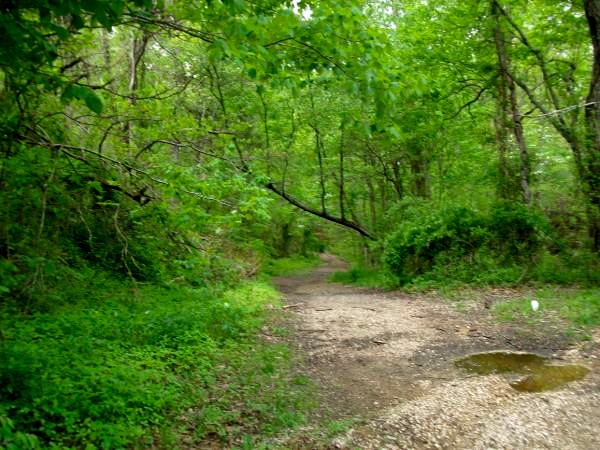 |
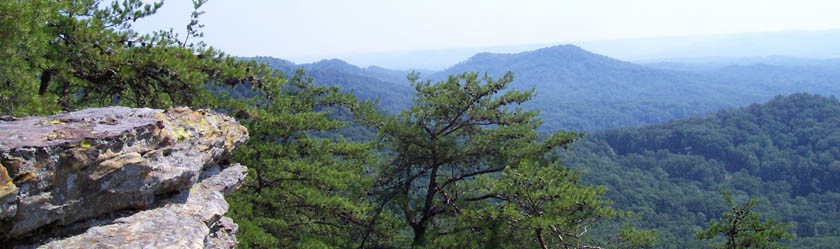
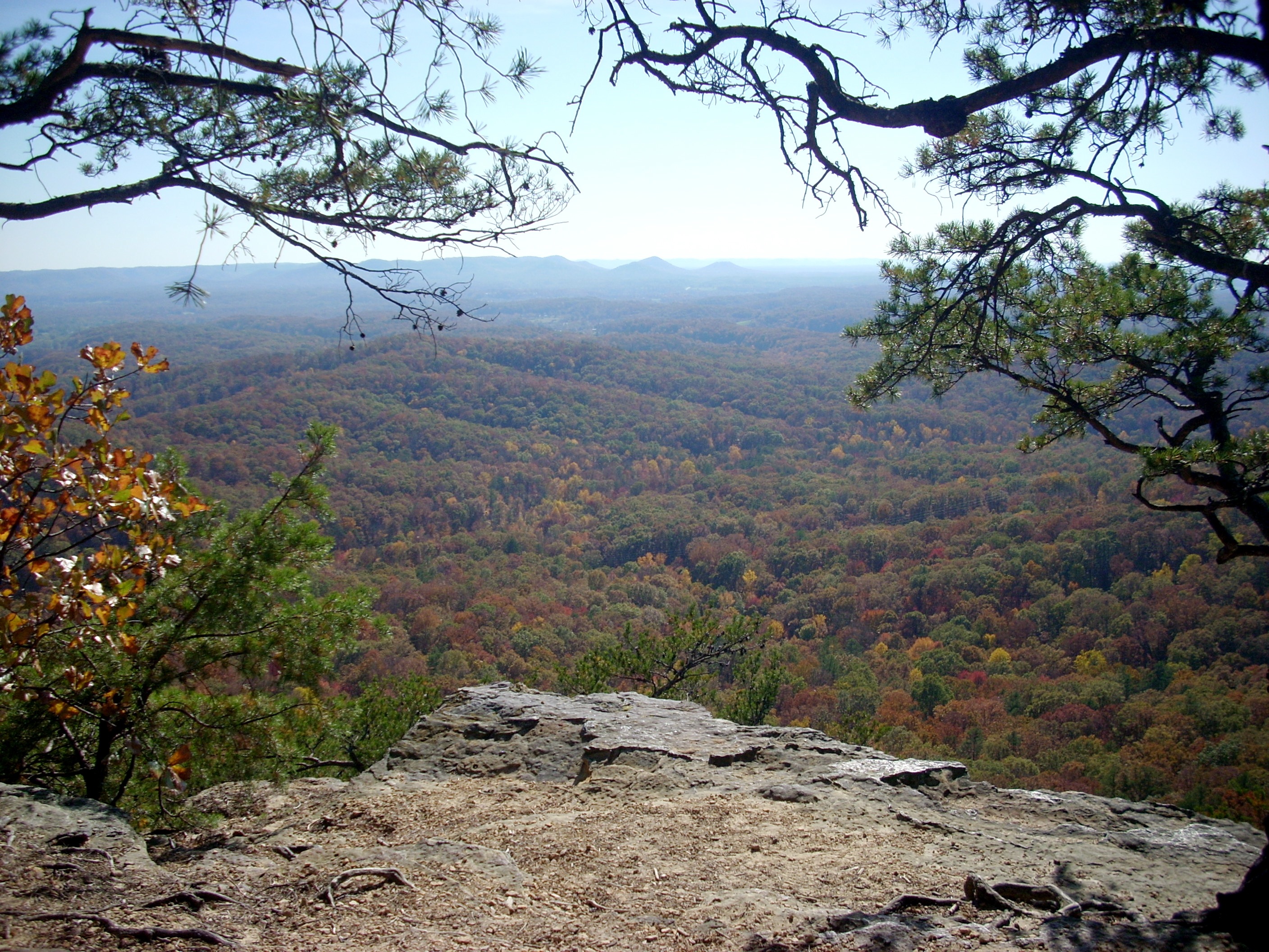
Shown at left is the Pilot Knob trailhead, basically the end of Brush Creek Road. The trail up to The Knob, also called Boone's Point, is just 2.0 miles but is classified as "strenuous." Then the Sage Point Loop Trail, connecting Pilot Knob and Sage Point , is 2.0 miles and reconnects with the main trail halfway down the hill for a total six mile hike. There's an additional spur trail, the Millstone Quarry Trail, a one mile round trip off the main trail. It's rated only "moderate," and is a very nice hike in the Fall, when leaves are in color, or in Spring, when the wild flowers are in bloom. Pilot Knob is technically a 742 acre State Nature Preserve administered by Eastern Kentucky University. There's no camping allowed but in Spring or Fall, Pilot Knob makes a perfect one day excursion. You can either pack lunch or take a backpacking stove and fix a hot lunch up at The Knob or Sage Point. The trail has some sections of stairs and walkways. From the top, you can look East and South across the forested hills of the Cumberland Plateau (see panoramic photo at top and photo above right) or West and North across the gently rolling Blue Grass (below). |
 |
 |
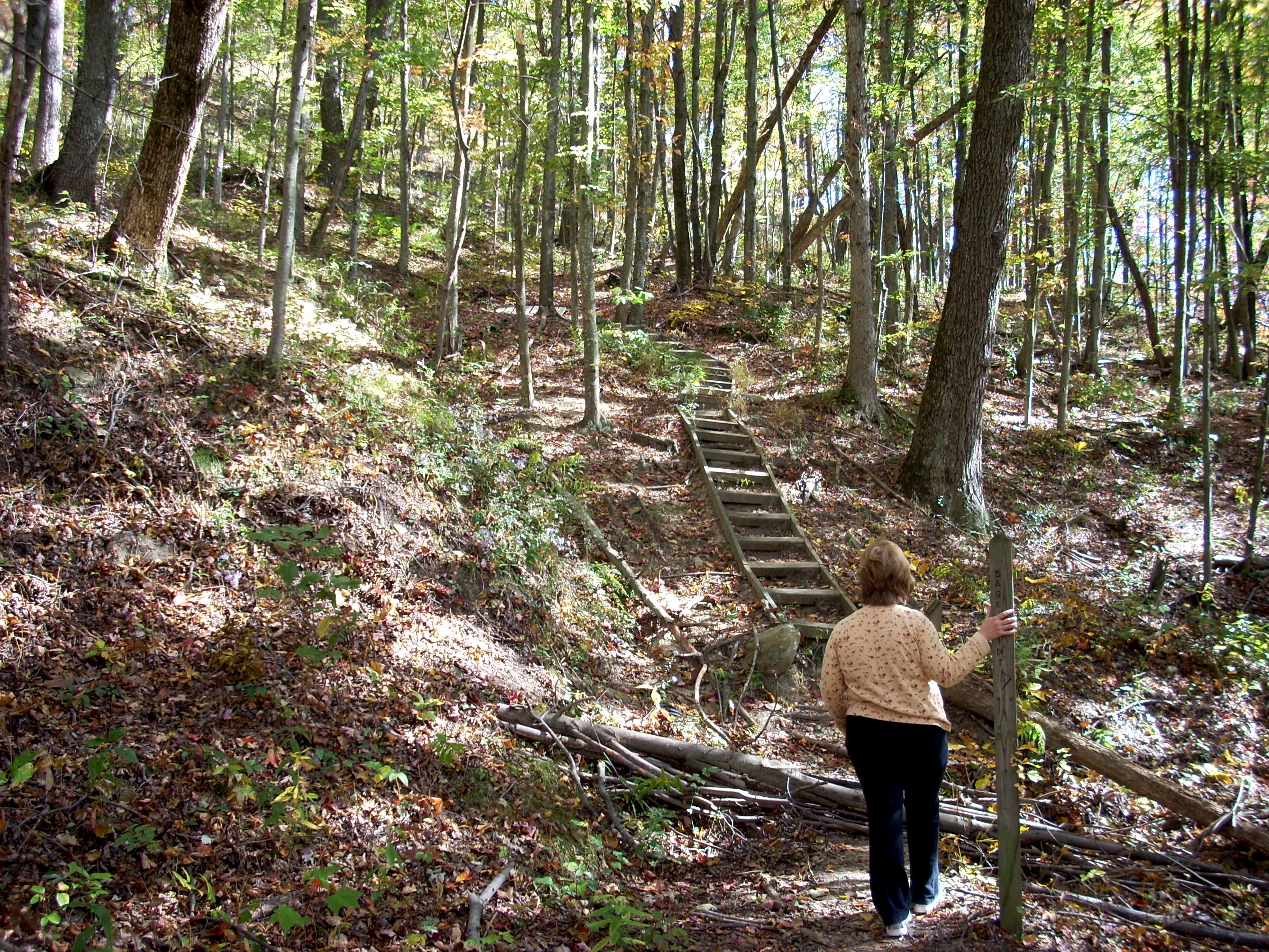 |
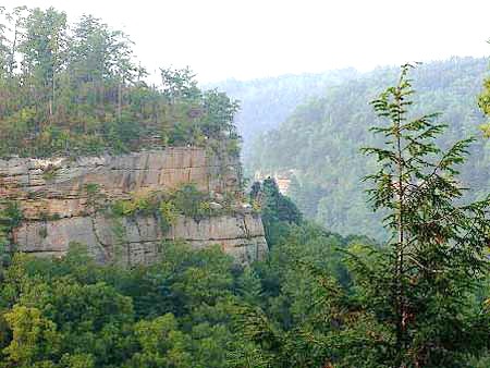
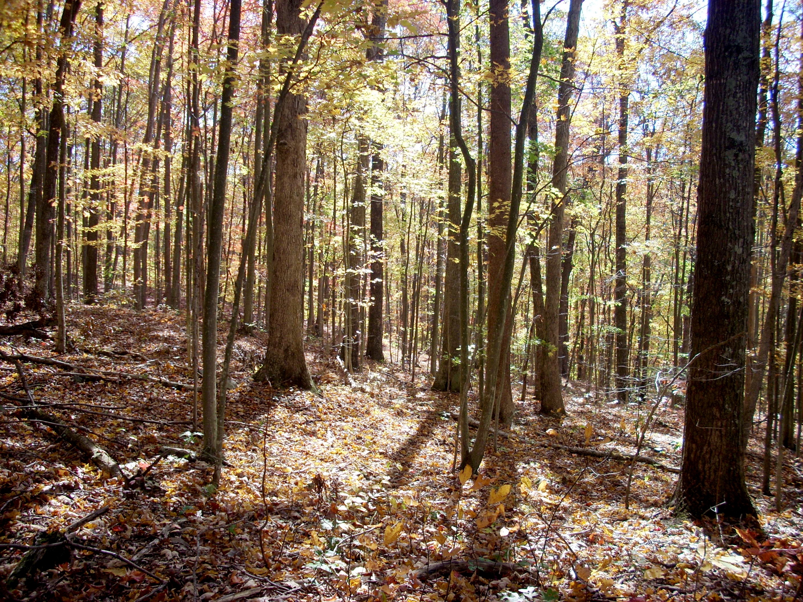
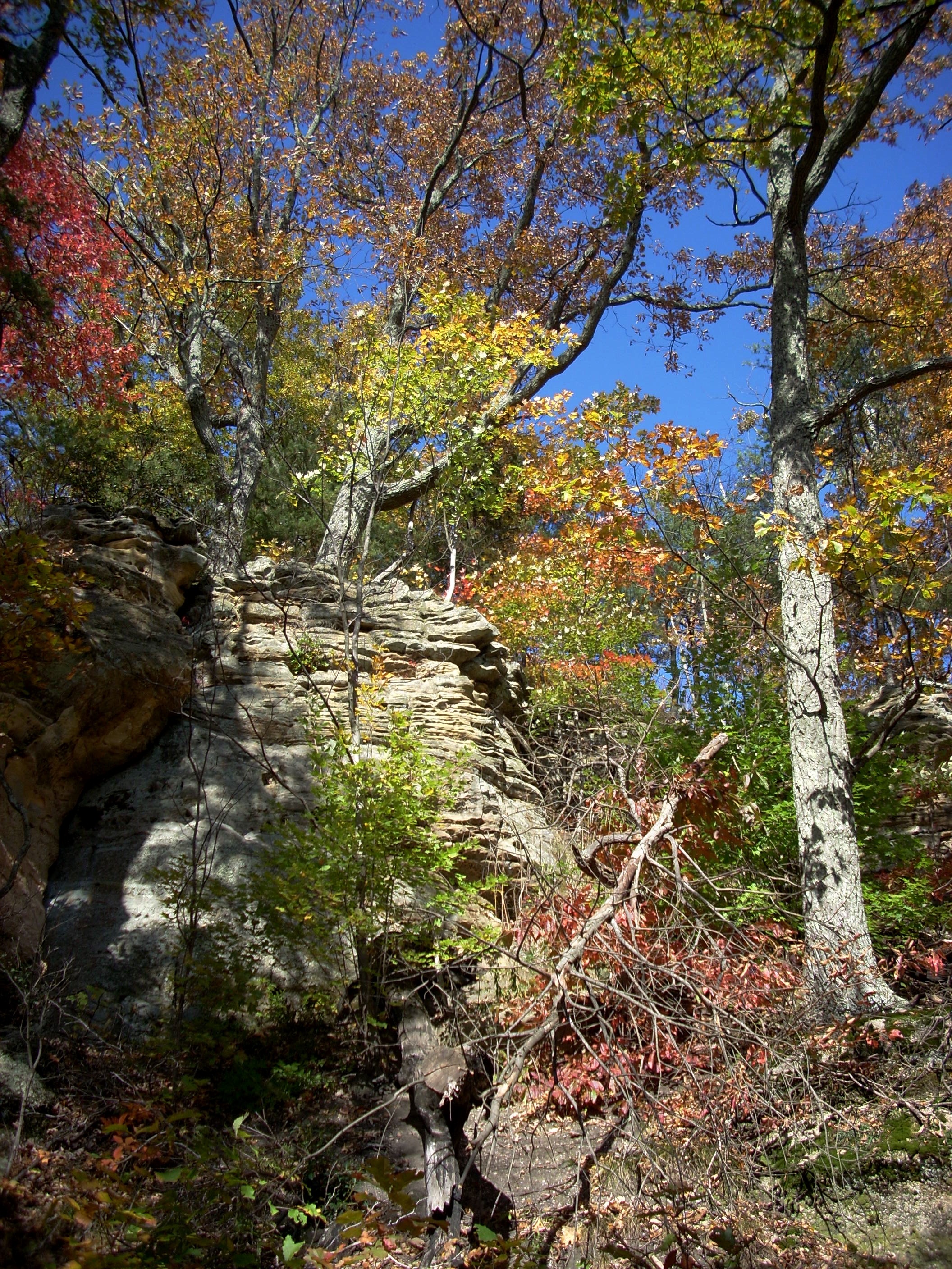
| Pilot Knob Trail ranges from "occasionally maintained" to primitive. As you can see in the photo above right and here at right, staircases and wooden bridges help at the roughest places and frequent waterbars have been installed. But there's a lot of deadfall needing cleared; you're constantly stepping over trees or large branches and sometimes ducking under them. The above left photos shows much of the lower slope is fairly young forest still recovering from a major forest fire back in the 20th Century. The center photo above shows the main cliffline. The trail used to climb through a cleft in the cliff just to the left of this photo. It was shorter but so steep they hung a rope to help people pull themselves up. The new trail was extended further around the back of the knob. It's much nicer hiking but takes longer. The old trail mileage is still posted at 1.5 miles, but now it's actually 2.0. You'll be hiking through mostly Oak, Hickory, Maple and Sassafrass trees with lots of wildflowers and some ferns lining the trails. As you reach the cliffline the trail base becomes sandy with millions of tiny pebbles, remnants of the geologic history when this area was underwater. | 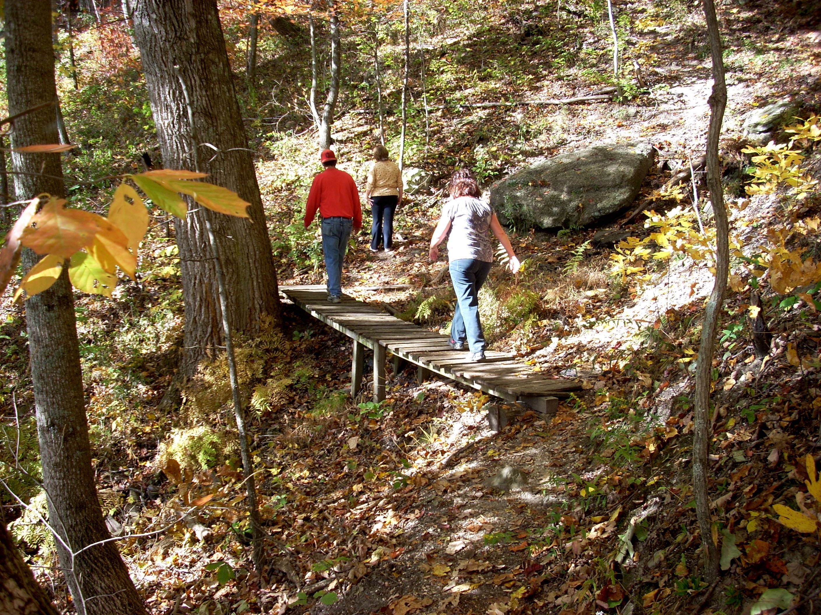 |
This is the view from The Knob looking Southeast, back across the Cumberland Mountains Boone and Finley had just navigated with great difficulty. Notice the huge expanse of forest down there. It's trailless but a great place for bushwacking when you really want to get away from it all. You'll need a topo map and either a good compass or good GPS, plus the skill to use them. To get to Pilot Knob, take the Mountain Parkway 15.8 miles East of Winchester, take Ky 15 North, follow it 2.7 miles, turn right on Brush Creek Road, and drive 1.5 miles to the gravel parking lot. It's a total of 20 miles from Winchester to Pilot Knob. There are no facilities at Pilot Knob, so you may wish to stop at the gas station/convenient store as you pull off the Mountain Parkway onto Route 15. Do not make a great effort to get here early, because fog often lays over the valleys until the sun burns it off by 10 or so. |
 |
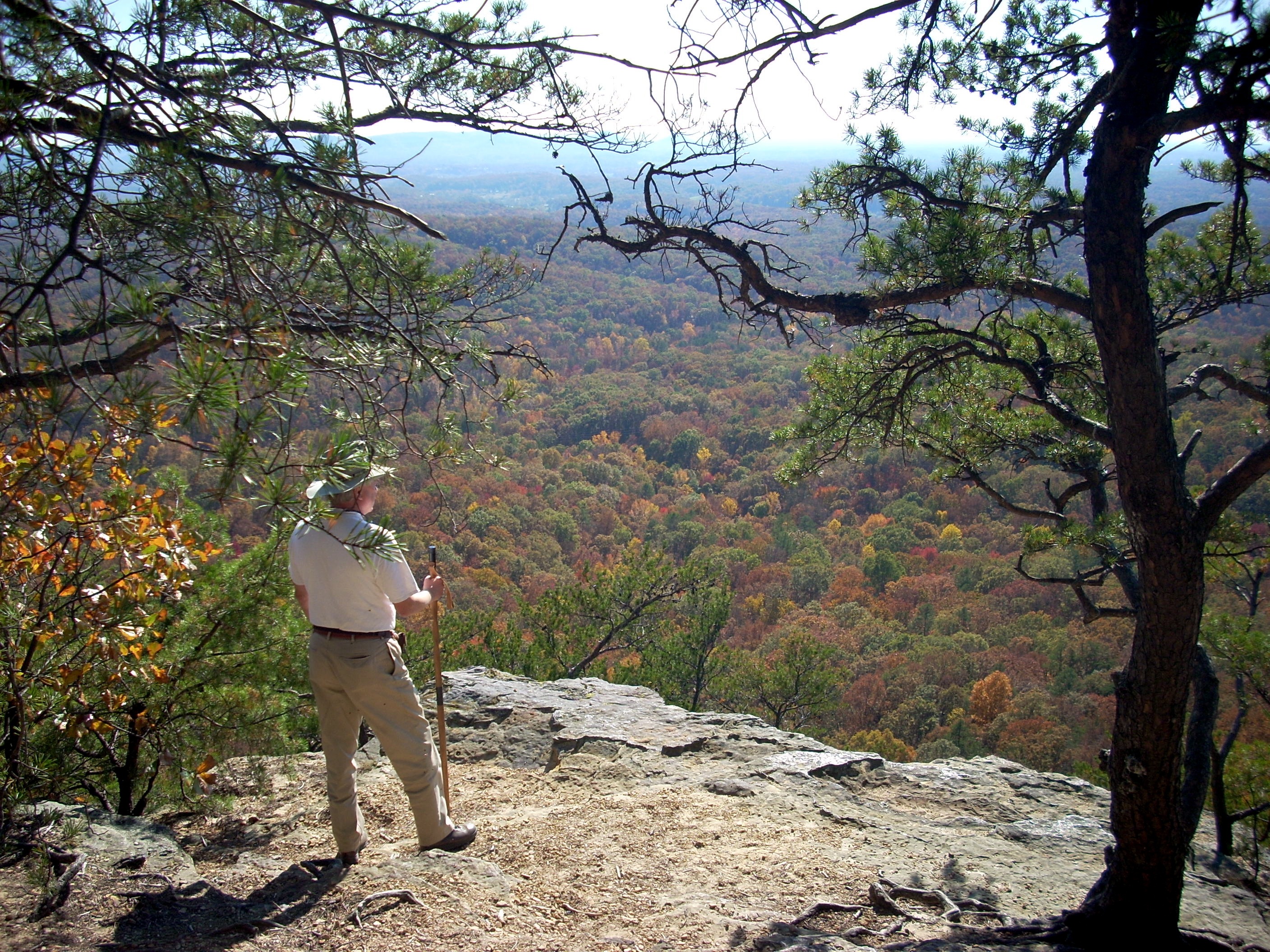 |
This is the precise spot where Boone and Finley stood on June 6, 1796. This scene looks Southwest, back toward the trailhead. Both Pilot Knob and Sage Knob are significantly higher than anything in the Red River Gorge. In October the two knobs are notable for their swarms of mating Lady Bugs. They make it difficult to enjoy a lunch break in the sun, but you can step just a few yards back into the shade and they don't follow. That's Powell County spread out below, with Estill County back toward the horizon. None are visible in this photo, but you can usually sit here and watch Red Tailed Hawks circling on the thermal currents. On this day, they were over to the left out of the picture. |
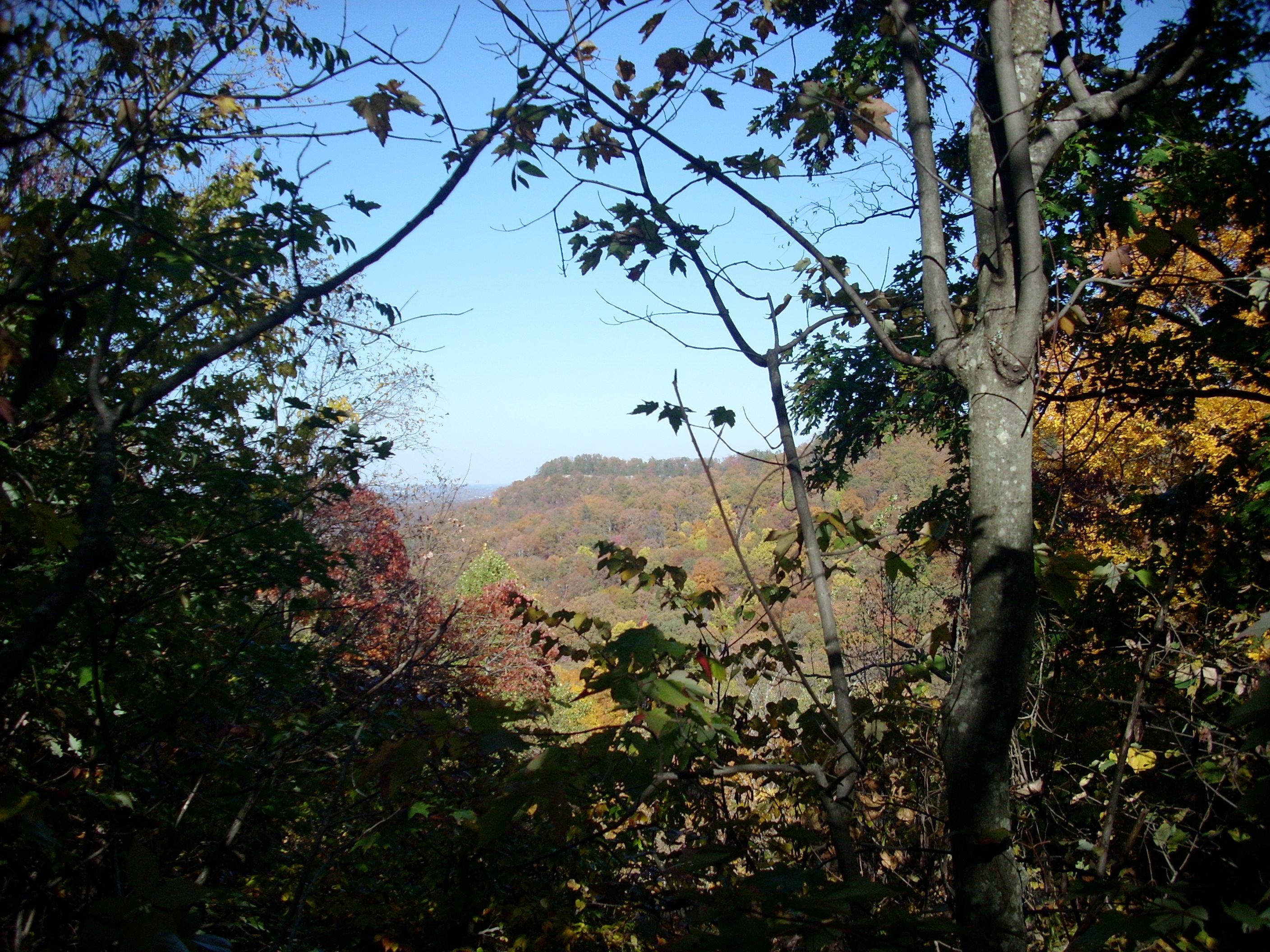
| This is the view looking due West across Clark and Fayette Counties and the Central Blue Grass. The Lexington skyline is visible but we inadvertently allowed the tree branch to obscure it here. On this first exploration, on horseback, Boone and Finley came in through Pound Gap (near Jenkins) and up through what is now Letcher, Perry, Breathitt, Wolfe and Powell Counties. When Boone brought later groups of settlers with their heavy wagons, he used Cumberland Gap (Middlesboro), which skirted the mountains to the west and used the famous Wilderness Road. That strip of white buildings in the center of the photo, just left of the tree branch, is an equestrian training center you'll see on your right as you drive back down the Mountain Parkway. | 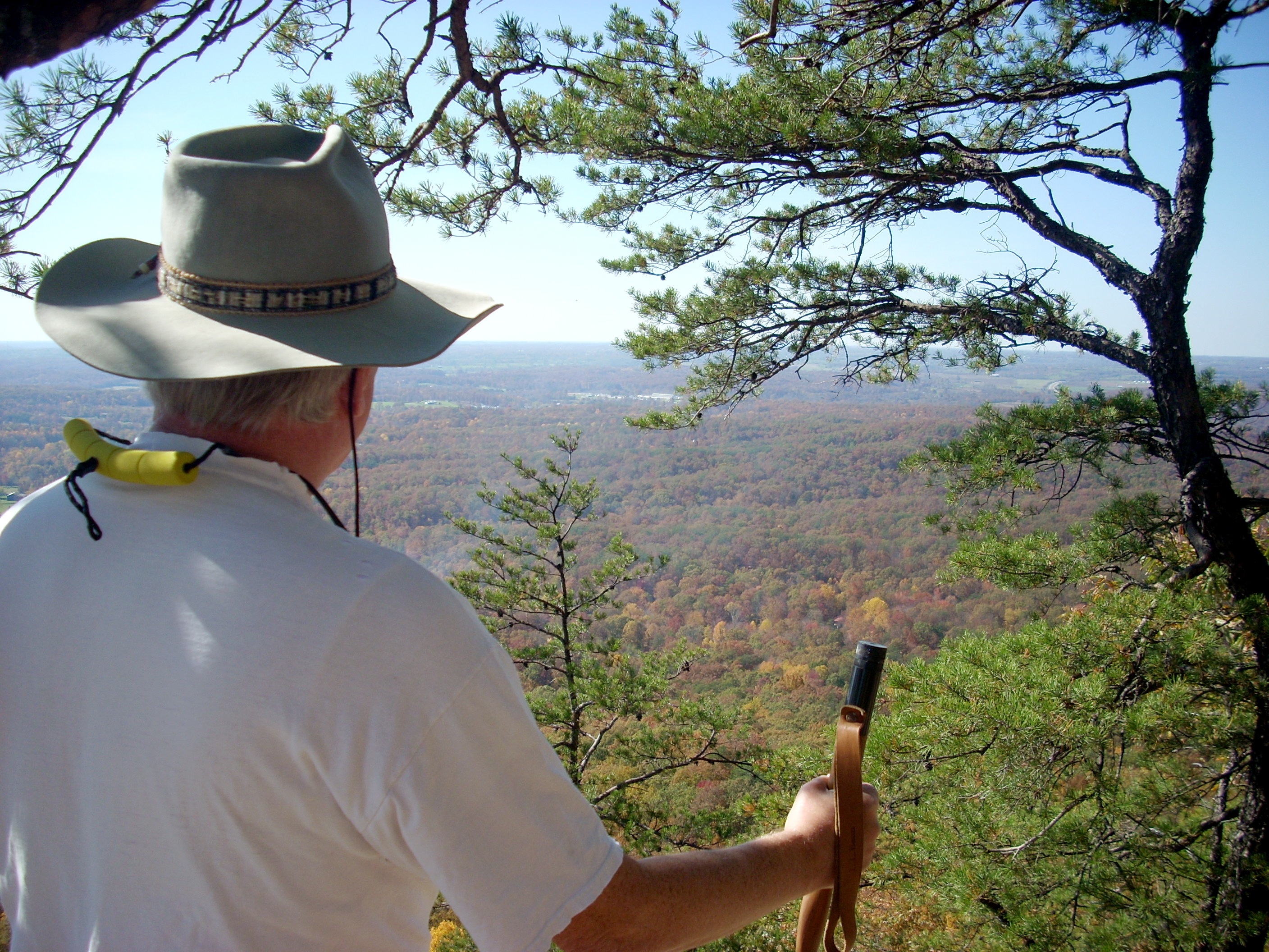 |
 |
This is Sage Knob, seen through the trees along the trail to Pilot Knob. The trail to Sage Knob cuts off the main trail here and takes two miles extra to wind around to Sage Knob, then follows a different route down the east side of the ridge, rejoining the main trail almost at the bottom. Sage Knob is a worthwhile addition to the hike, but the views are basically the same as the ones from Pilot Knob, except that Sage offers better northernly vistas while Pilot offers better southerly vistas. The main trail to Pilot Knob is heavily used on Spring and Fall weekends, but few people take the Sage Knob route, so you'll get more solitude over there and see more wildlife. One reason most serious photographers hike around to Sage Knob is to get distant views of Pilot Knob. The trail over there is even less maintained than the main trail, but it's discernible all the way. You'll have more deadfall to climb over and it's narrower, with no staircases or bridges at the rough spots. |
|
|||
|