Attractions
| Route 66 | Cities | Beaches |
| Outpost
Attractions |
|
| Getting There | Lodging | Restaurants | Attractions | North Conway | Fishing | Hiking | Backpacking | Hut Trekking |
You may be coming to New Hampshire for the hiking and backpacking, but there are other attractions well worth your time. We might go so far as to call these essential to your visit. They're unique. They give you a feel for the area and help place the trails in context. Alternating a day of these attractions with a day of hiking will also give your legs time to recover. As you plan your trip, however, be aware that New Hampshire begins shutting down in mid October. As soon as the fall foliage display fades, state parks, campgrounds, restaurants, motels, stores, the attractions listed here and even some highways begin closing for the Winter. So if you want to enjoy any of these, you must plan your trip no later than the second week of October and ideally no later than the first week of October. |
 |
| KancamagusHwy | CannonMtnTram | Flume | NorthConwayScenicRR | Mt. WashingtonCogRR | CoveredBridges | Diana's Baths |
 |
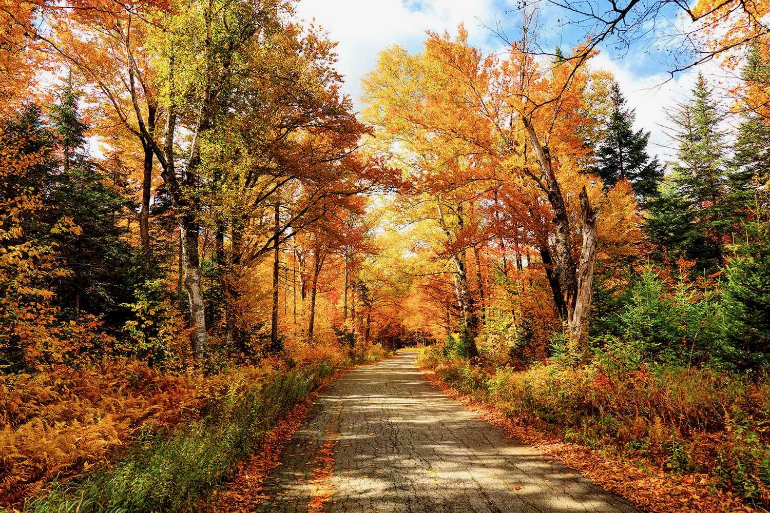
The first thing you must do is drive the Kancamagus Highway, pictured here at left and in the photo at the very top. It's spectacular all year, but during fall foliage it is a photographer's fantasy. Named after Kancamagus, the final Sagamon of the Penacook Confederacy, the 34.5 mile highway connects eastern New Hampshire with western New Hampshire and was only completed in 1959. It runs from Conway in the east to Lincoln in the west. 34.5 miles is not a great distance, but you should allow plenty of time for this drive. The road itself is winding and narrow, so you can't drive fast, and along the way there are numerous turnouts for scenic overlooks, waterfalls, covered bridges, historical sites, hiking trails and wildlife viewing. There are plenty of Bear, Moose and Deer crossing the road so you have to watch carefully. We recommend combining this drive with The Flume and Cannon Mountain Tram at the western end. Then, on the return drive, we suggest turning off on Bear Notch Road (near the Russell Colbath Farm Site) and taking it across Bear Mountain through the Bartlett Forest to the village of Bartlett, a few miles north of North Conway. |
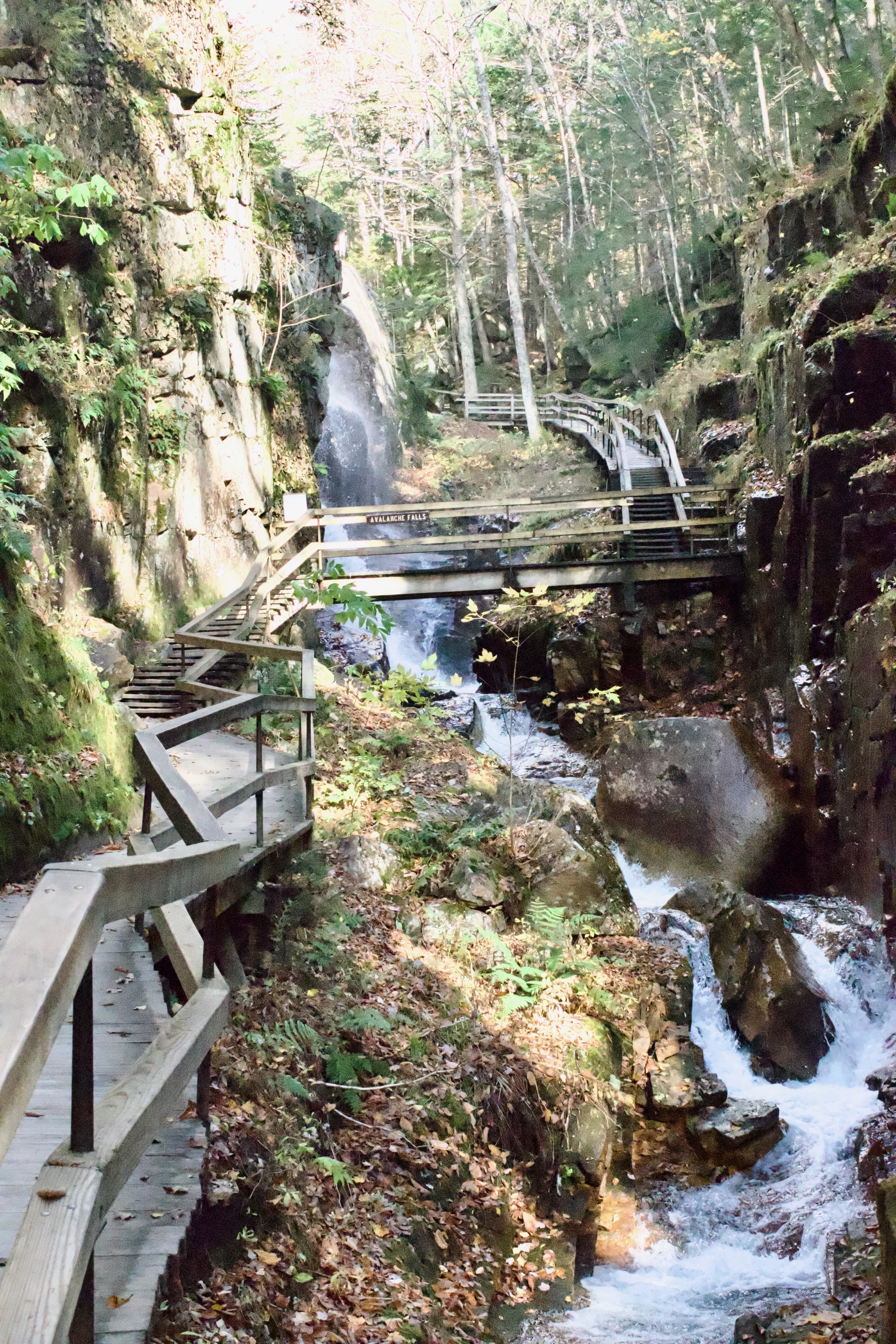
Once you get to Lincoln on the Kancamagus Highway, turn north on routes 93 or 3 just a few miles to Flume Gorge. This isn't the most difficult hike you'll do, and it doesn't offer any high mountain views, but it may be the most spectacular, and it's certainly the most unique. For starters, it's a privately owned hiking trail inside a state park inside a national forest. You have to pay to hike it. There's a ticket booth and visitor center, complete with snack bar and gift shop. What you're paying for is maintenance. 50% of the entire trail is a boardwalk with bridges and staircases, hanging from the rocks with bolts and cables. Every Winter this gorge fills up with ice, which twists and breaks this walkway. So every Spring it has to be either repaired or replaced. All Spring, Summer and Fall water is splashing, misting and flowing over everything, so every day workmen are out here repairing and replacing. The Flume was discovered in 1808 by 93 year old Jessie Guernsey, who was fly fishing the Pemigawassett River and gradually working her way upstream. It's a natural gorge extending into the base of Mount Liberty. The walls of Conway Granite rise to a height of 70 to 90 feet and are 12 to 20 feet apart. These rocks are Jurassic, and are covered by dozen different kinds of ferns and mosses. Approaching the gorge, the trail leads you across a beautiful 1886 covered bridge, and on the way back you'll cross a newer one built in 1838. Both are maintained by Flume work crews. On the way out, once you cross the larger covered bridge, you'll climb steadily, first on a steep trail, then on the ramps and staircases. You'll eventually climb past the biggest falls of all and reach an overlook and a rest shelter. From there, you'll hike down through a beautiful forest, cross the smaller covered bridge, then wind through a boulder garden. It's an incredibly photogenic hike which takes most people about two hours due to the many photo stops. There are benches along the way. There's a mystery here. When Jessie discovered the Flume, a huge boulder was wedged between the cliffs near Avalanche Falls. It remained there until 1883, when a prolonged heavy rain caused the gorge to fill up with water. The force of the water dislodged the boulder, which washed down out of the gorge. Geologists from around the nation, and many locals, have searched for 140 years for the boulder and never found it. |
 |
|
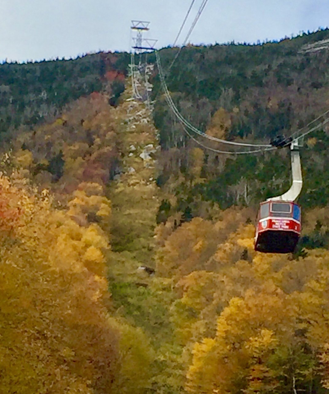
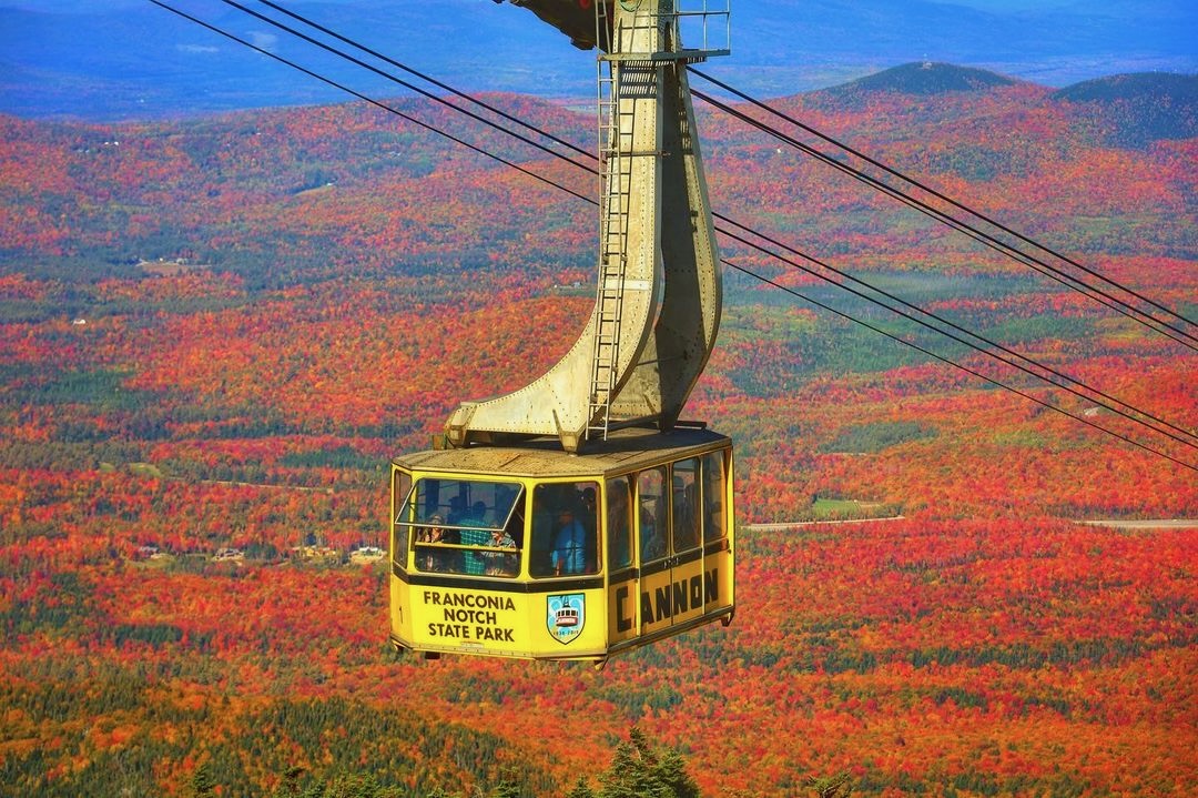
After you leave the Flume, a short distance north but still in the state park is the Cannon Mountain Tram. This spectacular device takes riders to the top of 4080 feet Cannon Mountain, from where you can see New Hampshire, Vermont, New York, Maine and Quebec. At the summit you'll find a 360 degree observation deck, a cafe, restrooms and hiking trails. The Tram runs daily from 9 - 5 late May to mid October. A round trip costs $28 per person. Remember the Tram receives no tax dollars and is expensive to operate and maintain. The current "Mustard and Ketchup Cars" (because they're yellow and red) are at the end of their lifespan and need either refurbished ($15 million) or replaced ($25 - $30 million). The first tram was built in 1938 and was the first in North America. It lasted until 1980, when it was replaced by the current model. The original required 232 tons of steel and four miles of cable. The modern tram takes eight minutes to get to the top. Each car carries 80 passengers and ascends 2180 feet. We highly recommend making reservations ahead, especially during the first two weeks of October. Almost everyone does, and if you arrive without one during busy times you simply won't get on. To get the most out of this experience you need to spend some time up on top. Eat lunch, hike one or two of the trails, enjoy the views from the observation deck, and take photos. It's almost certain to be windy on top, and half the time the wind chill is significant, so a jacket or anorak is advisable. We like to spend 90 minutes to two hours on top, but there are longer trails you could hike which could extend your visit to half a day. But be careful of the time. The last tram down leaves at 5 and there's no road. |
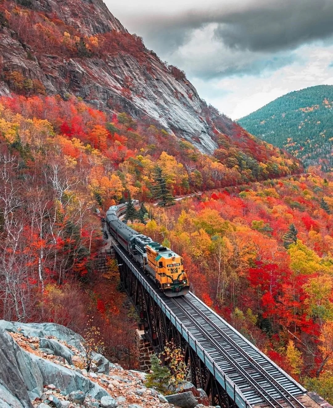
The Conway Scenic Railroad is a magnificent way to spend a day. It's a serious railroad experience. These were once commercial tracks, engines and cars which are now used for tourists. There are a couple of shorter trips but you want the one to Crawford Notch and back or, if possible, the trip to Fabyan Station and back. The Fabyan trip goes past Crawford Notch, descending into the valley beyond and the famous Britton Woods area, where Britton Woods Resort and the Mt. Washington Cog Railway are located. Either of these trips will depart from the beautifully maintained 1874 Russian Victorian station on the square in downtown North Conway at about 11 a.m. In early October, this is an absolutely beautiful trip. It takes about two hours to the Crawford Notch Station and half an hour past that to the Fabyan Station. You'll have 30 minutes at the station while they turn the engines and move them around to the other end of the train. They reverse your seats so you sit on the opposite side on the way back, allowing everyone to see the views on both sides. We advise against the meal option. We don't find it worth the high price. You can order drinks or snacks from your seat along the way, or smuggle a small soft drink or water bottle and perhaps a sandwich or other item in your coat pockets. You definitely need to make advance reservations. Every trip sells out. We'd advise at least a week ahead. You can make them on their website. You should arrive about an hour early to find a parking space because the North Conway downtown is busy. You can go over to the "will call" window, pick up your tickets, then spend 45 minutes browsing in the stores across the square from the station. Or you could grab a Coffe, Cappucino or Hot Chocolate from one of the coffee shops. |
 |
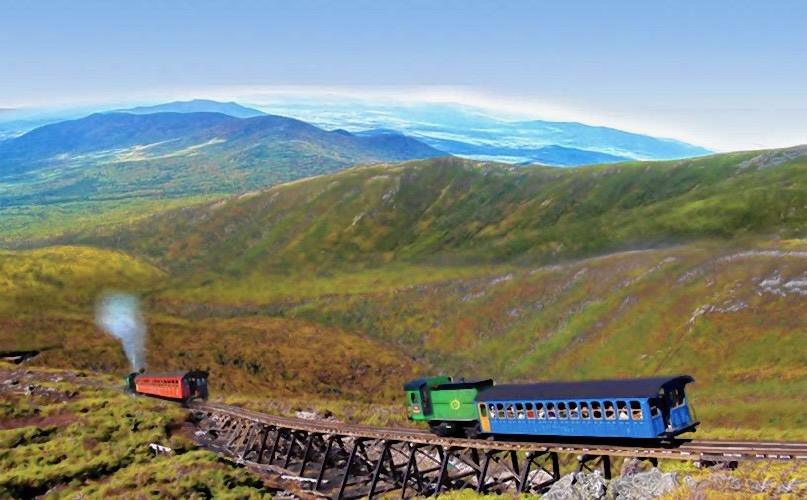 |
The other Must Do rail experience is the Mt. Washington Cog Railway. This is absolutely amazing. Regular trains cannot handle grades more than 6% and specialized trains can't go above 10%. "Inclines" handle steep clinbs by using cables to pull cars up. Mt. Washington, 6288 feet, requires cars to go around curves. Cables are impossible. Building a railroad to the top meant conquering 37% grades. In 1869 Sylvester Marsh built a cog track, then custom built coal burning engines to run on it. 150 years later, they use biodiesel engines. Engines drive a gear which sinks teeth into the cog "ladder" and pulls engines up the mountain. You need advance reservations because the trains sell out every day. There's an observation deck and snack bar on top. Regardless of the weather below, take a Very Warm hooded parka and gloves, as Mt. Washington is famous for the world's worst weather even in mid Summer. Allow half a day for the museum, the 90 minute trip up, 30 minutes on top, and the 90 minute trip back. IF wind and temperature allow, there are several hiking trails on top, so you could spend a day here. |
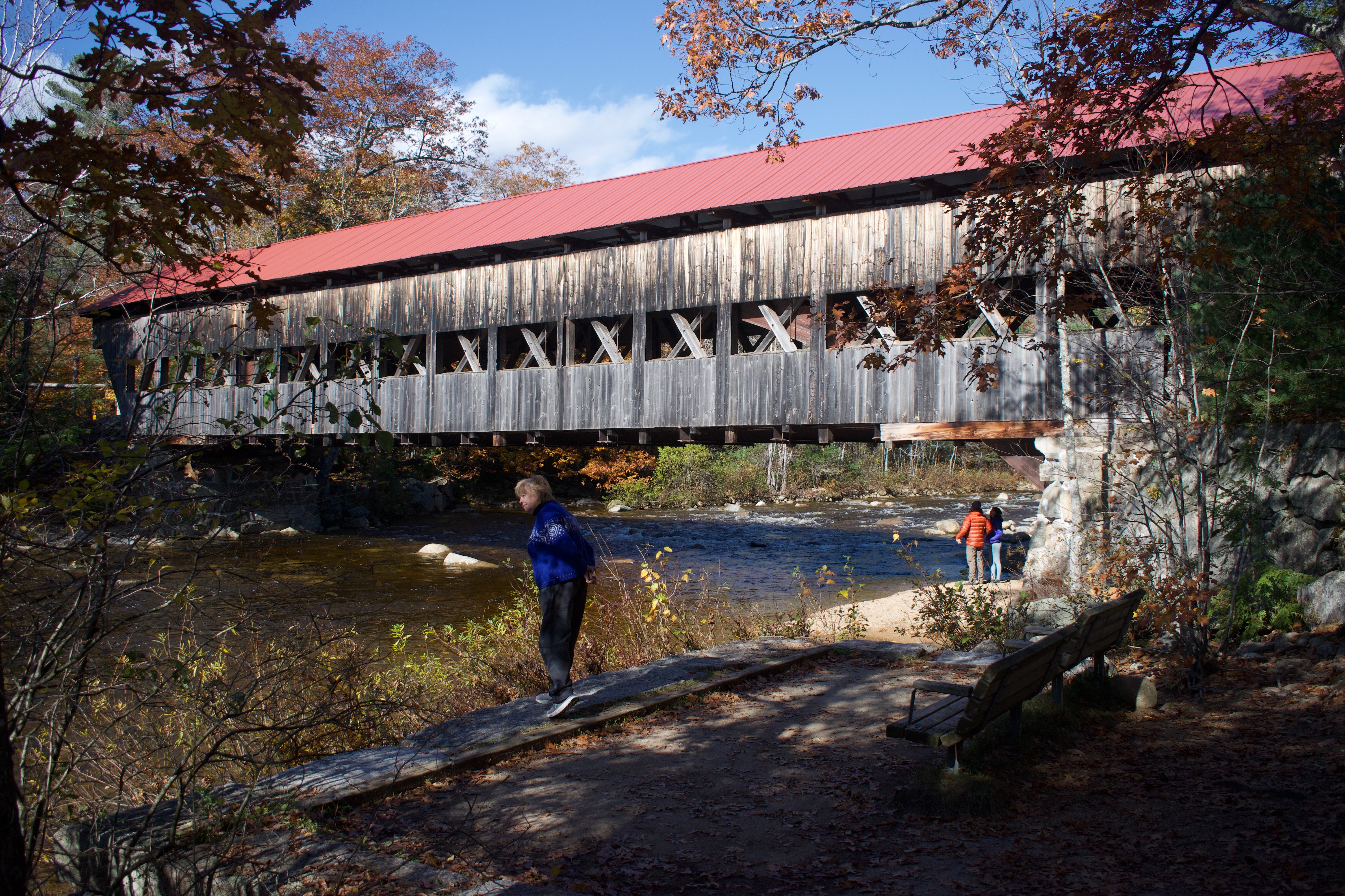
New Hampshire is famous for Covered Bridges and there are six around North Conway. You could spend a day driving from one to the other, taking photos and studying their architecture and construction details. Closest to North Conway are the Saco River Covered Bridge and Swift River Covered Bridge in the town of Conway. A little further is the Albany Covered Bridge, shown here at right. It's four miles out the Kancamagus Highway. In the opposite direction is the Bartlett Covered Bridge, unique in that a family has built a gift shop inside of it. But it's a real 1851 covered bridge, along Route 302 just outside the town of Bartlett. Honeymoon Covered Bridge is just off route 16 as you enter the town of Jackson, heading toward Gorham Notch and the town of Gorham. Whittier River Covered Bridge is in Ossipee, on Route 16, south of Conway. |
 |
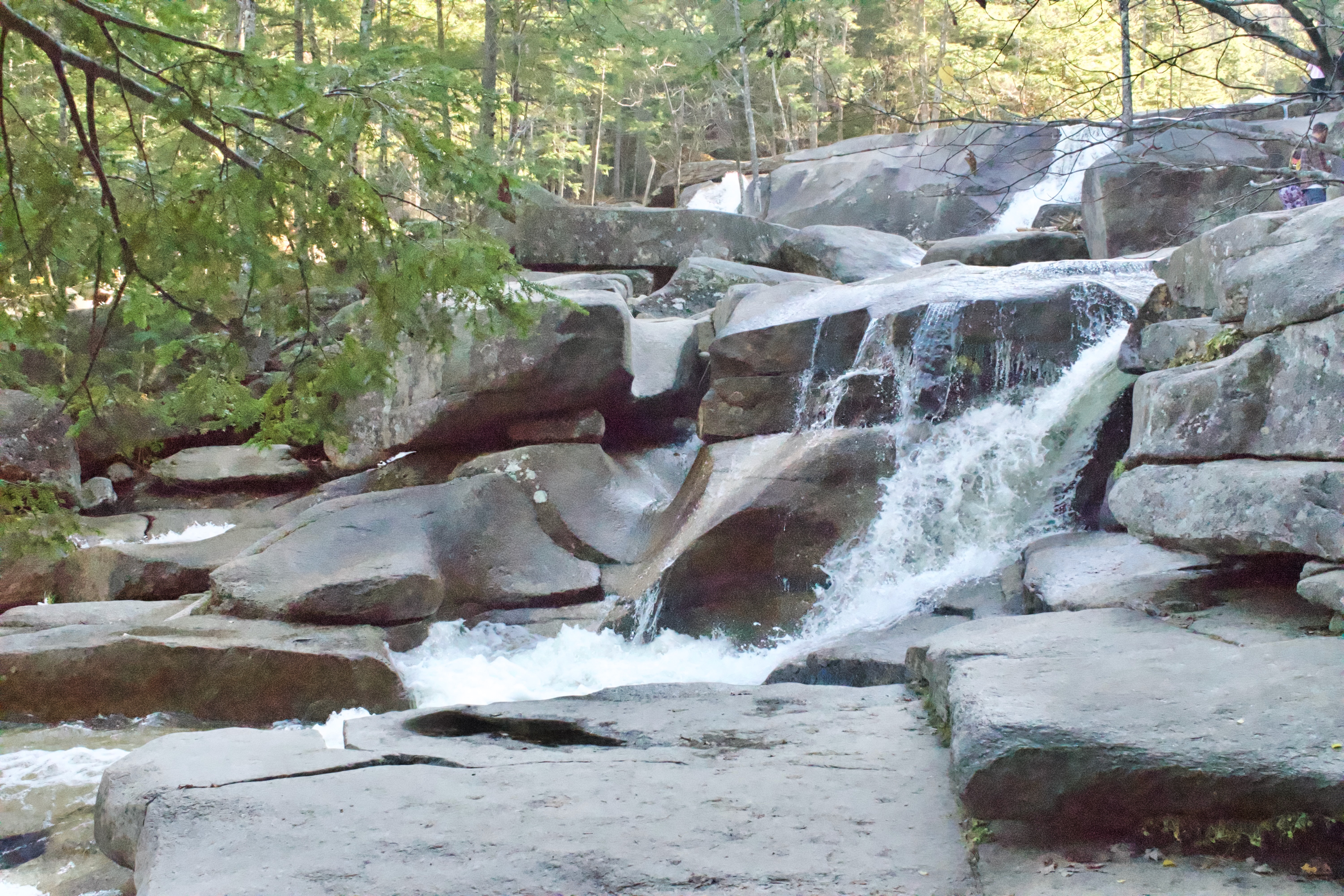 |
Diana's Baths is a hugely popular attraction in the warm weather months. It's a long series of cascading pools and falls where visitors can sit and dangle their legs in the pools or climb down into the water and escape from the heat. In late Fall it's still a beautiful place. To reach it, turn west off Route 16/302 in North Conway onto River Road and follow it across the river to West Side Road. Bear right (northward) onto West Side Road. In a few miles you'll come to the Diana's Baths parking lot and trailhead on the left. The trail out is very gently uphill for a mile through a beautiful forest. There are picnic tables and various rock ledges and boulders you can sit on and enjoy the scene. |
|
|||
|