Backpacking
| Route 66 | Cities | Beaches |
| Outpost
Backpacking |
|
| Getting There | Lodging | Restaurants | Attractions | North Conway | Fishing | Hiking | Backpacking | Hut Trekking |
Overnighting in the White Mountains is divided into two categories : Backpacking and Hut Trekking. Backpacking may cross over a high segment, but must return to lower elevations every evening because camping where trees are less than eight feet tall is prohibited. To spend a night above treeline you must use one of the huts. Here, we cover traditional backpacking where you carry tent, stove, food and pad. Open wood fires are prohibited here, and you're expected to practice Leave No Trace Camping. There are many beautiful backpacking trips in the Whites. Most of them are 2-3 days. Keep in mind the difficulty of these trails, which means good days are 6-8 miles. 9-12 mile days are almost impossible in the Whites even for skilled, experienced hikers in good condition. You can't make that kind of time over football sized rocks, steep slopes of gravel, tilted rock slabs, knee deep stream crossings, ladders, stone steps and gnarled roots. Plus you'll want to stop at the numerous overlooks and take photos or just enjoy the views. Remember wherever you park your vehicle at a trailhead, a parking permit must be displayed or you may return to find your vehicle towed. |
 |
| Moat Mountain | Baldface - Wildcat Traverse | Crawford Notch Loop | Downes - Sabbaday Loop |
 |
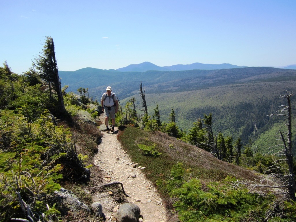
The Moat Mountain Trail is our recommendation for a first backpacking trip in the Whites. The trail follows a long ridge linking South Moat, Middle Moat and North Moat Mountains, at 2700, 2800 and 3100 feet. At the top of each, you're just at the edge of treeline, as the photo here shows. You could hike this as an out-and-back from either the Diana's Baths trailhead or the Dugway Road (off the Kancamagus Highway) trailhead. Or you can hike it end to end if you have a friend and a second vehicle. Parts of this trail wind through beautiful forest. The climbs to each mountain get steep and rocky in places. Many overlooks are magnificent and you'll be tempted to linger, so even though the entire trip is only 10 miles taking two or three days is justifiable. There are many beautiful campsites down in the forested valleys between the peaks. The land slopes to the west. If you drop off trail down that slope about 200 yards, either between South and Middle, or between Middle and North Moat, you'll find tributaries of Big Brook which are almost always flowing. At either trailhead, the first two miles are relatively level and then the trail steepens. From the Dugway Road trailhead, you'll reach the South Moat summit in 2.7 miles. From the Diana's Baths trailhead, you'll reach North Moat summit in 4.3 miles. Many guidebooks recommend this trip as a long day hike, but we don't think that allows enough time to enjoy the many scenic overlooks and summits or the beautiful forest. Better to use this as a backpacking warm up trip. |
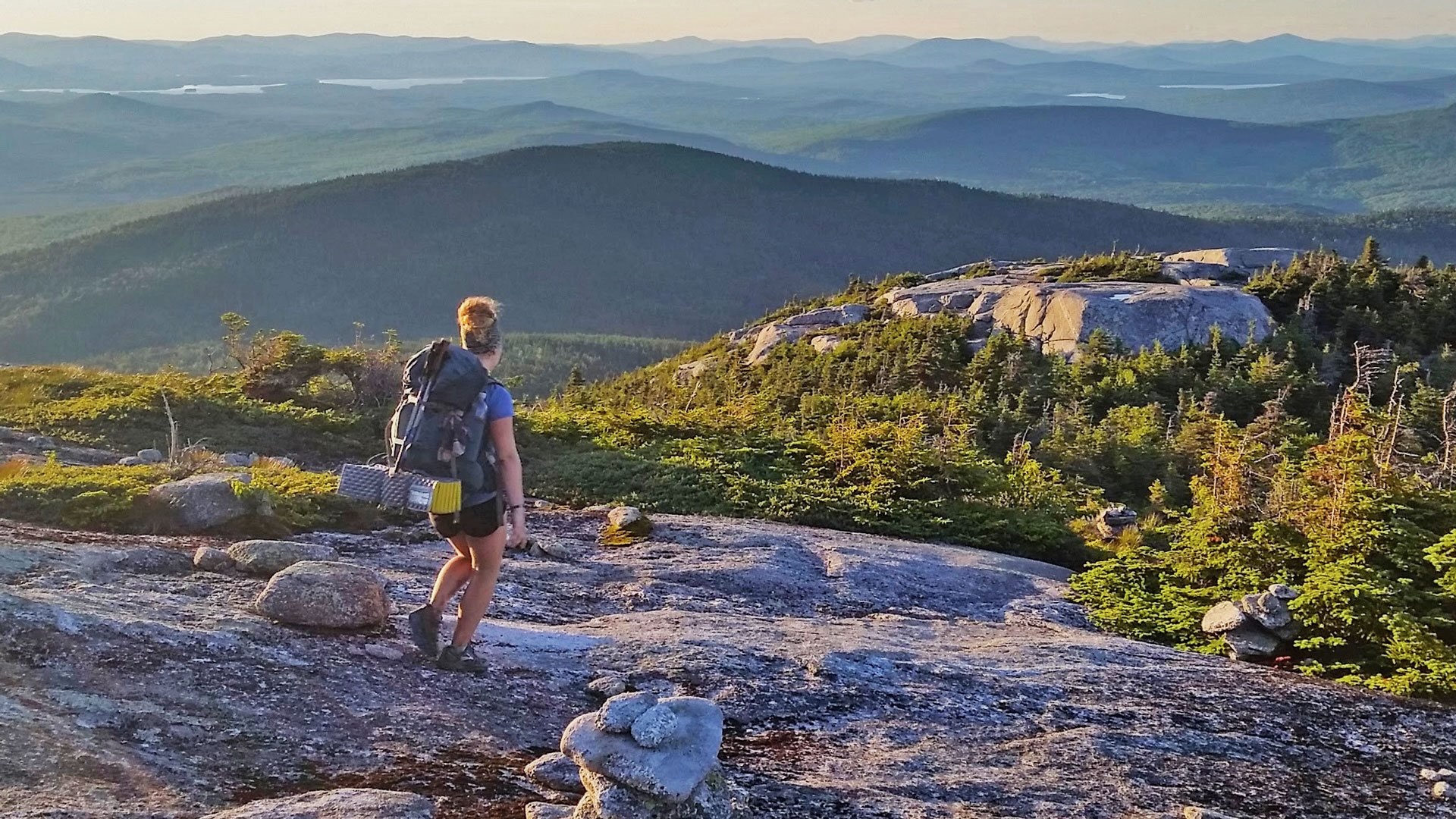
The Baldface-Wildcat Traverse is a great 2-3 day trip which alternates high exposed ridges (photo, right) and beautiful forest with waterfalls and pools. The trailhead for the Baldface Circle Trail is almost exactly on the New Hampshire - Maine state line on Route 113, a short distance east of North Conway, at the AMC Cold River Campground. The trail begins across the road a short distance north. At the Emerald Pool (beautiful and worth a photo; you can swim in it but the water's ice cold) turn right (north) onto Bicknell Ridge Trail. You'll pass several waterfalls, the biggest of which is Eagle Cascade. Then turn right (north) onto Eagle Crag Trail. Off to your left (south) are North and South Baldface Mountains (each 3000 ft.). You could detour over and hike up one or both. The trail between the two has breathtaking views of the entire White Range plus far over into Maine. But then hike over to Eagle Crag (3000 ft.) and pick up Eagle Link Trail heading southwest. You'll follow this to Wild River Trail to Wildcat River Trail to the AMC Carter Notch Hut, from which the Wildcat Ridge Trail leads down to Glen Ellis Falls and the Route 16 trailhead, where you can either have a car parked, a friend picking you up, or a room and hot meal waiting for you at the AMC's Joe Dodge Lodge 100 yards north. The best campsites on this trip are down in the magnificent Beech forests between the peaks. In season you'll have plenty of blueberries to snack on. Avoid this trip after a day or two of hard rain because the streams fill up and you'll face several hairy crossings, plus the rocky ledges become dangerously slippery. But in dry weather this is a spectacular traverse. It's not extremely difficult but there are several stretches of football sized rocks, tilted ledges and steep gravel slopes to navigate. |
 |
|
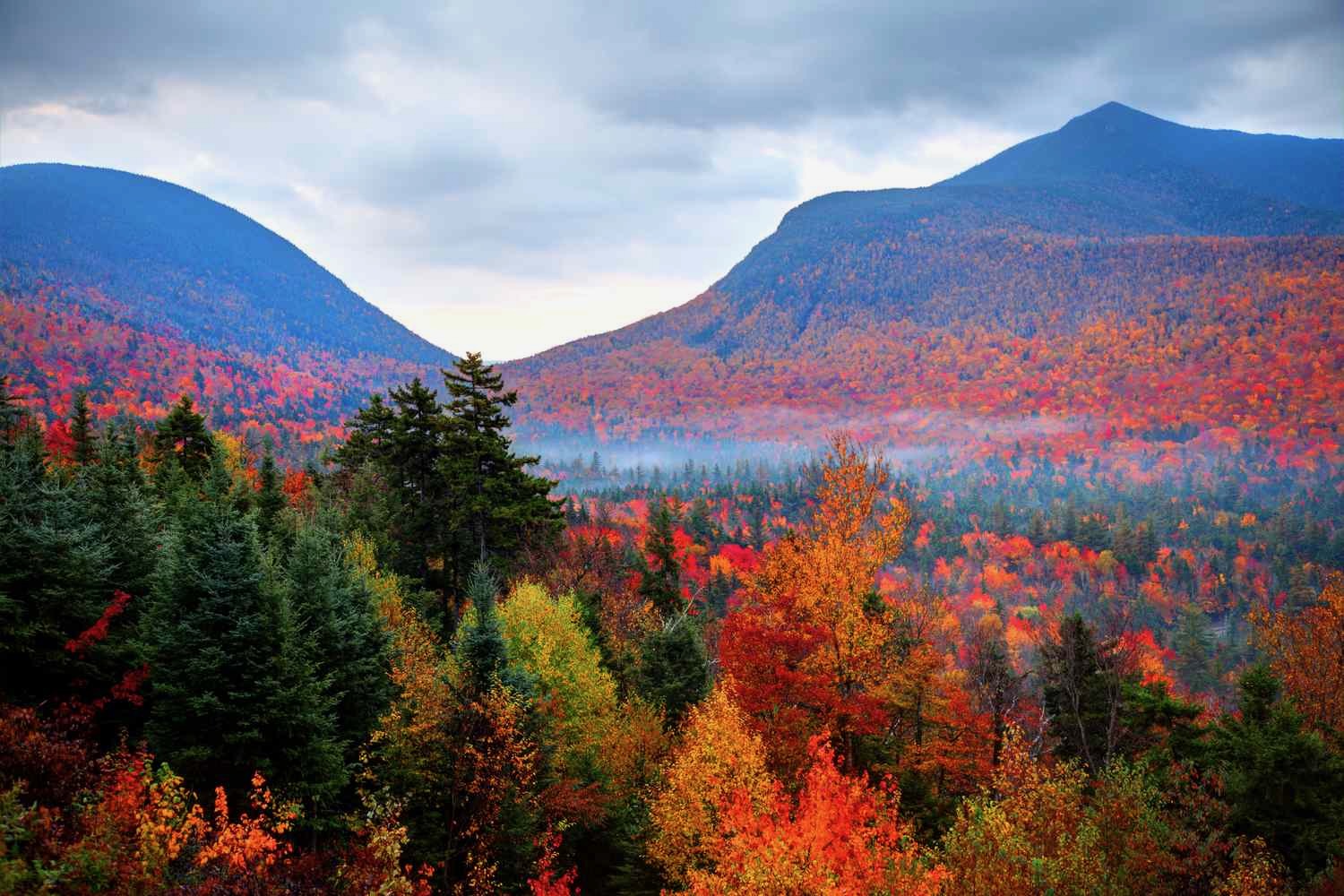
The Crawford Notch Loop is a beautiful, challenging 2-3 day 16 mile backpack beginning and ending at the AMC Crawford Notch Lodge ("Highland Center"). The outward leg follows the Avalon Trail to Mt. Avalon (3442 ft.) and continues on A-Z and Wiley Trails to Mt. Field (4340) and Mt. Wiley (4285). It descends on the Ethan Pond Trail to cross Route 302 and head back westward on the Webster Cliff Trail. After a series of switchbacks you arrive at the Cliff section, where the trail looks down into Crawford Notch for a mile, as in the photo at left. When you reach the summit of Mt. Webster (3910 ft.) if you're exhausted you can turn left on the Webster Trail and begin the long descent to the Lodge. Or you can turn right and climb Mt. Jackson (4052) before heading down. In between exposed segments above treeline you'll find plenty of potential campsites down in the deep forests. There are streams, including the Sacco River, for water. You don't have any stream wadings (there's a bridge over the river) but you do have a few rock chimneys to squiggle up and the usual stretches of football sized rocks, steep gravel and tilted rock slabs. At several steep points you have long flights of stone steps. Don't let the 16 mile length mislead you; the steep ascents are long, slow and exhausting and three days is perfectly reasonable. |
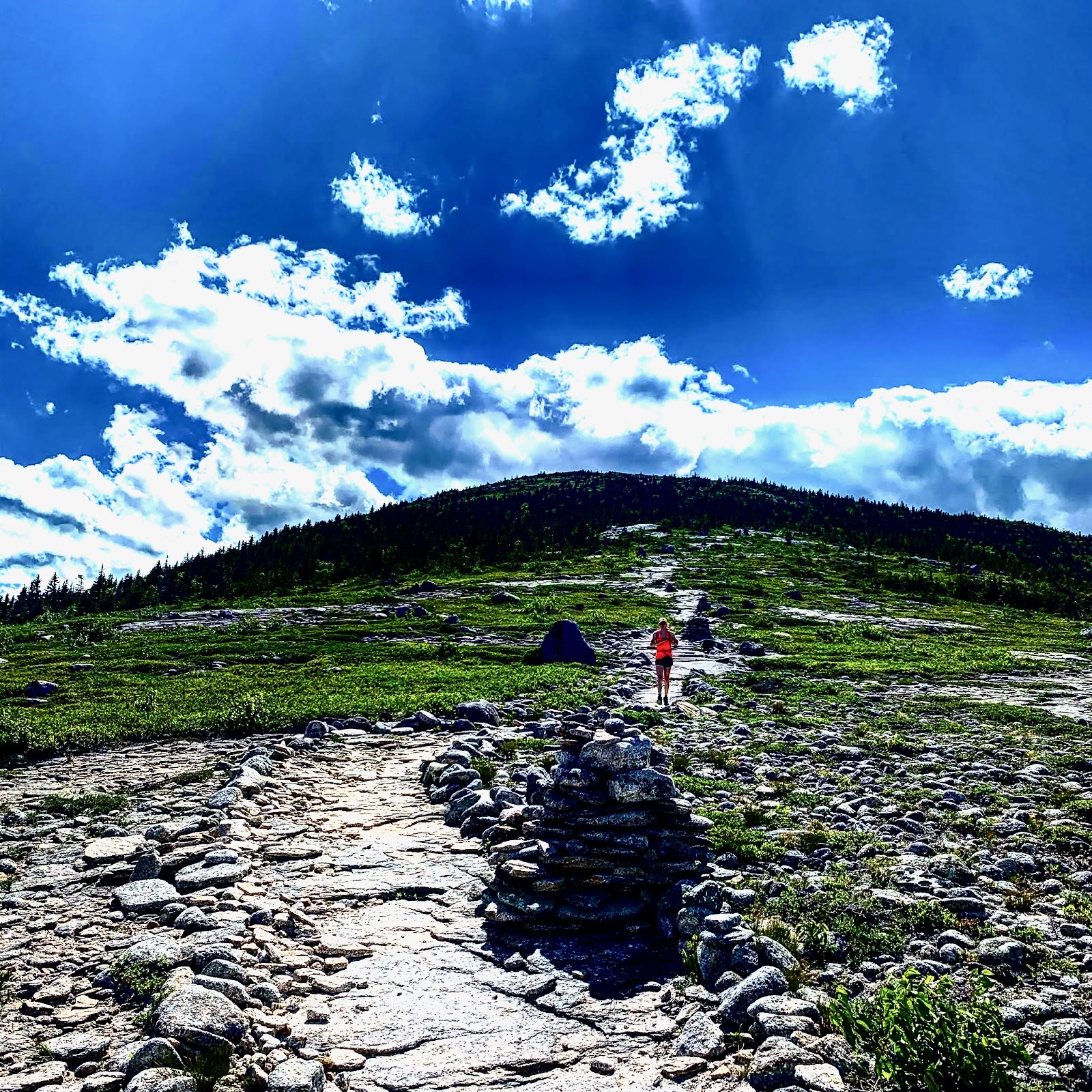
| The Sabbaday Falls Loop is a 2-3 day, 15 mile backpack heading south from the Kancamagus Highway. The trailhead is across the road from the Passaconaway Campground, and is labelled the "Downes Brook - UNH Mt. Potash Trail." You'll hike south on the Downes Brook Trail, cut across on the Sleeper Trail, and follow the Sabbaday Brook Trail back to the highway. Along the main trails, you'll hike along babbling brooks with plenty of photogenic waterfalls and pools. The Sleeper Trail cuts across a high saddle between Mt. Passaconaway (4043 ft.) and the TripPyramids (4000 each). It's named after Kate Sleeper, a local farm woman who founded the trail network because she thought it would bring much needed tourists to the area. There's no water along the two mile Sleeper Trail, so fill up at Downes Brook if you need to. The Sleeper Trail runs through beautiful forest with frequent huge fern gardens. You are very likely to see Moose here. They often bed down amid the Ferns, which is what causes those huge flattened spots. A major storm blew through here back in the 1990s and brought down hundreds of trees. The forest is reovering, and work crews have cleared the trail, but you'll see massive amounts of downed trees. The best campsites on this trip are along here. There are several peaks nearby, which you could take the time to ascend and which would justify another night. There's Passaconaway, The Fool Killer (3548 ft.), Whiteface (4019) and North and South Tripyramid. When you come to Sabbaday Brook Trail, it's extremely steep at first. A particularly difficult section involves a long granite slab, which you have to be very careful descending. This location has been the scene of frequent serious injuries over the years. Many hikers butt scoot down. This section is so difficult many local backpackers do this trip counterclockwise so they can come up Sabbaday rather than descend it. However, once you get below the steep section, the stream becomes beautiful and the trail alongside quite easy. If you brought equipment along, you can fly fish here. Eventually you'll come to Sabbaday Falls, at 45 feet the second highest in New Hampshire. It's a major tourist attraction and staircases, ramps and ewalkways have been built to handle crowds who walk the mile out from the highway. | 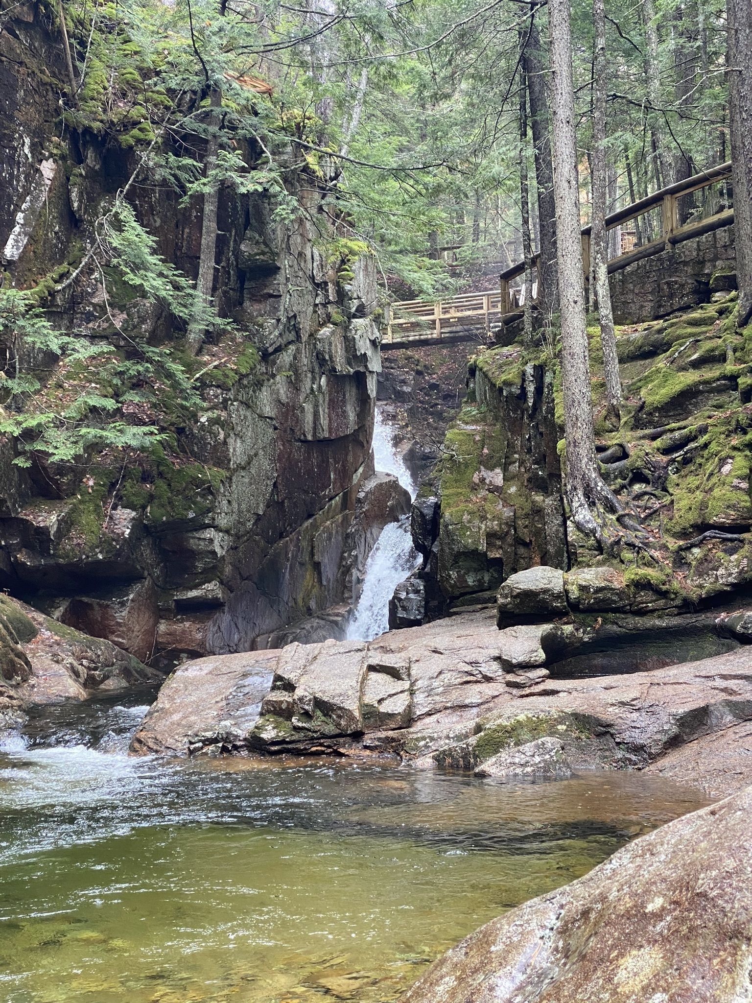 |
|
|||
|