Hiking
| Route 66 | Cities | Beaches |
| Outpost
Hiking |
|
| Getting There | Lodging | Restaurants | Attractions | North Conway | Fishing | Hiking | Backpacking | Hut Trekking |
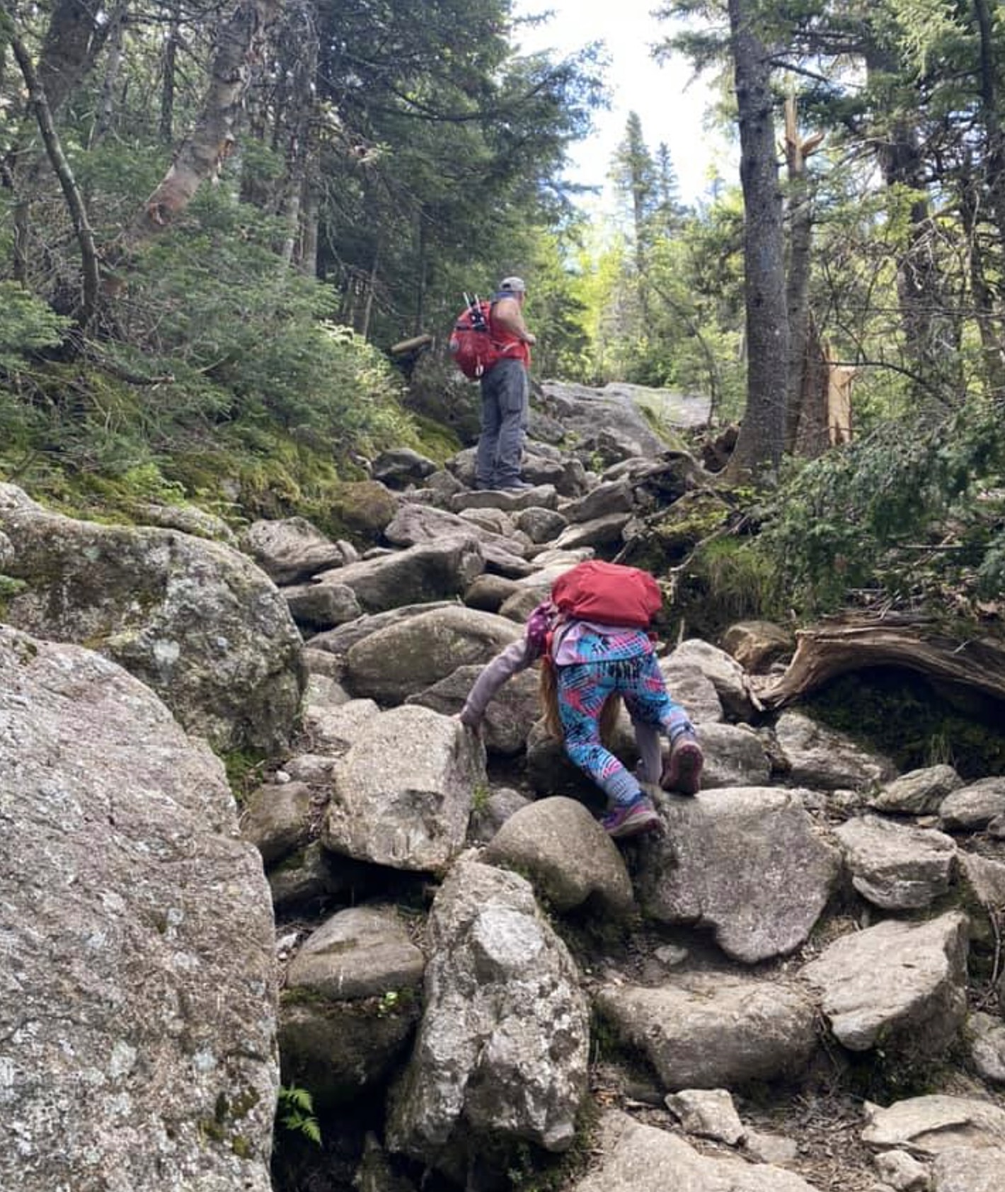
It's tempting to think of New England hiking as rather tame compared to the Rockies and Southern Appalachians with their much higher peaks and larger national parks. That is a mistake. White Mountain trails are extremely tough and the weather can turn hostile in just a few minutes. The peaks here may be lower but the trailheads are slightly above sea level, whereas out West the trailheads are at 7000 ft., so your elevation gain is often about the same. Trails elsewhere zigzag up steep gradients, sometimes switchbacking back and forth many times. Here, trails go straight up. Down South and out West you're hiking on dirt with an occasional rock or tree root. Here, you're hiking on a never ending array of boulders (photo, right), football sized rocks, gravel, and rock slabs. This is why sprained and sometimes broken ankles are so common here and why so many hikers have to be helicoptered out. And it's why locals don't use the word "trails" but instead talk about "routes." While a good day's hike down South or out West is 8-10 miles, a good day's hike here is 5-8 miles. You can't make much time scrambling over rocks, pulling yourself up granite slabs and navigating gnarled roots and steep slopes of gravel. Terminology changes here. When you're travelling on mostly level land on mostly dirt, the locals say you're "walking," as in "out for a walk." It's not "hiking" here until you're going UP, on mostly rocks. "Hiking" here is not a relaxing activity. Instead, it's a real athletic event, intense, requiring a hiking staff or hiking sticks. You have to be in decent condition and expect to return to the trailhead exhausted. You don't see many fat people here. Do not bring quasi basketball shoes. You need real hiking boots, like the Vasque Sundowner, made of high quality leather, with a scree collar and Vibram sole. The sharp rock edges here will shred a nylon or canvas boot in just a few days. The hikes we're recommending are relatively mild and mostly below tree line. Their trailheads are also a short drive from North Conway. Once you're completed these warm up hikes, you can advance to those more challenging on a future trip. |
 |
| Cathedral Ledge | Moat Mountain | Kearsarge Mtn | Frankenstein Cliffs | Boott Spur Loop | Wildcat Mtn | Ammonoosuc Ravine |
 |
Every community in the Whites has a Search & Rescue squad, and Fish & Game and local police also go out after lost, injured or stranded hikers. But the cost of these rescues is high and is billed to hikers. To defray this cost, there's a kind of insurance policy, called the Hike Safe Card, which hikers buy every year. A card costs $25 per individual or $35 per family. You buy them online through the New Hampshire Fish & Game's site, or stop by a Fish & Game office, such as the one at the entrance to the Kancamagus Highway in Conway. You could also download a print and mail application. The policy covers rescue team, helicopter, ambulance or whatever else is needed, and is the best such policy in the nation. We've mentioned that New Hampshire doesn't believe in taxes so it's pay as you go. You pay to use these trails, collectible as a $3 parking fee at each trailhead. You can buy a day pass for $5 or annual pass for $30. The Golden Eagle National Park Pass is also accepted. They do patrol and enforce this so don't go off hiking and forget to display your pass. |
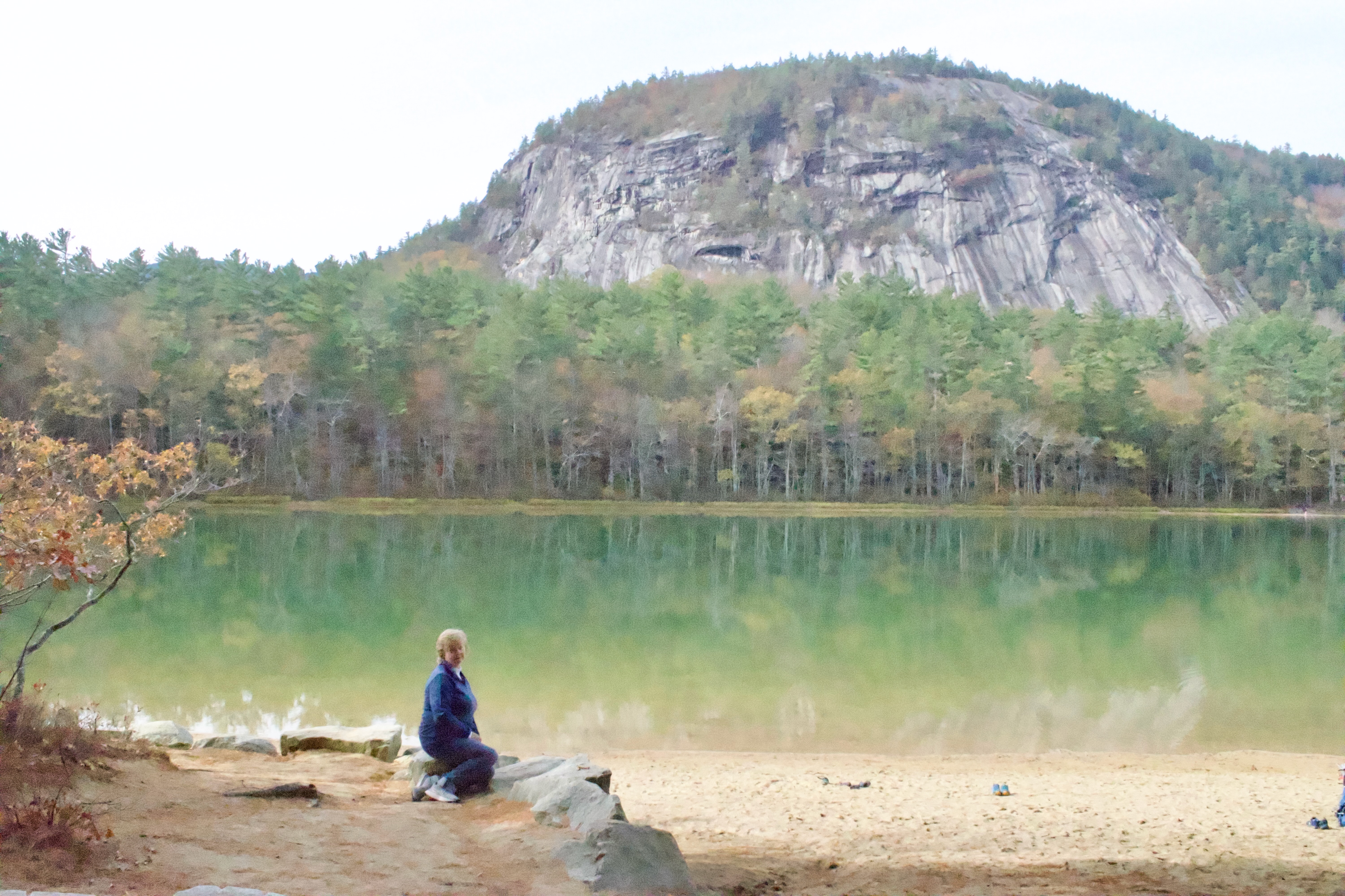
Cathedral Ledge is an outstanding hike, located in Echo Lake State Park on West Side Road just outside North Conway. Cathedral Ledge is atop that high granite knob in the photo at right. The trailhead is at Echo Lake, a popular beach in Summer. Hiking around the lake is a pleasant stroll in itself. The Cathedral Ledge Trail turns off the lake trail halfway around. It's 1.5 miles to the top with two steep sections. Figure about an hour for the ascent. You'll want to spend some time on top enjoying the great views of North Conway and the White Mountain Valley. The return trip will take about 45 minutes. There are rest rooms at the trailhead and a portapotty at the top. There are also a gift shop and snack bar at the trailhead. Most people take about three hours for the entire experience. |
 |
|
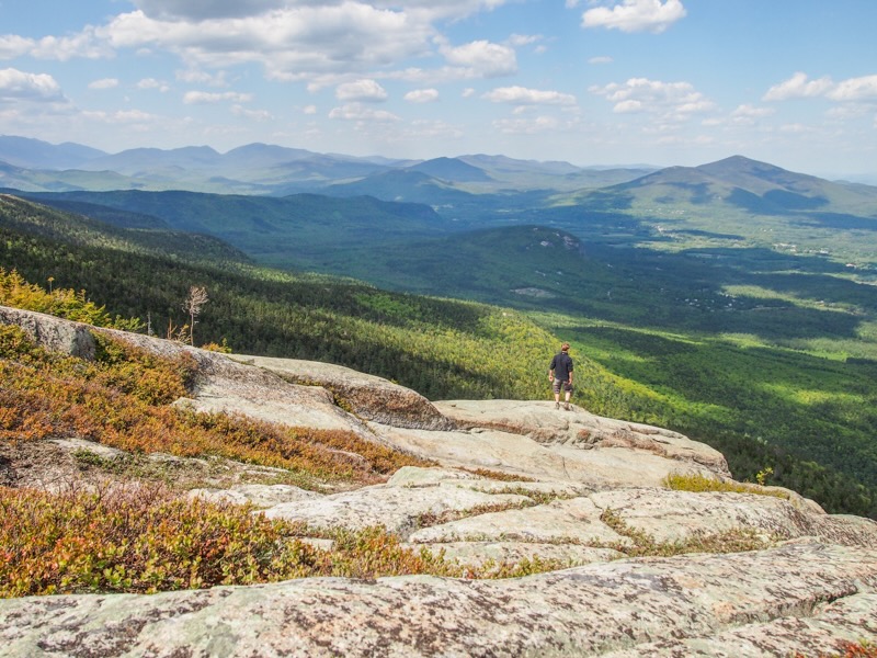
The first part of the North Moat Mountain Trail is the same as the Diana's Baths walk (see Attractions page). This is a major hike which takes all day but rewards you with spectacular views, as seen in the photo at left. There are three Moat Mountains: South, Middle and North. You could continue on the trail across the other two Moats, then drop down to the trailhead on Passaconaway Road, which leads back to Conway. That would be a 2-3 day backpacking trip. This North Moat dayhike goes up one side, then comes down by way of Red Ridge and the other side. The first 2.4 mile section follows Lucy Brook and is quite easy. Then the trail heads uphill and becomes more challenging. At 3.7 miles you climb above the treeline and the views begin. For 3/10 of a mile, the trail gets pretty steep over rocks, gravel, boulders and slabs. Then the summit, seen here at left, comes at 4.3 miles, and is a fine lunch stop. Resuming your hike, you'll come to two steep descents and a 10 foot chimney, then the intersection with Red Ridge Trail. Go left on that trail. Coming down, you'll find four steep segments over pinkish rock known as Conway Granite. It's actually a pretty scenic descent but you'll need to keep your eyes focused mostly downward on the trail. The trailhead is off West Side Road. |
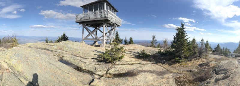
The Mt. Kearsarge trailhead is 1.4 mi east on Hurricane Mountain Road, turning off Route 16/302 on the northern edge of North Conway. It's three miles up to the fire tower (photo, right) and spectacular 360 degree views of the White Range and over into Maine. The trail passes through hardwoods, then pine forest, then gets steeper and slabbier as you approach the tree line. The entire last mile is very scenic as you cross broad Granite faces on the ridgetop. The fire tower was built in 1909 but updated in 1955. |
 |
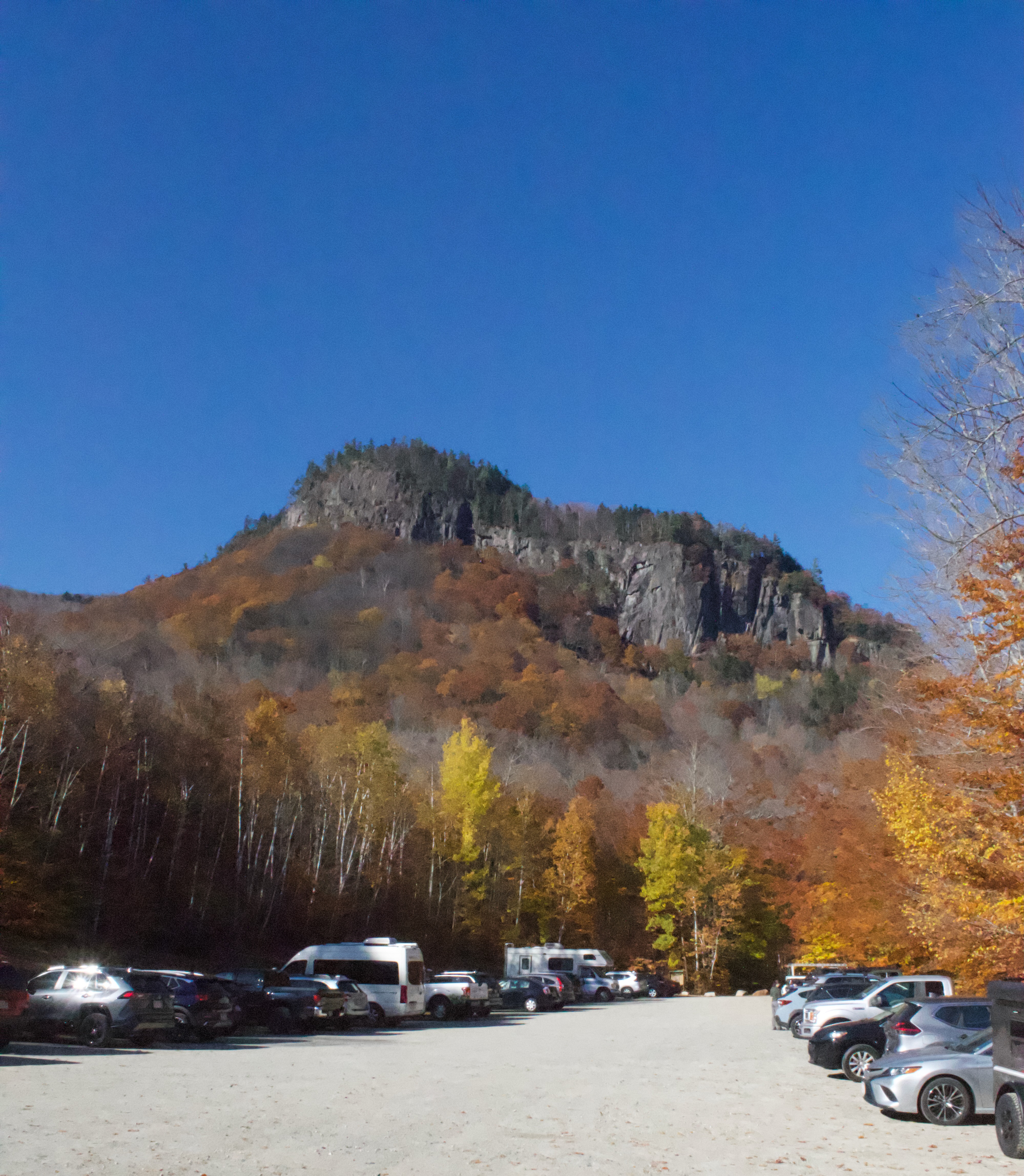 |
Frankenstein Cliff appears in this photo to be a steep but straightforward hike. It's not. Hidden on that mountain are two spectacular attractions : Arethusa Falls and the Frankenstein Trestle. The total hike is a 4.8 mile loop. You could just hike to the Falls, 1.5 miles out heading clockwise, or just to the Trestle, 0.6 miles out heading counterclockwise. But the expansive views lure almost everyone to hike the entire loop. The total experience will take about half a day, because you'll want spend time at the Falls, the Trestle and several overlooks plus the major one on top, which is where most people eat lunch. Try to hike this on a weekday for fewer people, and a day after a one or two day rain when the Falls, at 200 feet the highest in the state, will be flowing at its most impressive. The hike to the Falls is easy. We recommend the Bemis Brook Sidetrail, which passes several smaller waterfalls and pools before rejoining the main trail. As you near the Falls the trail steepens, crosses several small bridges, and includes both rock and log flights of steps. After the Falls the trail climbs gradually up to that saddle to the left in the photo, then steepens and climbs around the back of the cliffs. At 2.8 miles you reach an exposed rock slab on top, with great views of Mt. Washington. From here, the trail descends the sloping top of the mountain, left to right (south to north) as you can see in the photo. The trail is back in the woods, away from the cliff top. At 3.4 miles, you reach the actual Frankenstein Cliff, which is to the right in the photo. Again there are magnificent views. It's named for local artist Godfrey Frankenstein, who lived at the base in trhe 1800s. The trail down from here is very steep, which is why very few hike counterclockwise. The Trestle, which you reach at 4.2 miles, was built in 1875 and has had various pieces replaced since. It is still used by the North Conway Scenic Railroad at least twice a day.The parking lot seen at left is about 20 minutes NW of North Conway on Route 302. It's on the left as you drive toward Crawford Notch. Don't forget your parking permit as they do patrol every hour. |
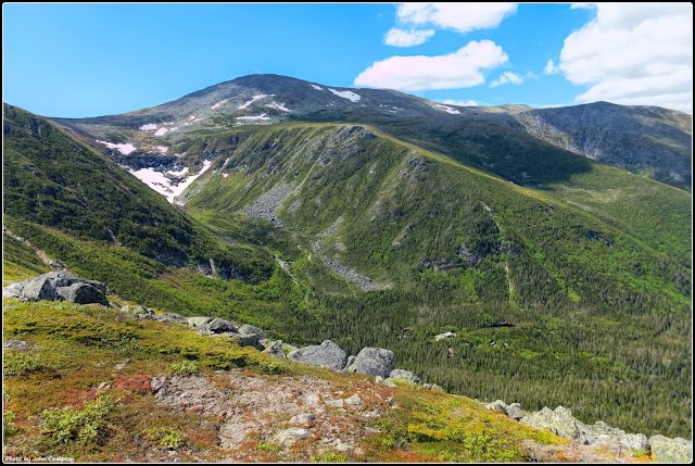
Tuckerman Ravine is one of the legendary hikes in New Hampshire, leading up the Lakes of the Clouds Hut on Mt. Washington. That's an overnighter. But this Boott Spur Loop, going partially up, then cutting across a shoulder of Mt. Washington and heading back down, is a great day hike. The photo at right shows the view from the top of the loop. From North Conway, take Route 16 north to the Pinkham Notch AMC Visitor Center, where the trailhead heads up from behind Joe Dodge Lodge. You begin by following the Tuckerman Ravine Trail upward. At 0.5 miles, you'll see the Boott Spur Loop returning on the left (south), but stay on the main trail. (You'll eventually come back down on that returning loop). Various trails will branch off to your right and left but stay on the main trail. This entire loop hike is 8.4 miles long. As you climb, you'll pass the turnoff to the Harvard Mountain Club hut, a waterfall, several sections of rock steps, and a lean to for shelter from the wind. At 3.6 miles, turn left on the Lawn Cutoff, and at 4.0 miles turn left onto Davis Path. You'll hit the Boott Spur Trail at 5.0 miles. Turn left and follow it down to the main trail. Allow eight hours for this epic hike. |
 |
 |
Wildcat Mountain Trailhead is also up Route 16 toward Pinkham Notch. It begins from Glen Ellis Falls parking lot, on the left (west) side of the road, 8.3 miles north of Jackson. For Wildcat Trail you hike under the road through an underpass. The trail sets off eastward, opposite Tuckerman Ravine Trail. At the top, you'll be in a ski area, with a gondola terminal. This is a 4.4 mile out and back. Like Tuckerman, this trail could lead to an AMC hut, at Carter Notch. But that would be several miles further and would require you to stay overnight. This Wildcat Trail just hikes 2.2 miles to the Wildcat D viewing Platform, a fine place for lunch. You then hike back down. The trail up is continuously steep but does offer frequent open rock slabs for great views. |
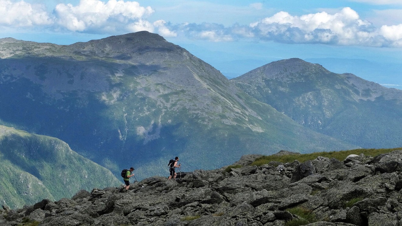
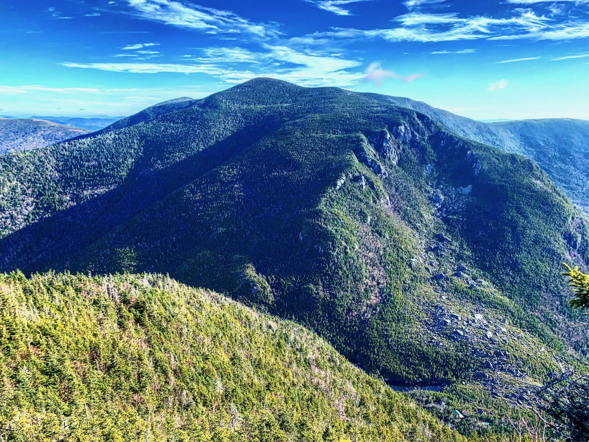
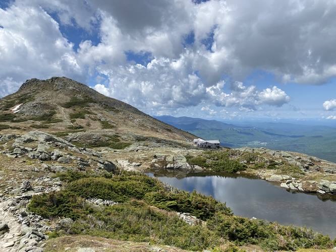
Amonoosuc Ravine is the Crown Jewel of Presidential Range Day Hikes. It's the only day hike which includes one of the Huts. But it's not a first timer's hike. You'll climb 4,000 vertical feet. It requires good conditioning, proper equipment and experience in navigating rocky, windy high altitude terrain. Trailhead is just to the right of the Cog Railway Station. The first 2.02 miles are easy, but then the trail heads steeply upward and the fun begins. For nine tenths of a mile you'll be pulling yourself up very steep terrain. But at 3.1 miles you come to Lakes of the Clouds Hut (photo, right). You can stop here, enjoy the 360 degree views for a while, then either head back down, or head on up to the Summit. You could bring your own lunch or buy lunch at the Hut, which will include Soup and freshly baked bread. If you head on to the Summit, it will be another 1.5 miles of hiking. The trail between the Hut and the Summit switchbacks back and forth several times. At the Summit you'll have hiked 4.6 miles. Again, you could buy lunch at the snack bar or eat your own out on the observation deck if you hit a calm day, or inside if the wind is howling at its usual 75 mph. If you hike back down the same way, you'll cover a total of 9.2 miles. But a common strategy is to take the Cog Railway down. Don't feel guilty; you'll work hard enough on the way up to earn a comfy ride back down. |
 |
|
|||
|